Tags : data imagery sample files
Over the last 15 years, FBS has collected the most up-to-date, ready-to-use, geospatial products for Ontario.
We strive to provide new, complementary data sets to meet the ever increasing demand for location intelligence tools.
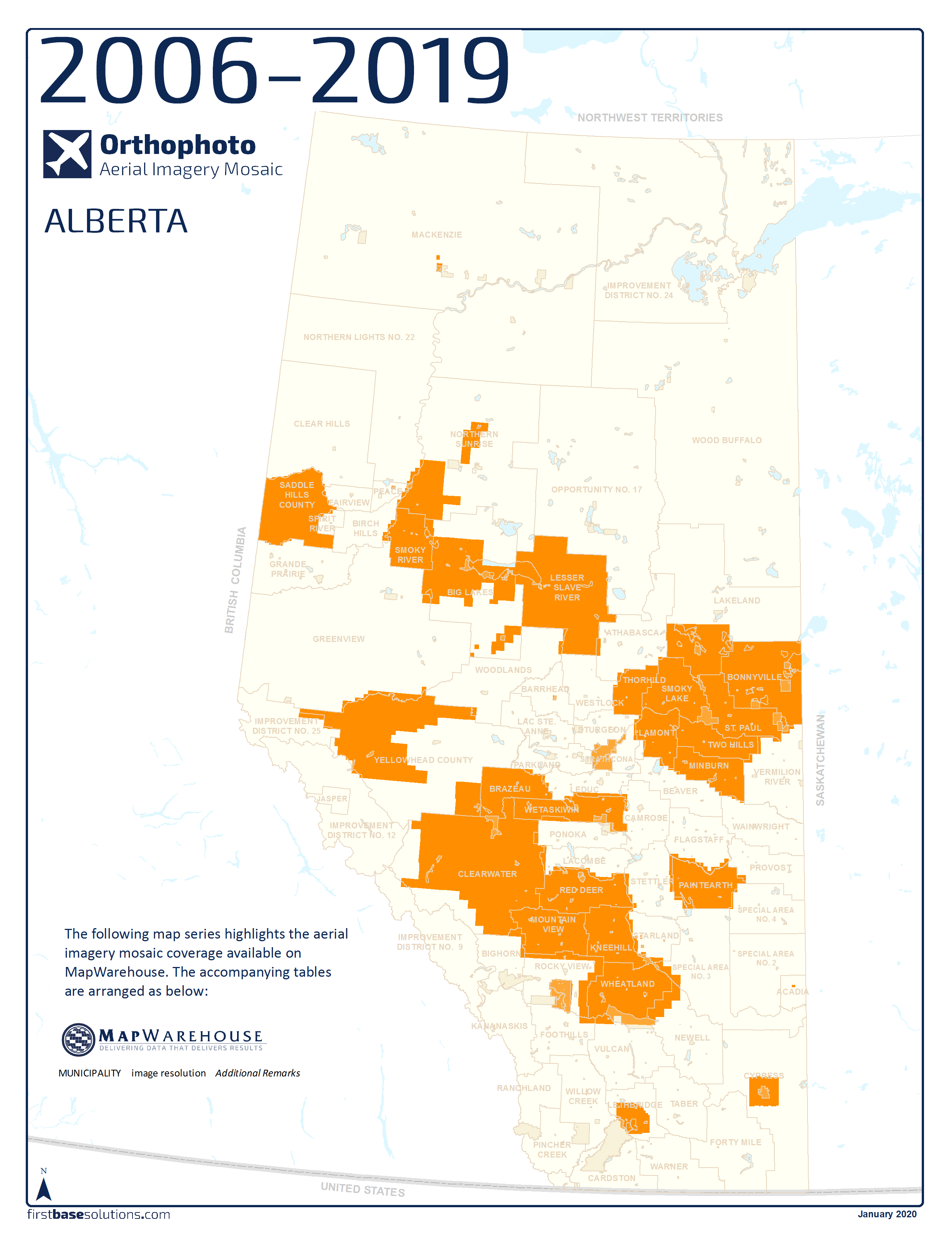
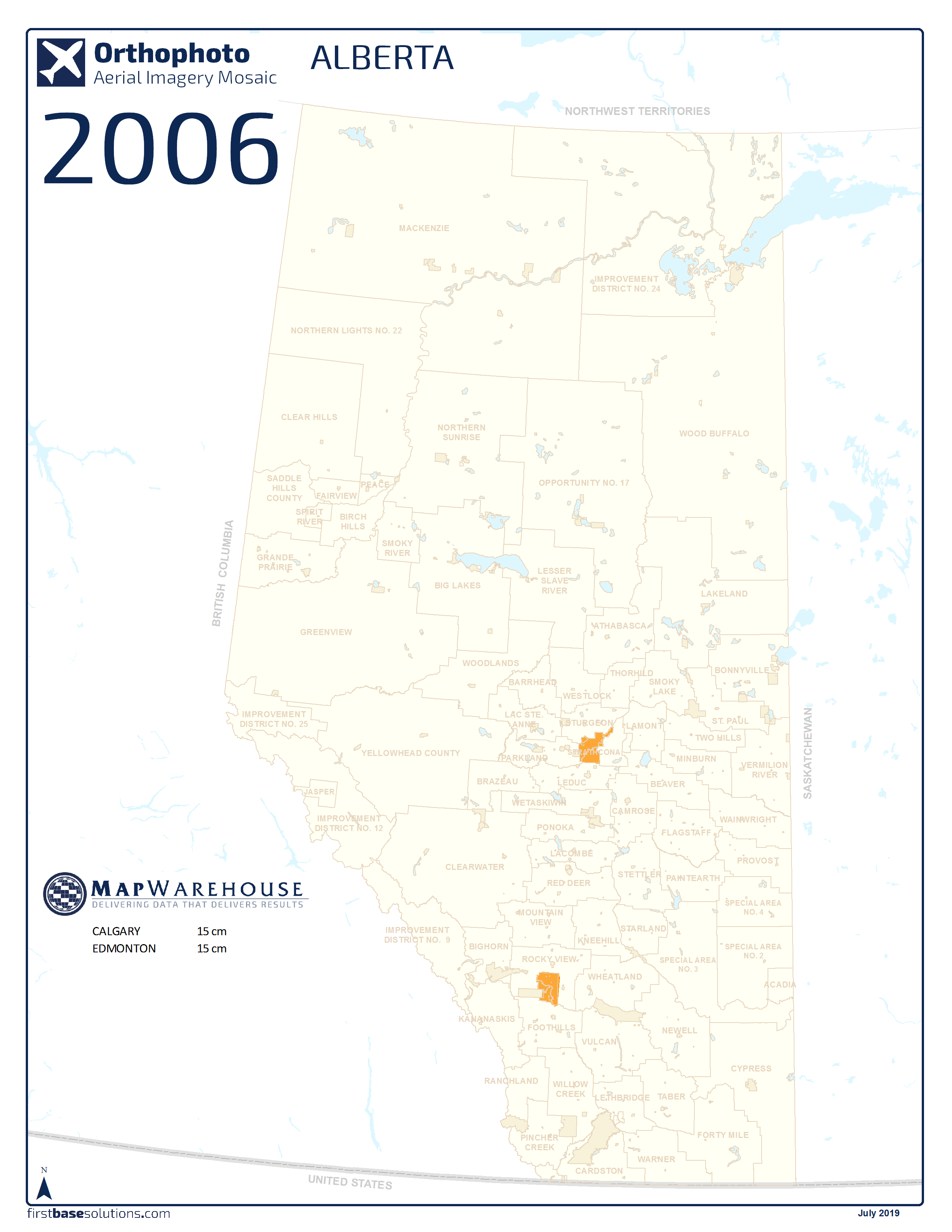
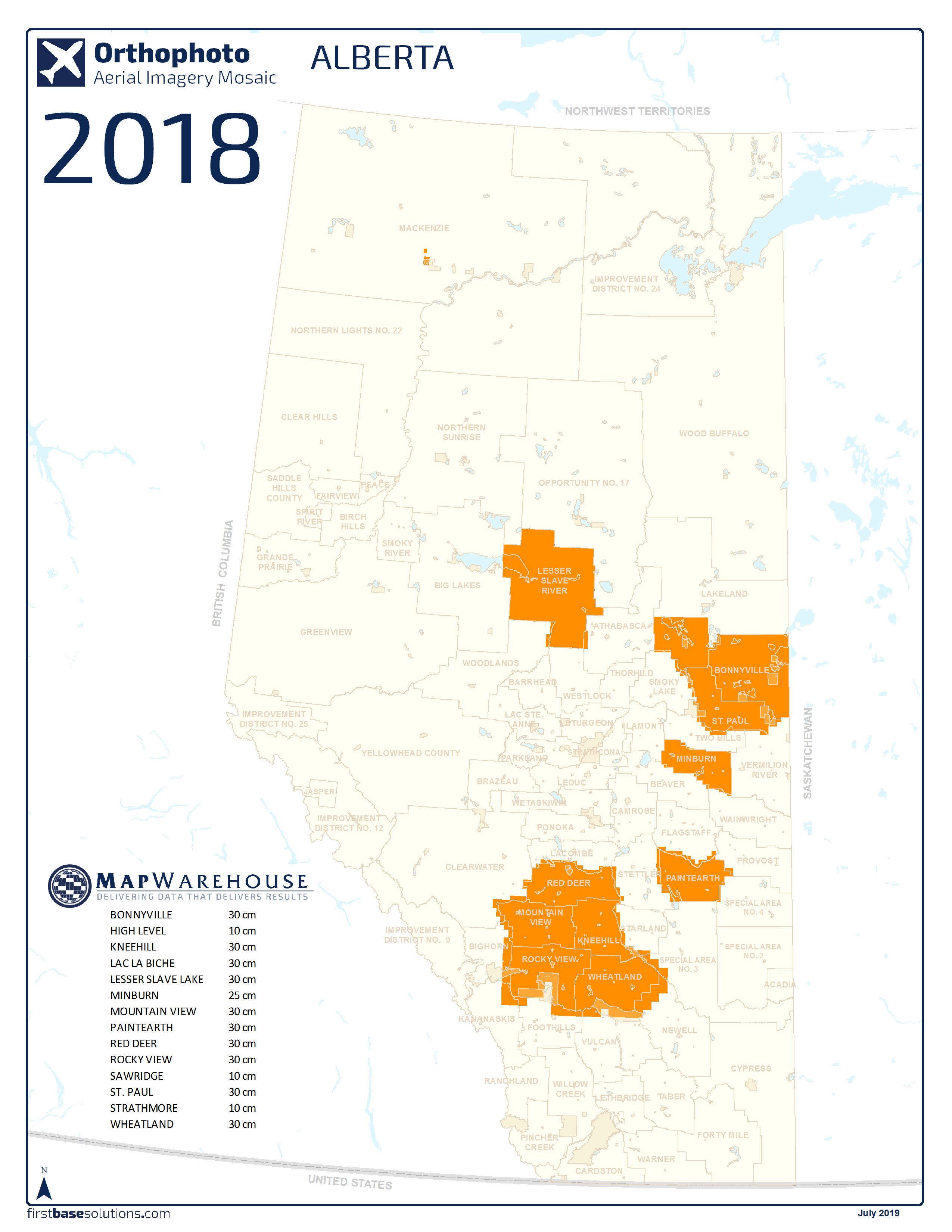
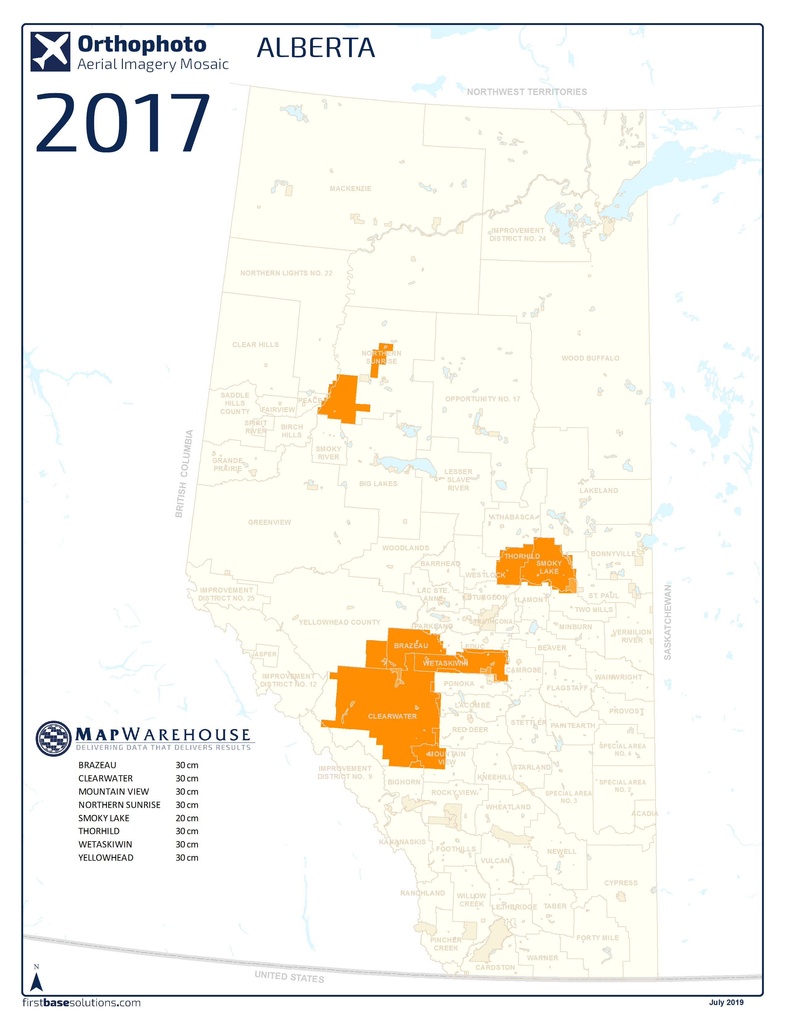
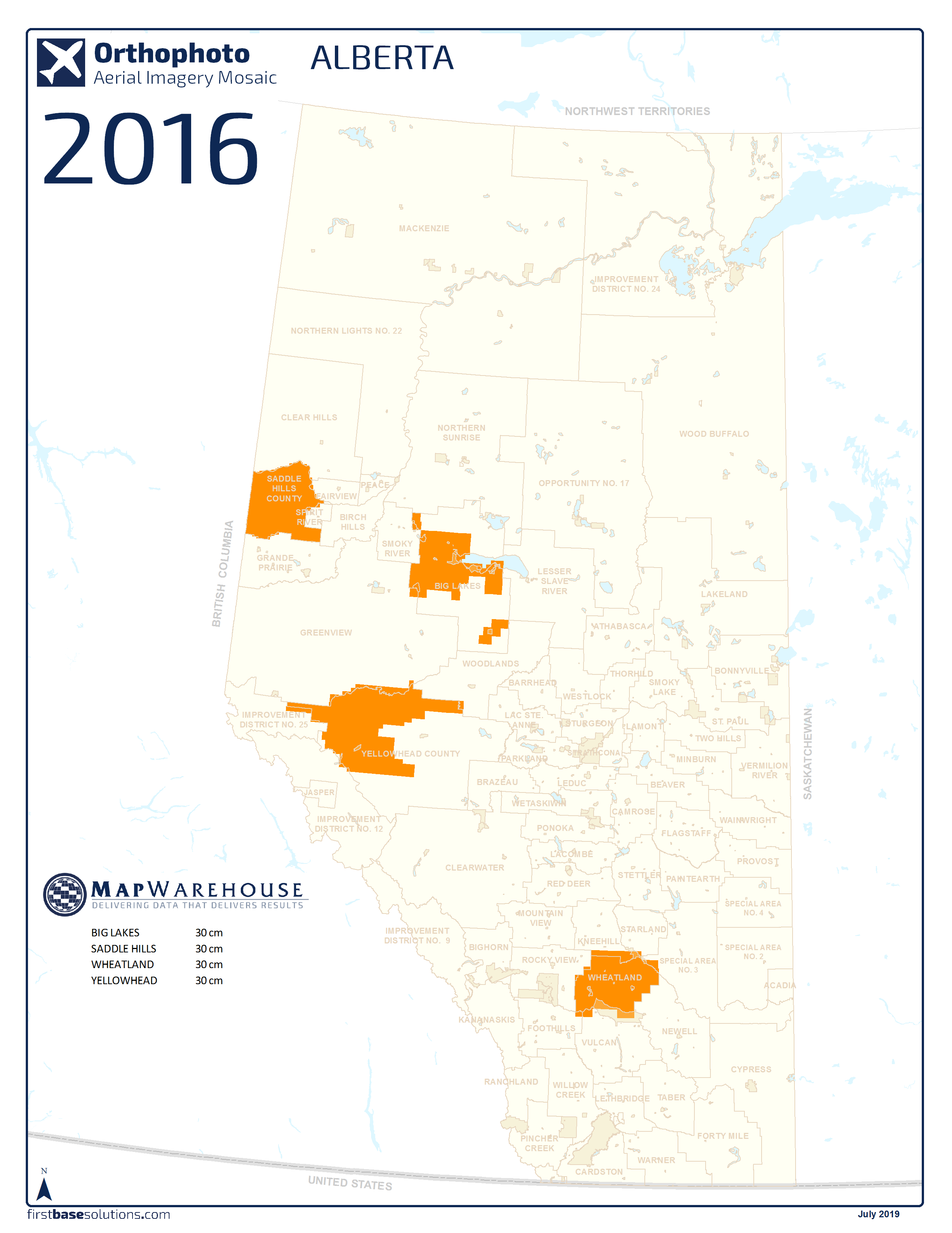
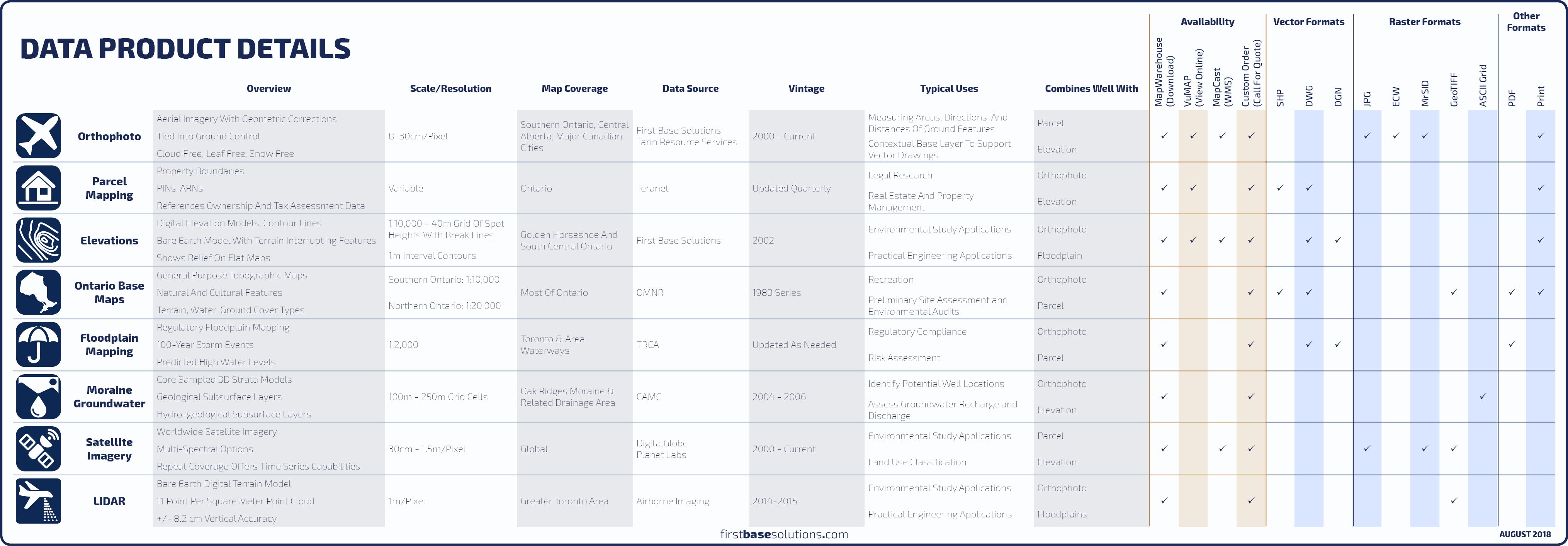
An orthophoto is an aerial photograph geometrically corrected such that the scale and overhead perspective is uniform, enabling users to measure true direction and distance.

Compare With Satellite
|
 FAQs
FAQs
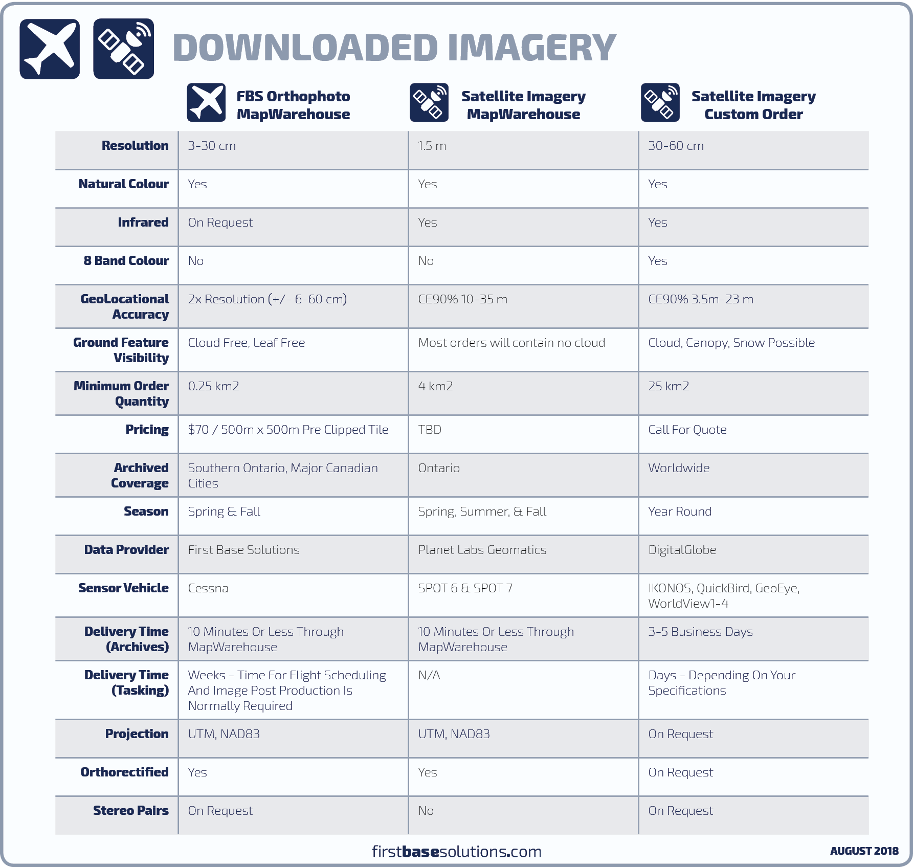
Earth imaging satellites from our data partners DigitalGlobe and Planet Labs Geomatics capture high and mid-resolution imagery around the world, year round. Order new or archived imagery including infrared radiation outside the visible spectrum.
Compare Sensors
|
FAQs
Access a centralized library of the province’s 7.5 million parcels of land. The database contains digital mapping for property boundaries in Ontario along with attributes to uniquely identify each parcel.
Compare Boundary Mapping
|
FAQs
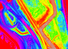
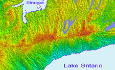
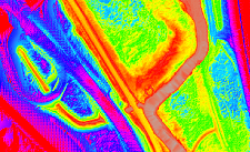
Laser pulses from aircraft are used to collect point clouds from the reflected pulses. The point cloud is used to create digital elevation models depicting the bare earth.
Compare Elevation Mapping
|
FAQs
First Base Solutions produces digital elevation models and 1m contours for areas covered by our orthophoto, or, we can source worldwide topographic coverage provided by DigitalGlobe.
Compare Elevation Mapping
|
FAQs
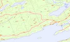
OBM, or “topos” are a province-wide series of general-purpose topographic maps produced by the MNR, providing an excellent reference map for navigation in rural and backwoods regions.
FAQs
Regulatory flood line mapping defines the known historical and predicted high water levels based on the 100-year storm event for lakes and rivers in the Toronto area.
FAQs
Get 3D digital strata models of geological and hydrogeological subsurface layers across the Oak Ridges Moraine and it’s drainage areas in the GTA, from the Kawarthas to the Niagara Escarpment.
FAQs
 Blog: Key concepts in digital mapping for professionals in any industry
Maps have great visual appeal. They’re easy to understand and interpret. They make boring data look like extraordinary data. They help you interpret other types of documents. They are time stamped objective records of the past. They’re also inexpensive and easy to get..

Blog: How to choose the data delivery method that’s right for your project
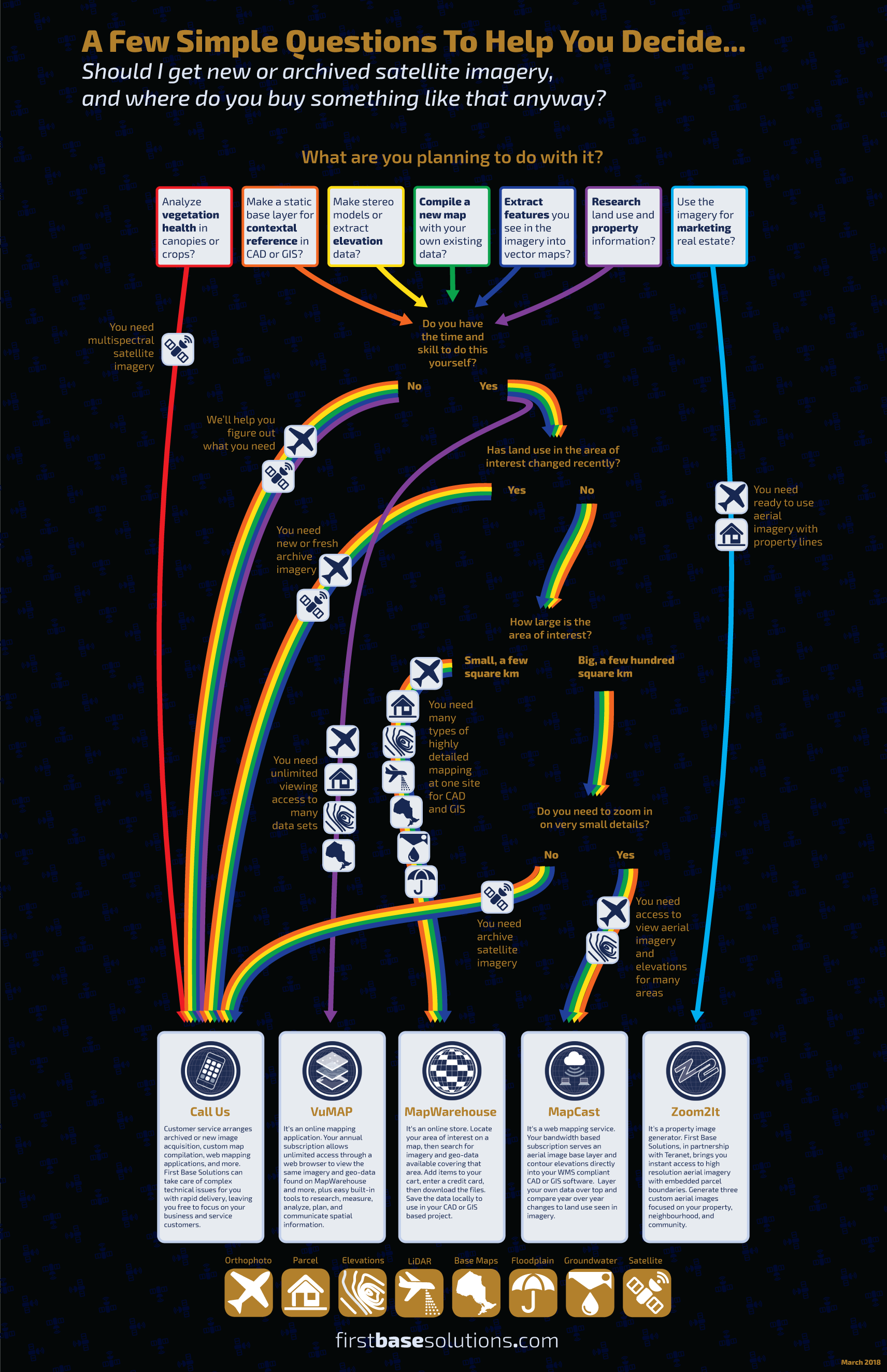
We’ve been working on enhancing our websites and making more reference materials available. Below you’ll find some handy cheat sheets to help figure it out…
How To Purchase
First Base Solutions creates and resells the most up-to-date and accurate geospatial data in Ontario through its online services; VuMAP, MapWarehouse, and MapCast.
FBS‘s collection of orthophoto and spatial data enables organizations to efficiently manage projects, offer superior service, and improve day-to-day decision making.
Blog: How To Get The Newest Data First
Once the intense flying season is over, we frequently get asked, “Is it ready yet? …How about now? …Now?” There are three ways you can keep in the loop when new data is released…
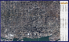
Ontario’s Largest Geospatial Data Marketplace
Search for data, select files covering your location, download your order, and work with aerial imagery and geographic data. Use the interactive map to locate your area of interest and purchase multiple data sets easily and quickly with a credit card.
 Go Now | Learn More
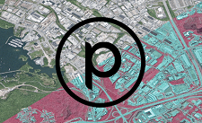
Access Every Place From One Place
View geographic data, query the map for more information, measure ground features you see in the imagery, and report on your research using this feature-packed online mapping application. Compare imagery year by year and research land information from anywhere.
 Go Now
|  Learn More
Unlimited Access To Ontario’s Largest Web Mapping Service
Connect to a high resolution aerial imagery mosaic base layer and elevation contours served directly to your CAD or GIS workstation, just as you would connect to data stored locally. Bandwidth based pricing allows your team to use MapCast as little or as much as you need.
 Go Now | Learn More
Contact Us For Special Orders
We can help you determine the best products for your specific project and navigate the ordering process. Even if you don’t see what you’re looking for through the services above, call us, we can arrange custom tailored solutions. Contact customer service for assistance.
 Go Now
Help Me Choose
Blog: Introducing Our Newest Data Partner: Planet Labs Geomatics
There’s a million new reasons to choose MapWarehouse. First Base Solutions has entered a new reseller agreement with Planet Labs Geomatics, a provider of commercial satellite imagery, to bring over 1,000,000 square km of new Ontario imagery to MapWarehouse, and that’s just the beginning!..
-
-
LiDAR
-

-
Orthophoto
-
-
Wall Map
-

-
Parcel
-

-
MapCast
-
-
Planet Labs
-

-
Help & Support
-

-
FBS University


 905-477-3600
  MapWarehouse
 MapCast
 VuMAP
VuMAP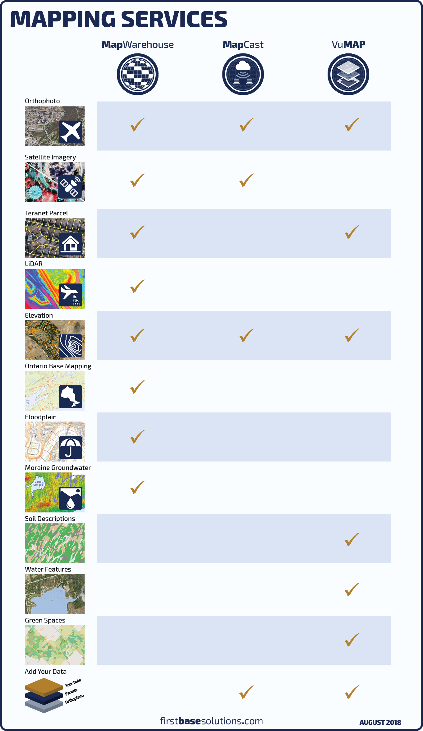


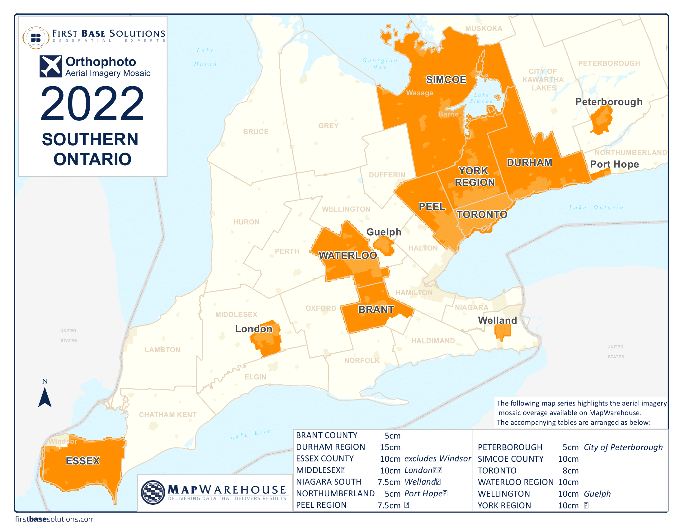
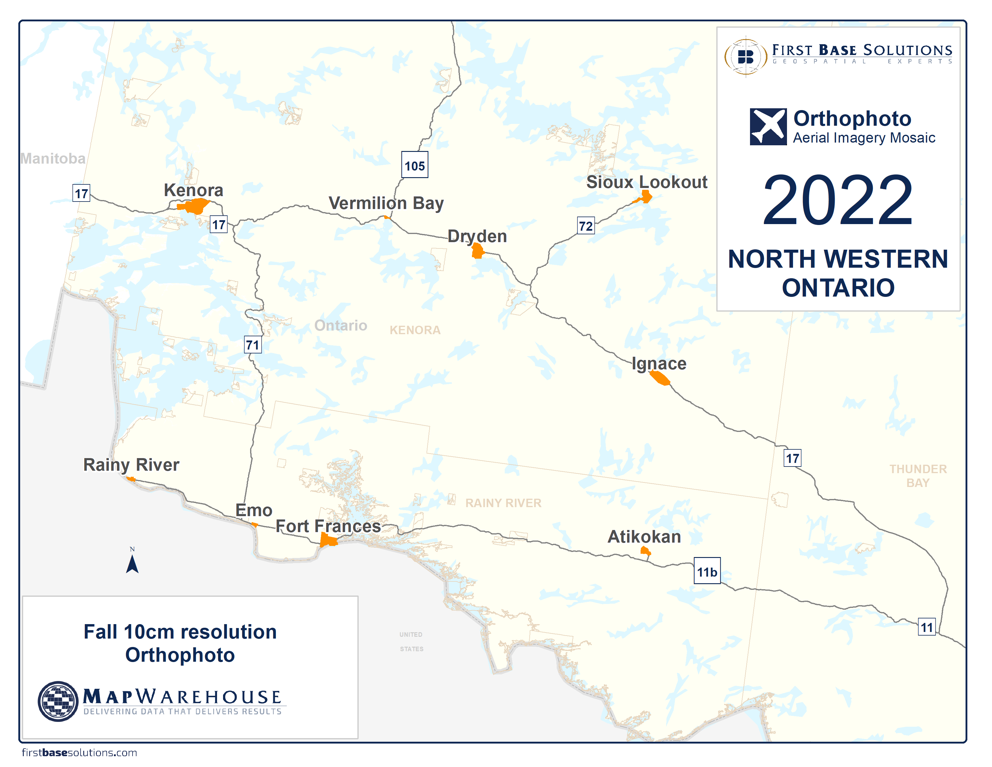
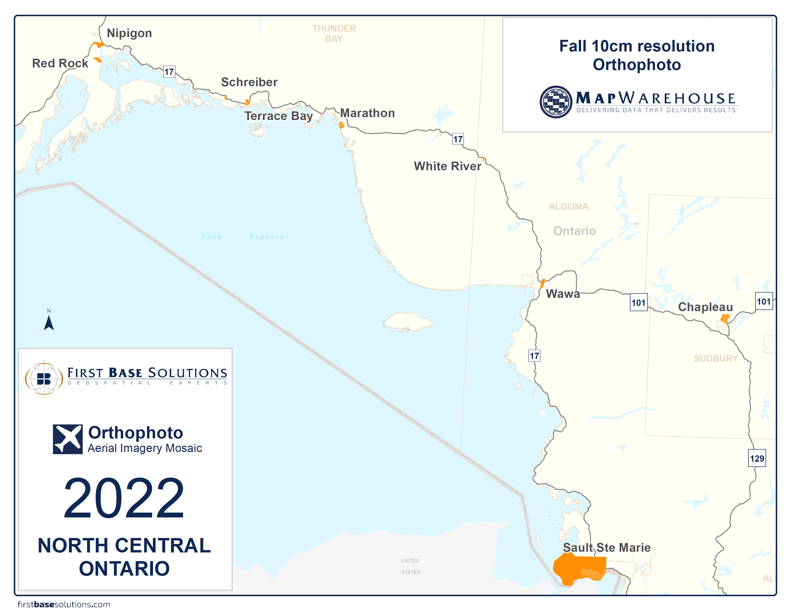
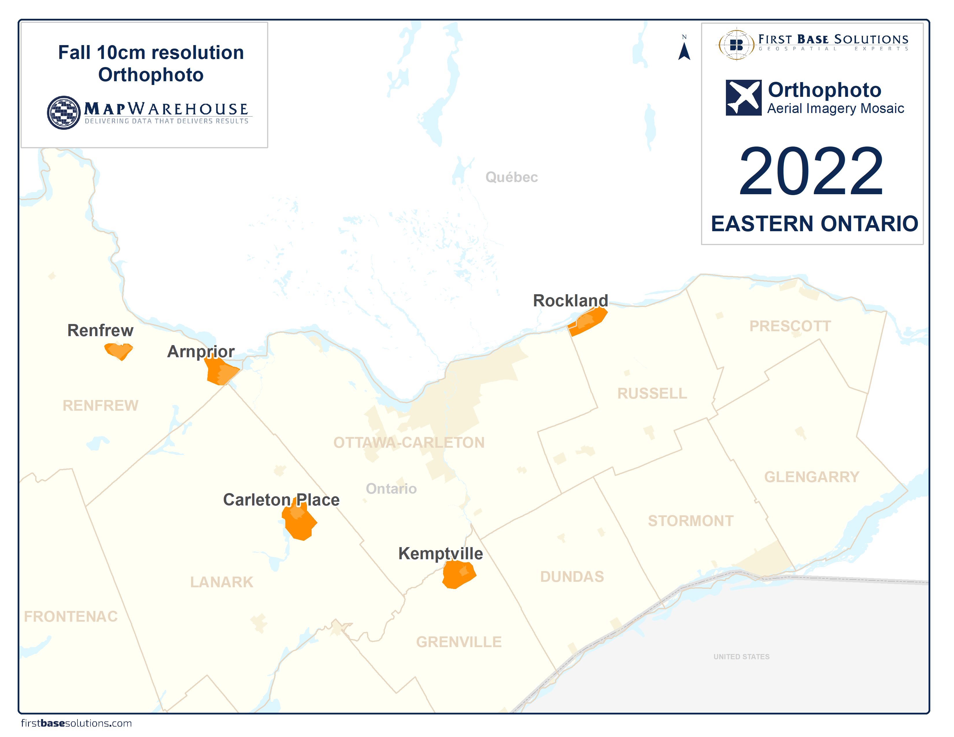
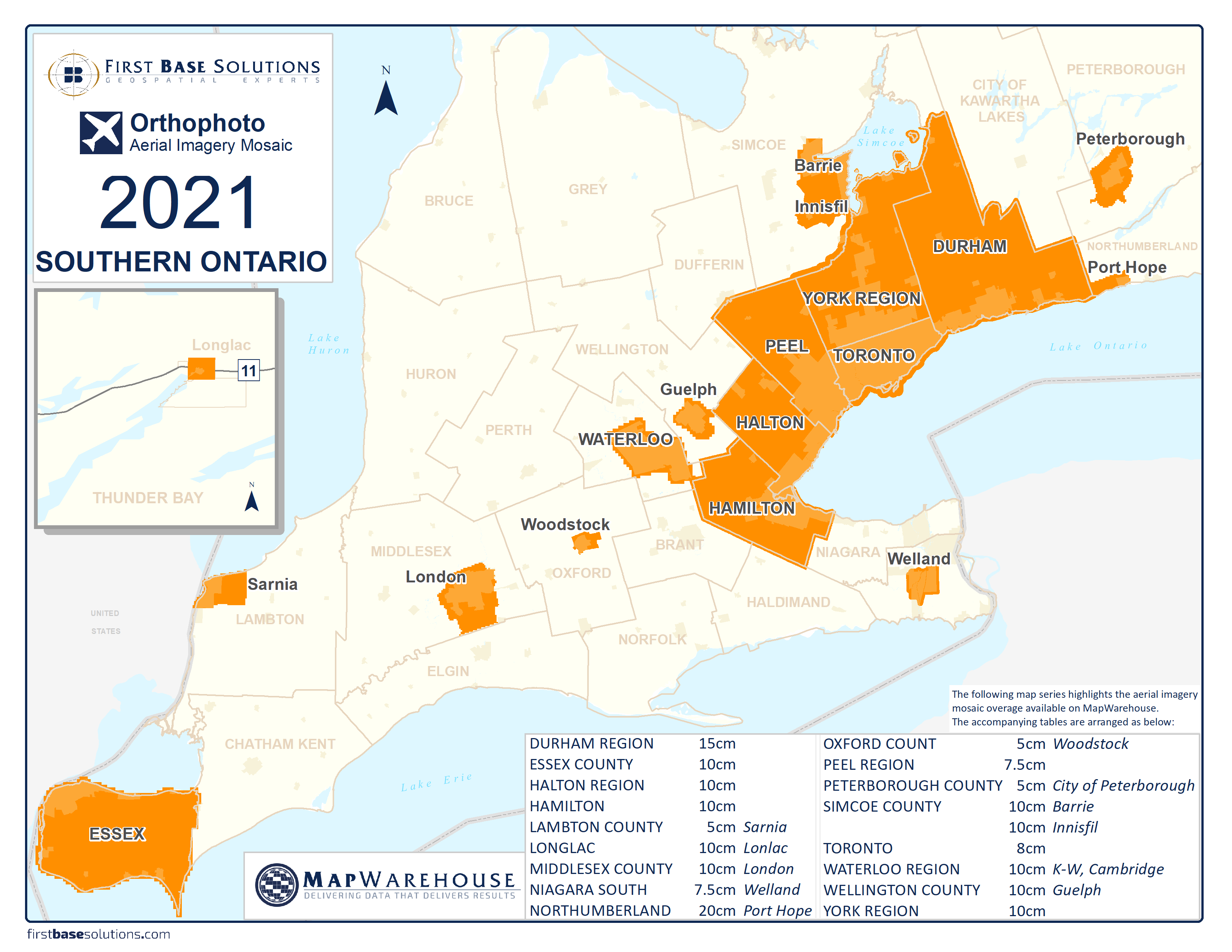
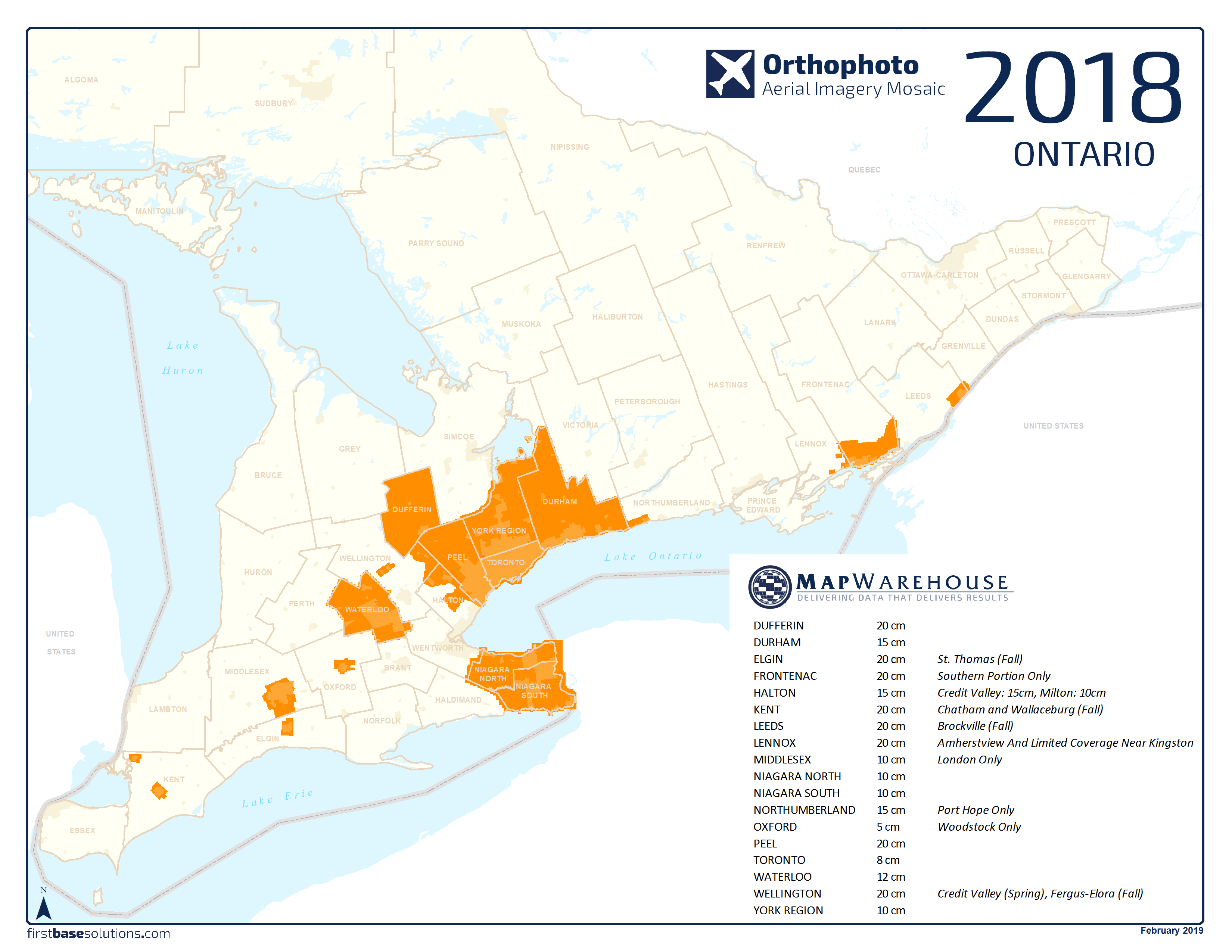
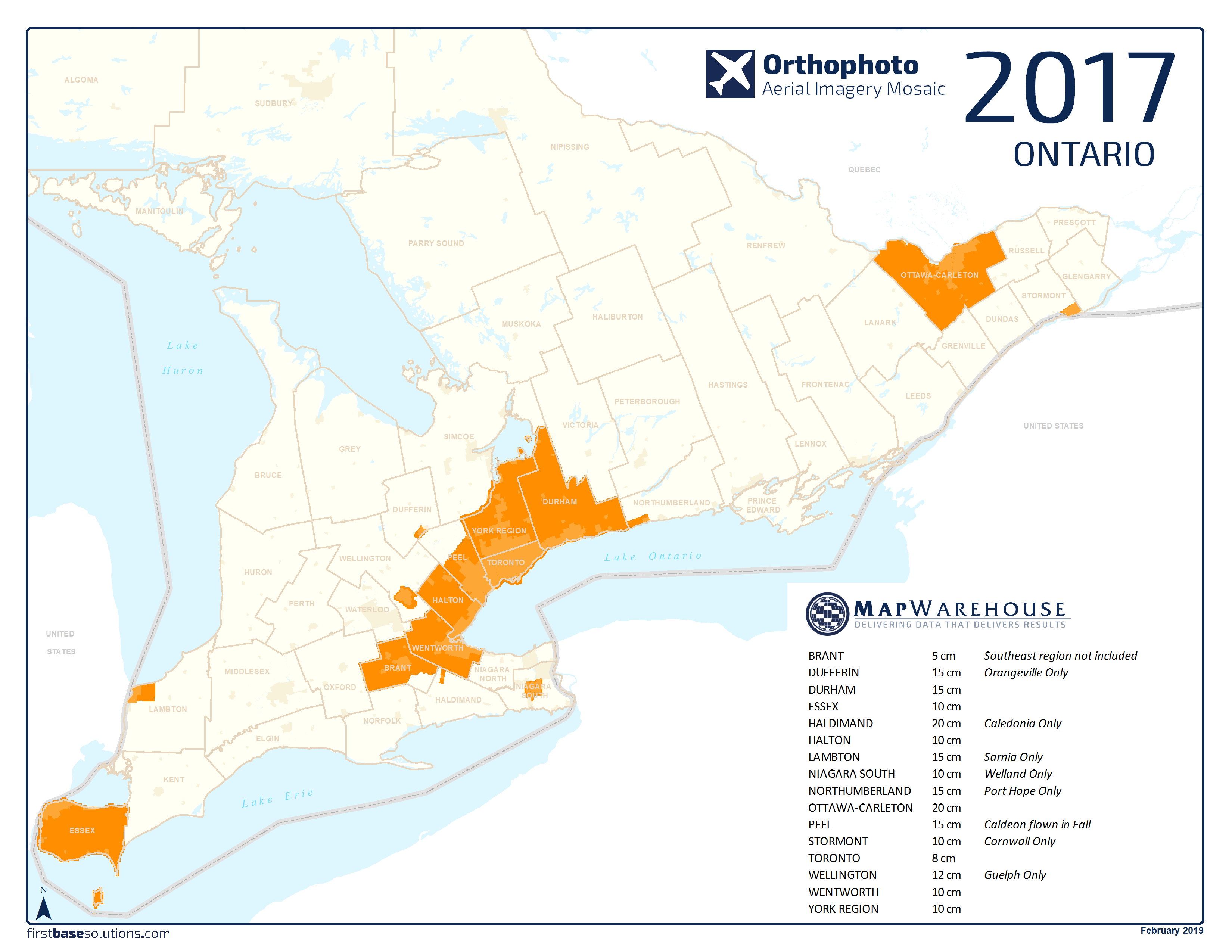
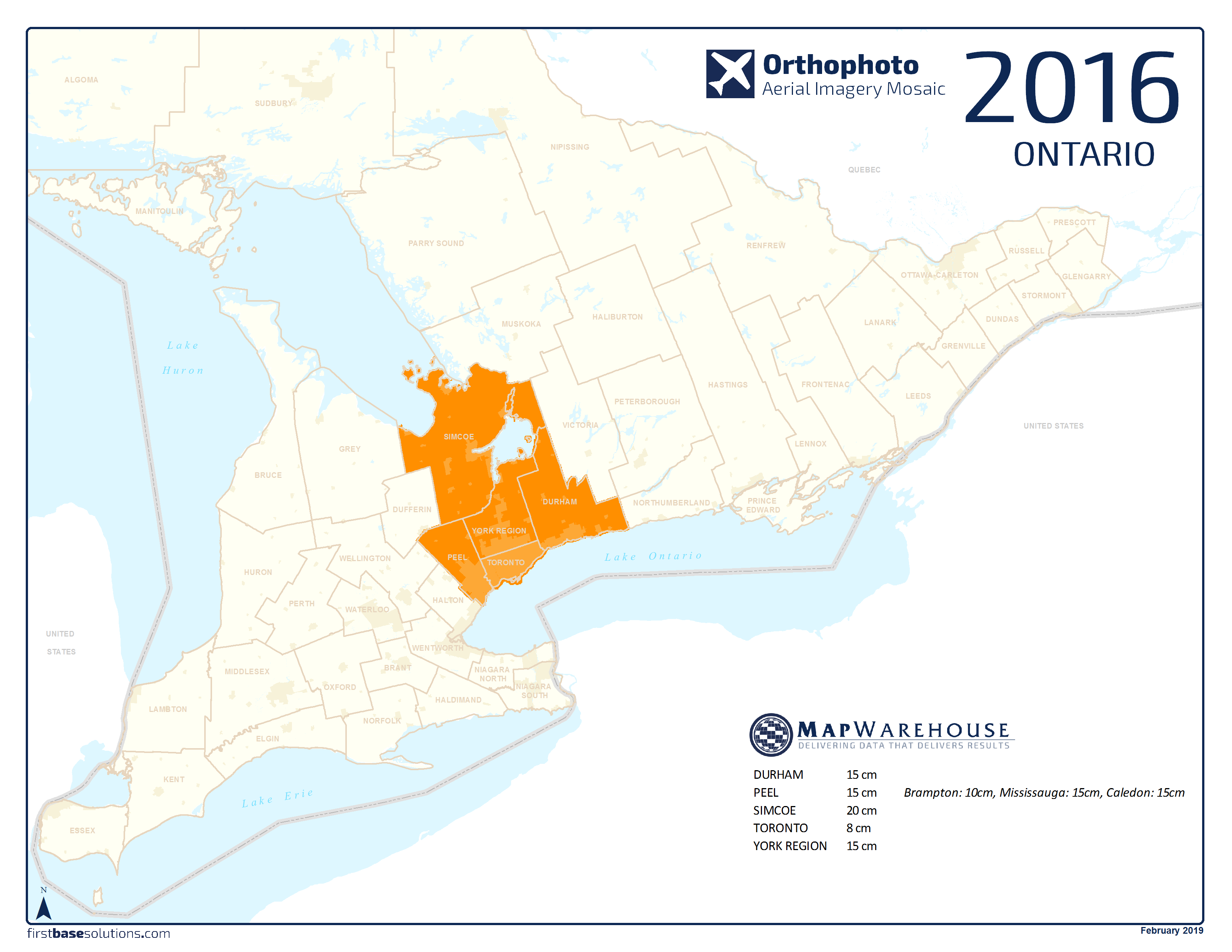
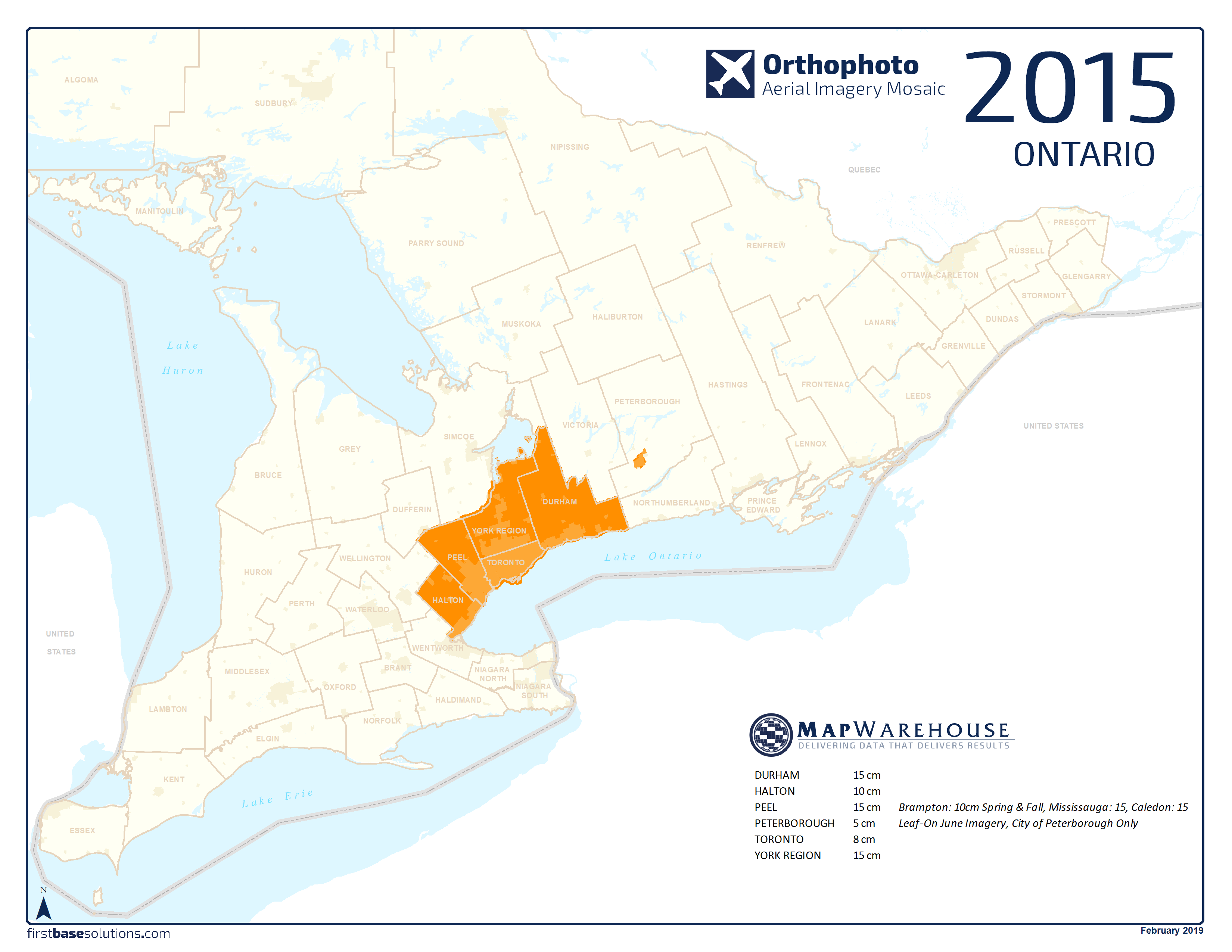
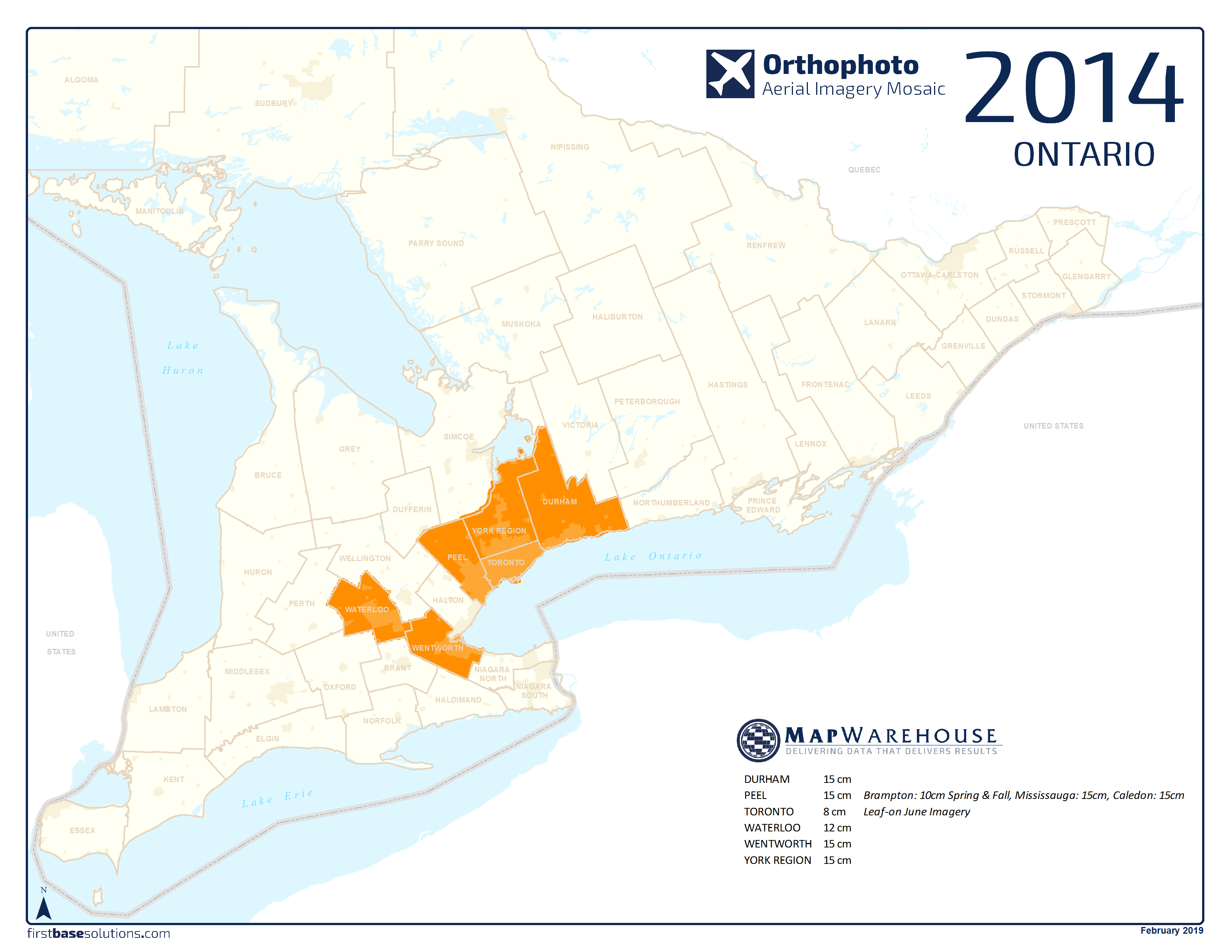
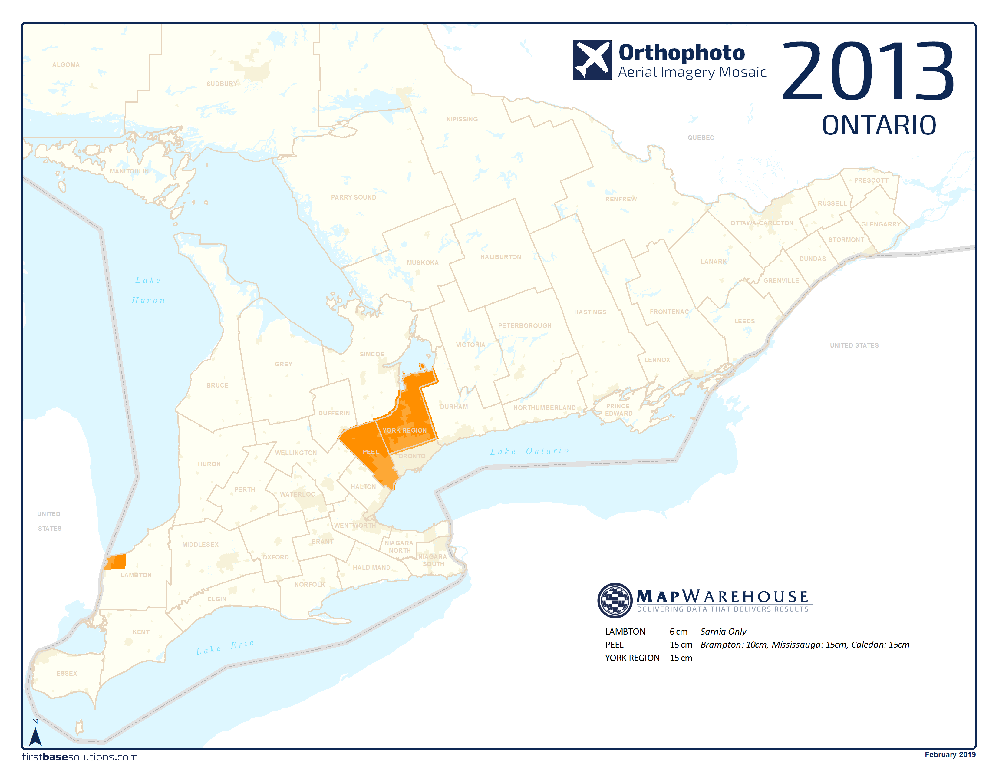
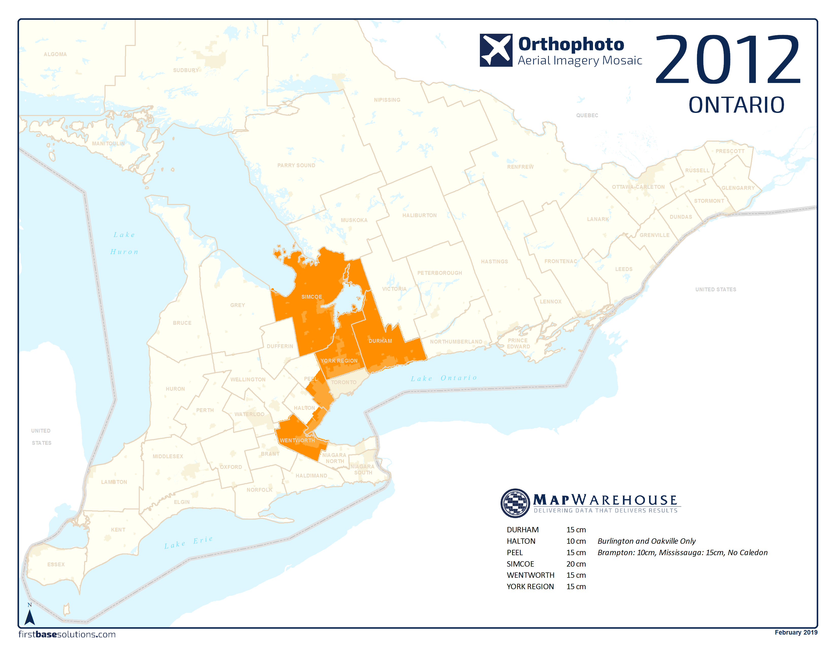
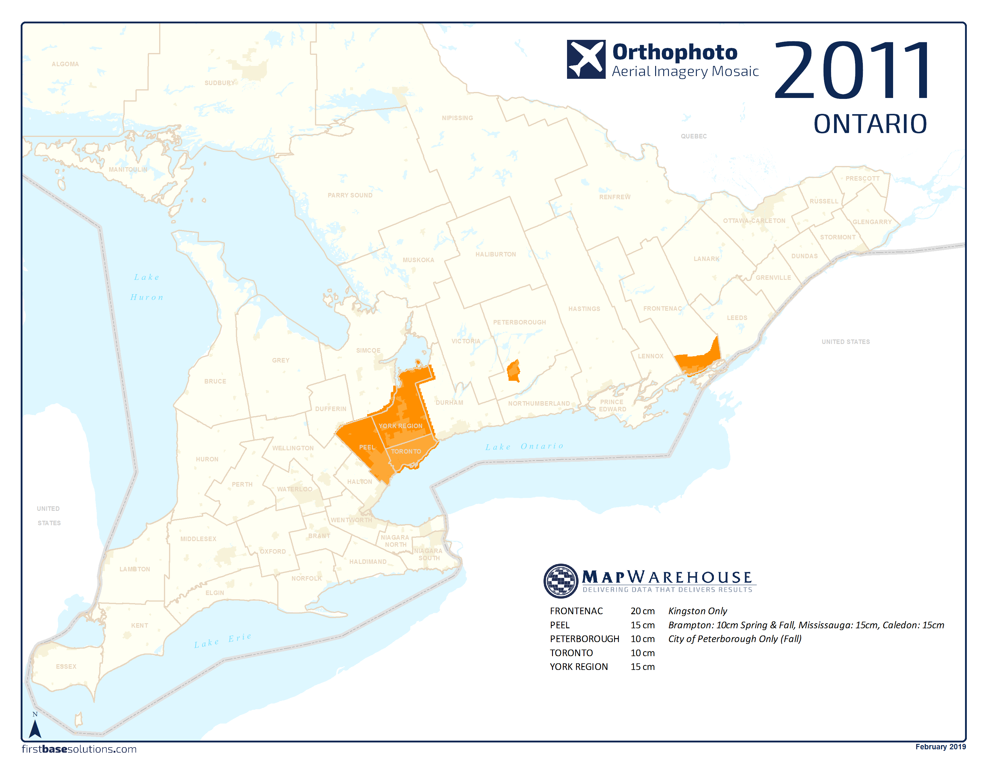
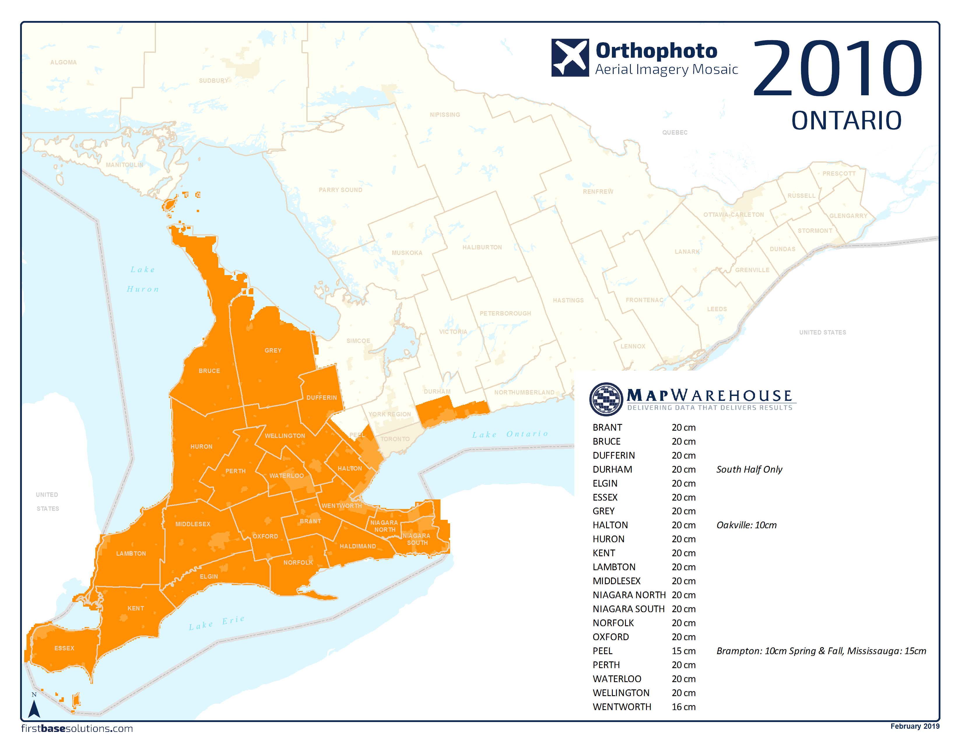
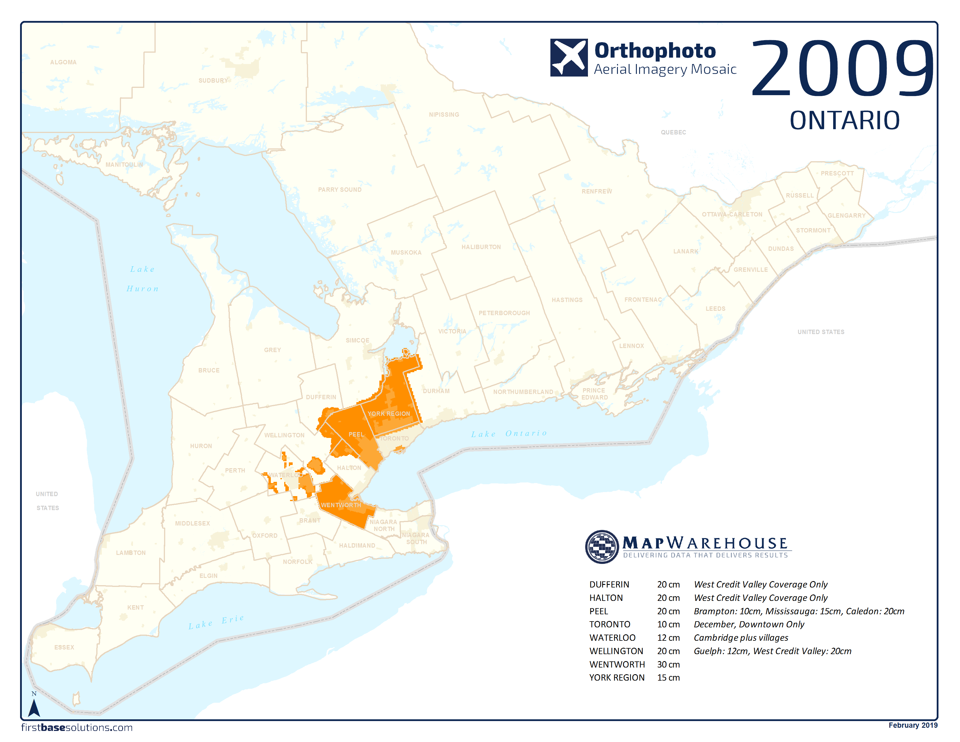
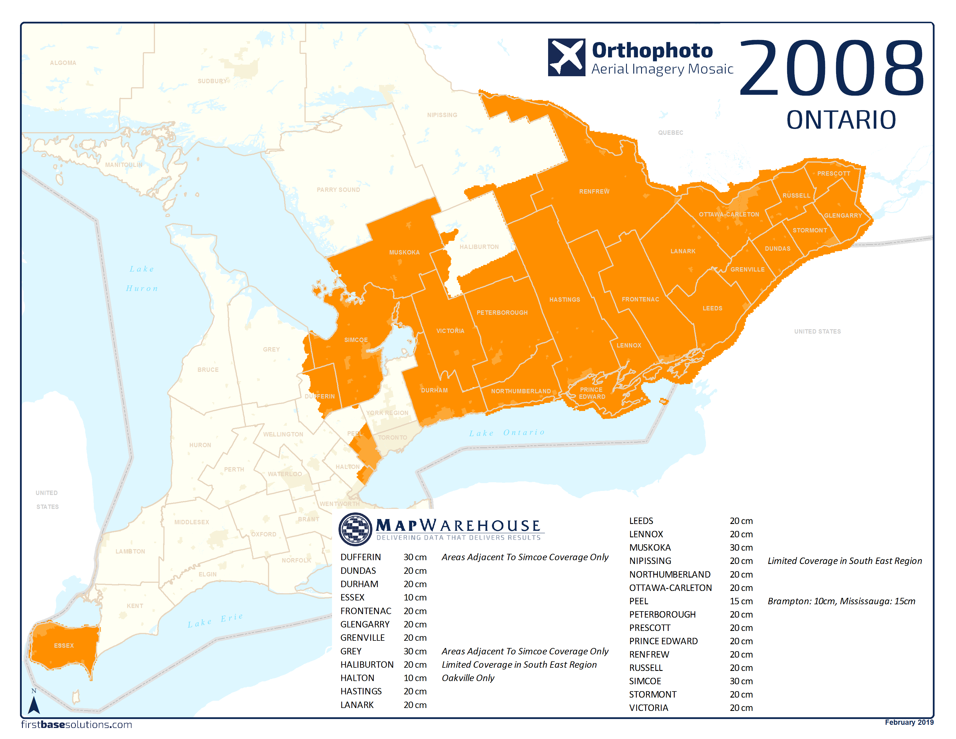
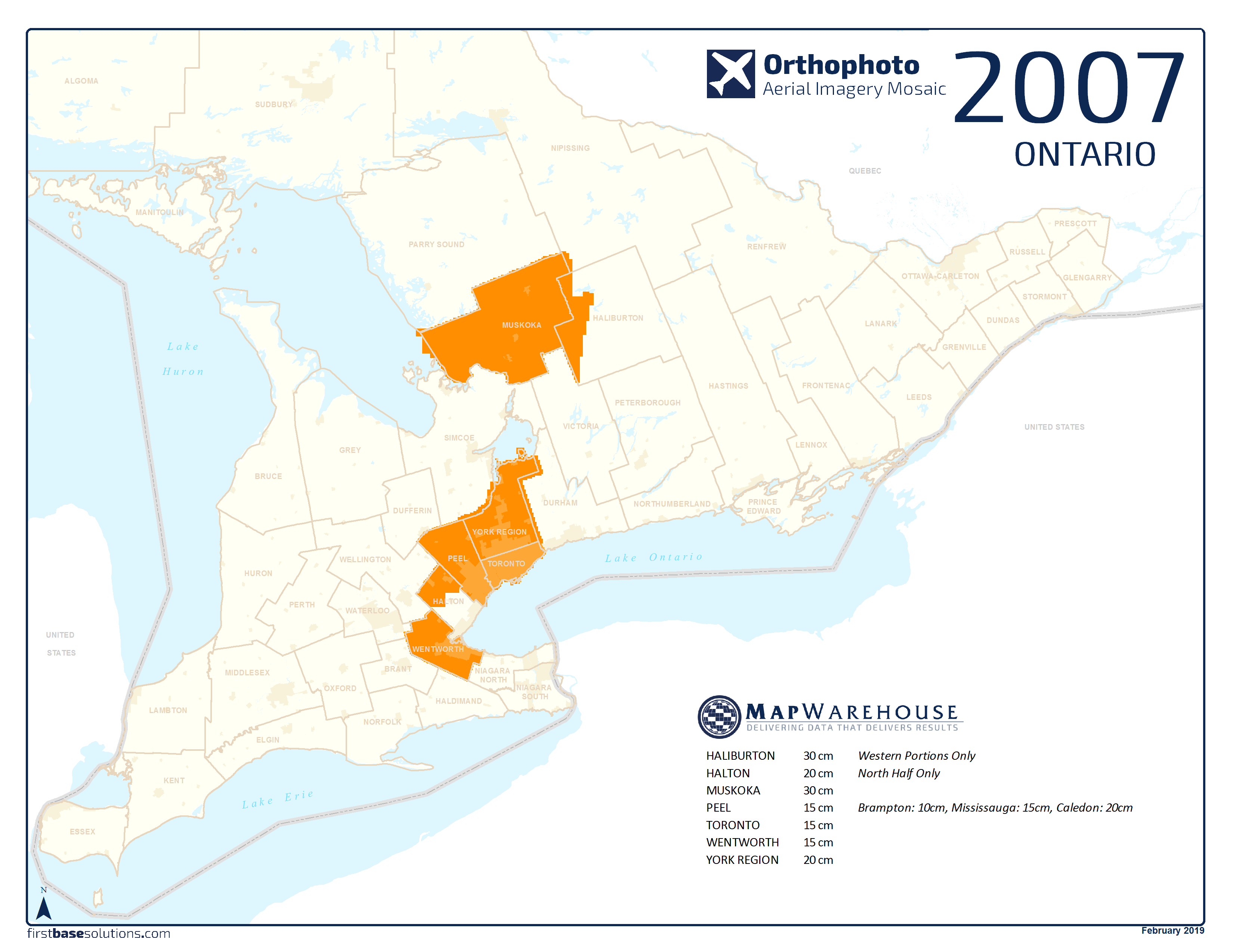
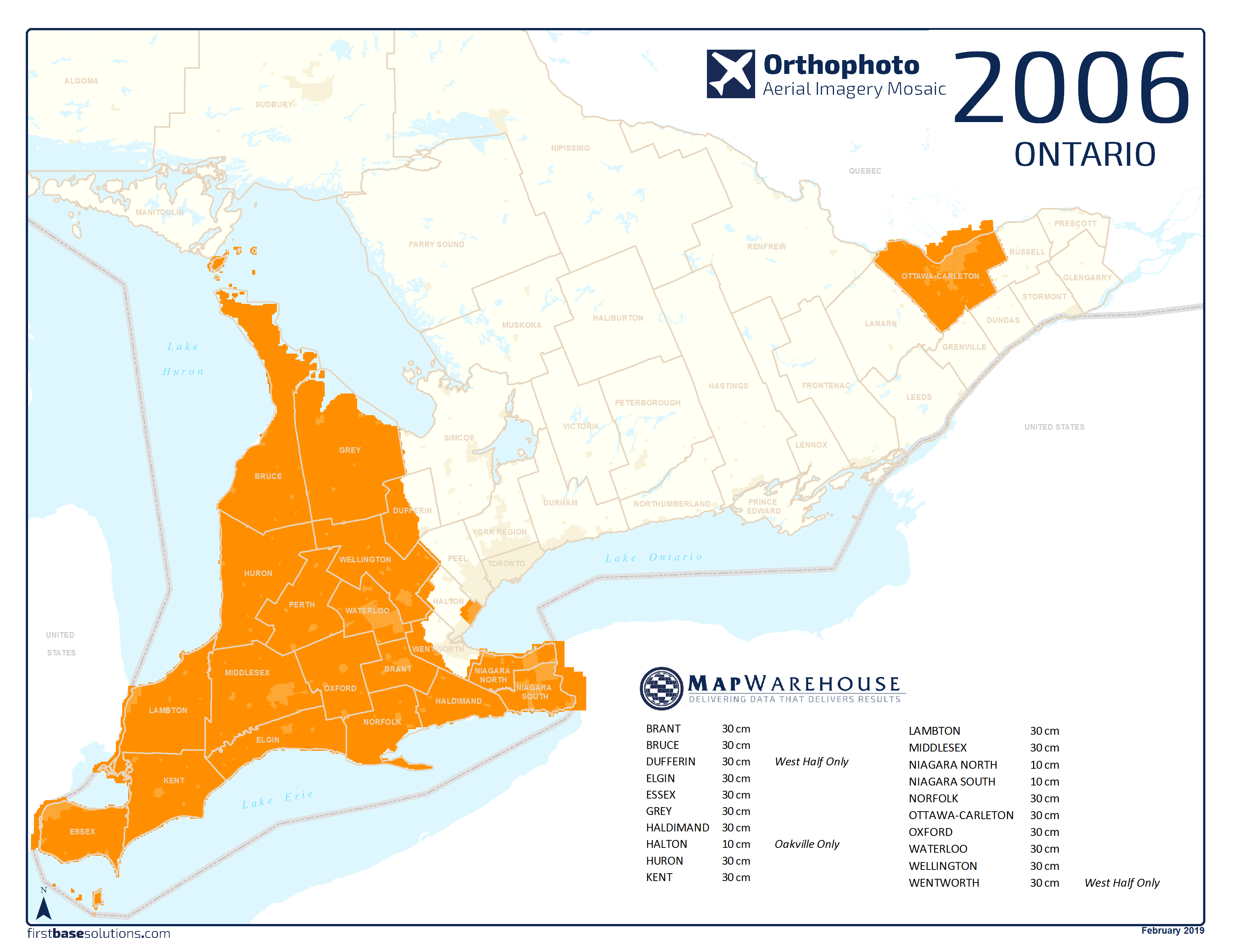
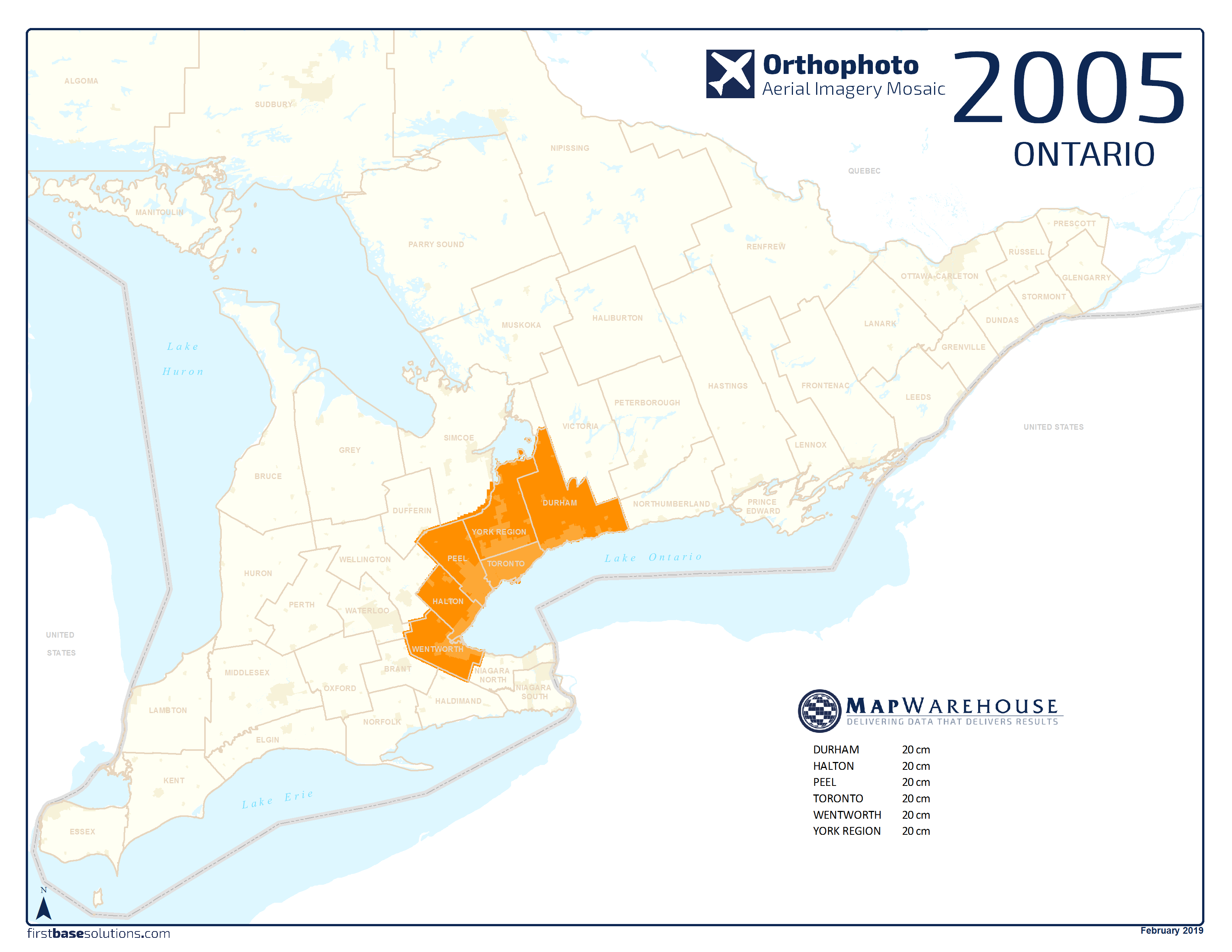
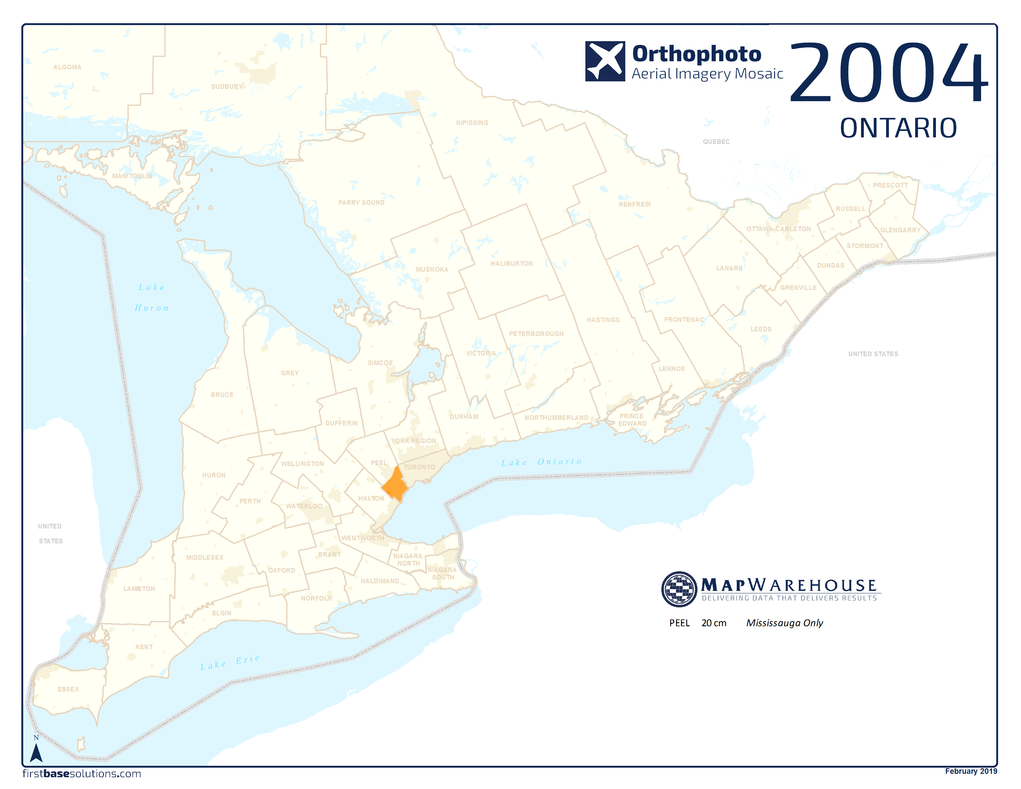
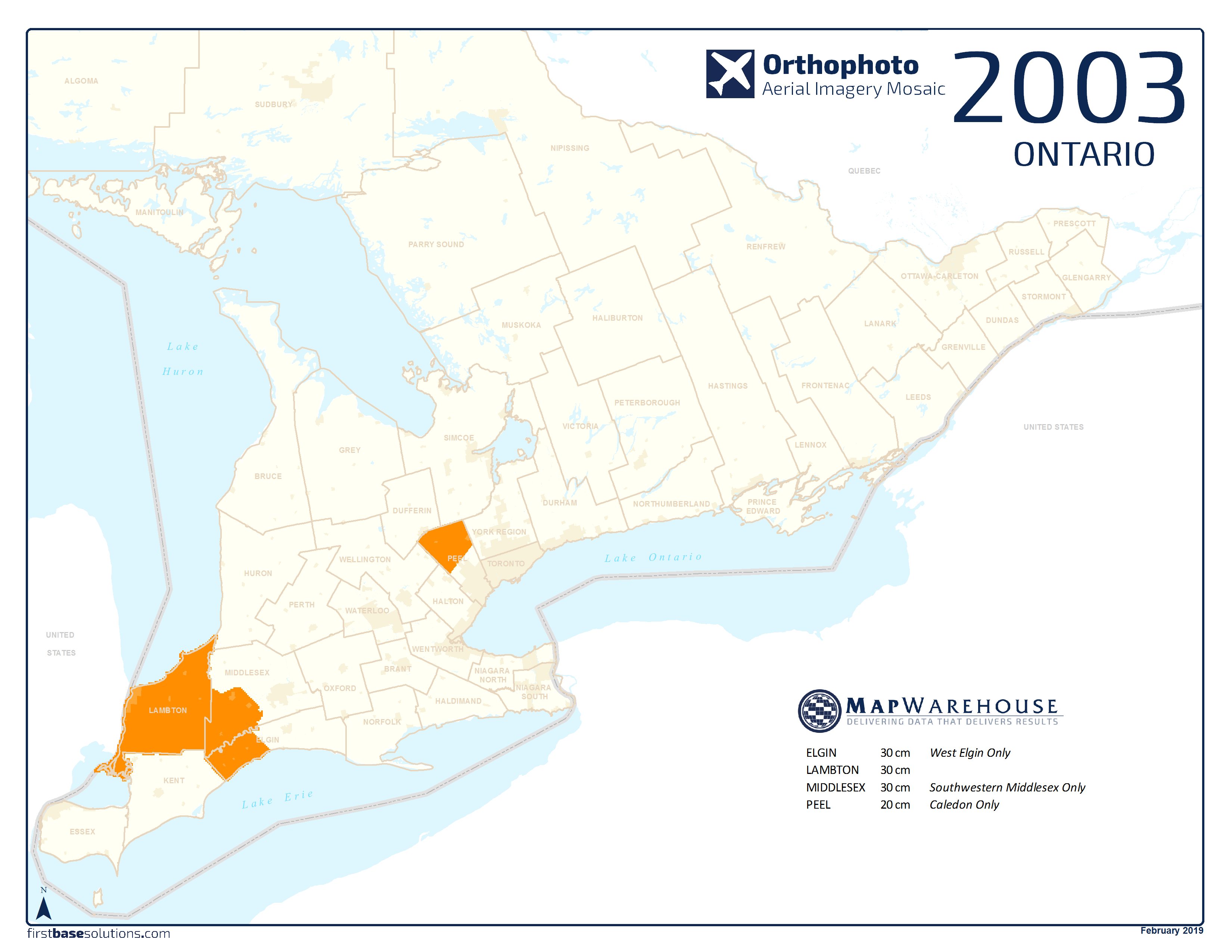
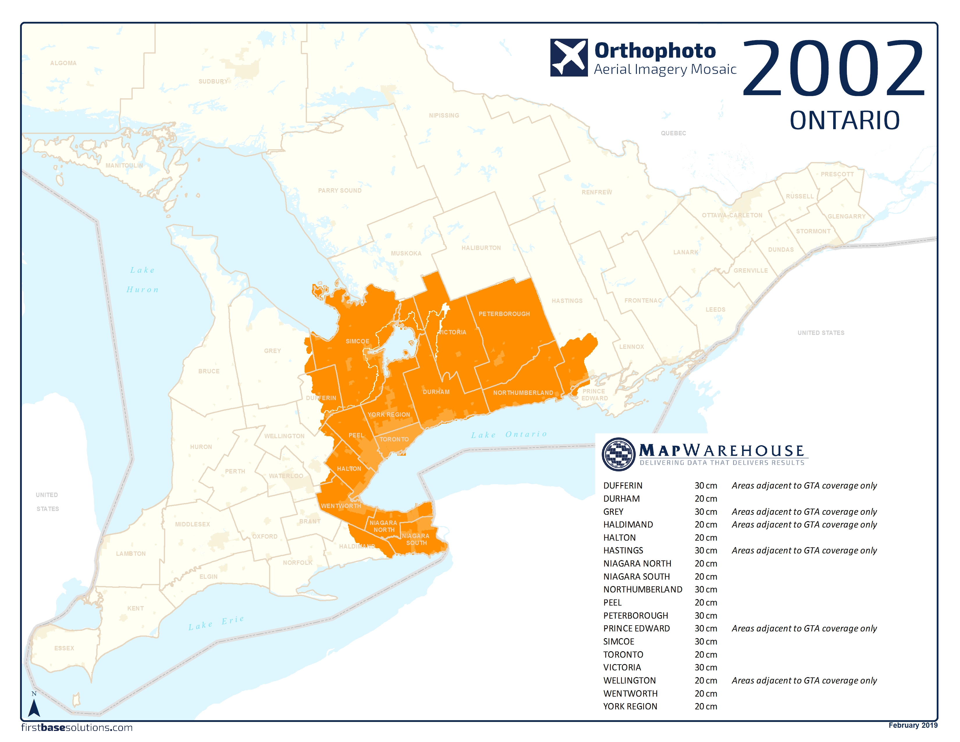
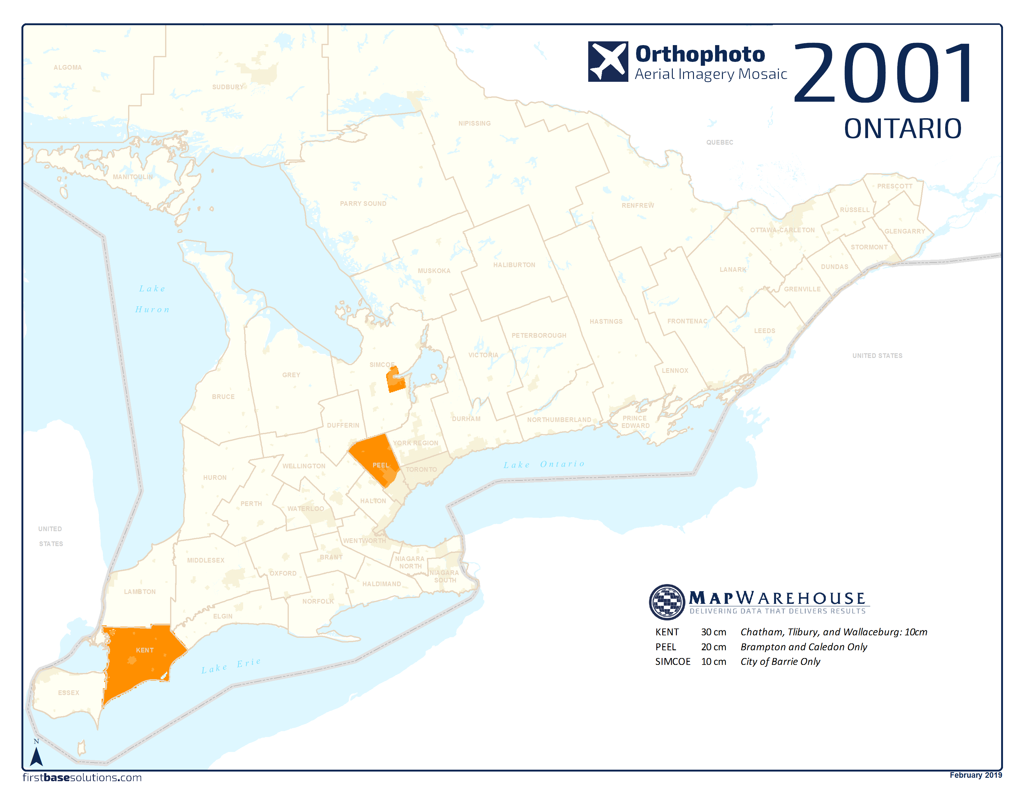
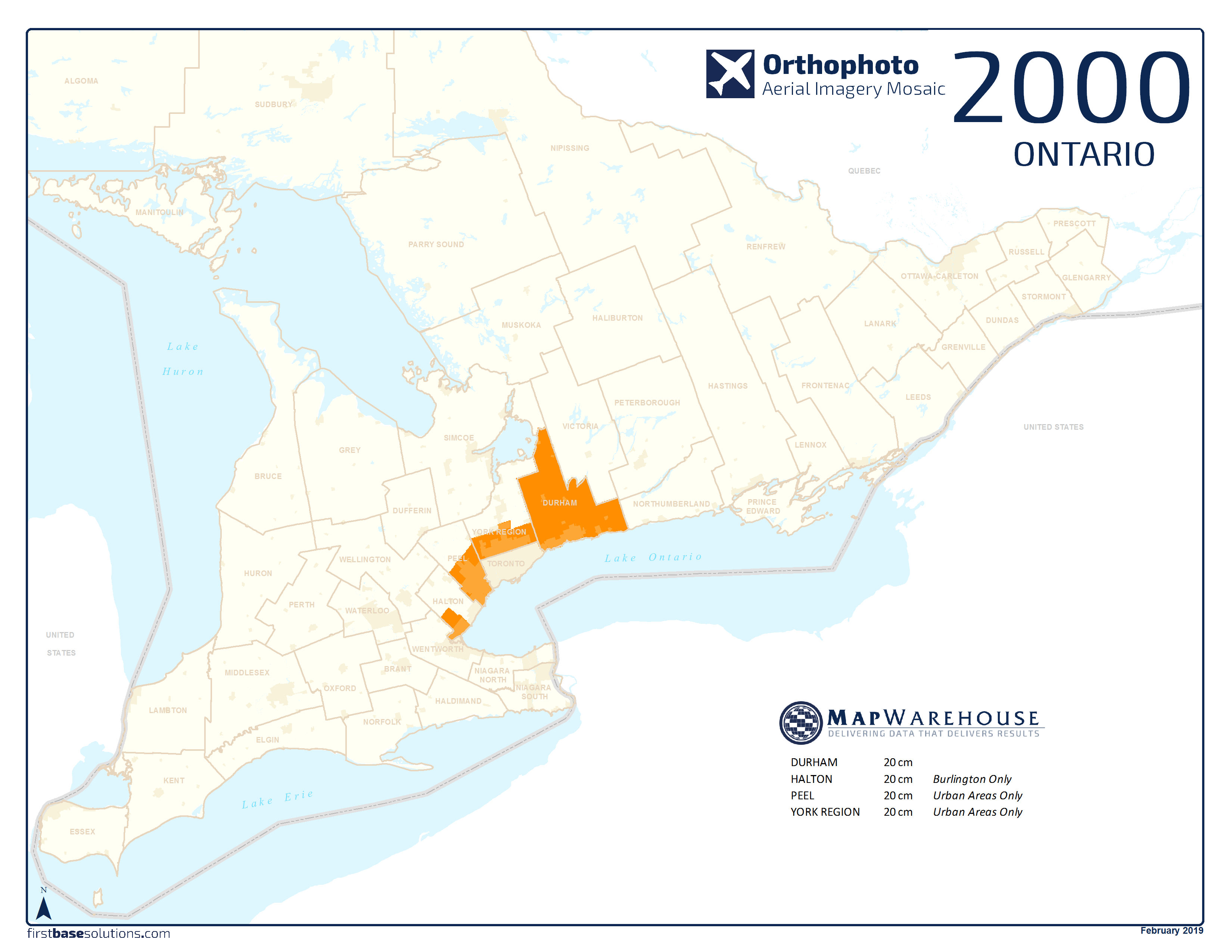
 Download All Ontario Ortho Coverages 2000 – 2022
 Video: Quick Tip – Choosing A Mapping Service [4:49]


 Compare All Data Products