

 905-477-3600

Ontario’s Largest Geospatial Data Marketplace
Delivering data that delivers results
![]()
The online store offers a variety of data for both beginners and experts through a user-friendly map-based search.
Customers can use the interactive map to locate their area of interest and purchase multiple data sets easily and quickly.

SEARCH
Search for data coverage at your area of interest using our customer friendly interactive map, free!![]()
SELECT
Select from a variety of geospatial data, file types, years, and image resolutions for all your needs.![]()
DOWNLOAD
Purchase the data with a credit card 24/7, and download your data package to your computer.![]()

WORK
Get to work in your own CAD or GIS software with the benefit of a high-quality aerial image base layer.![]()


Data Catalogue
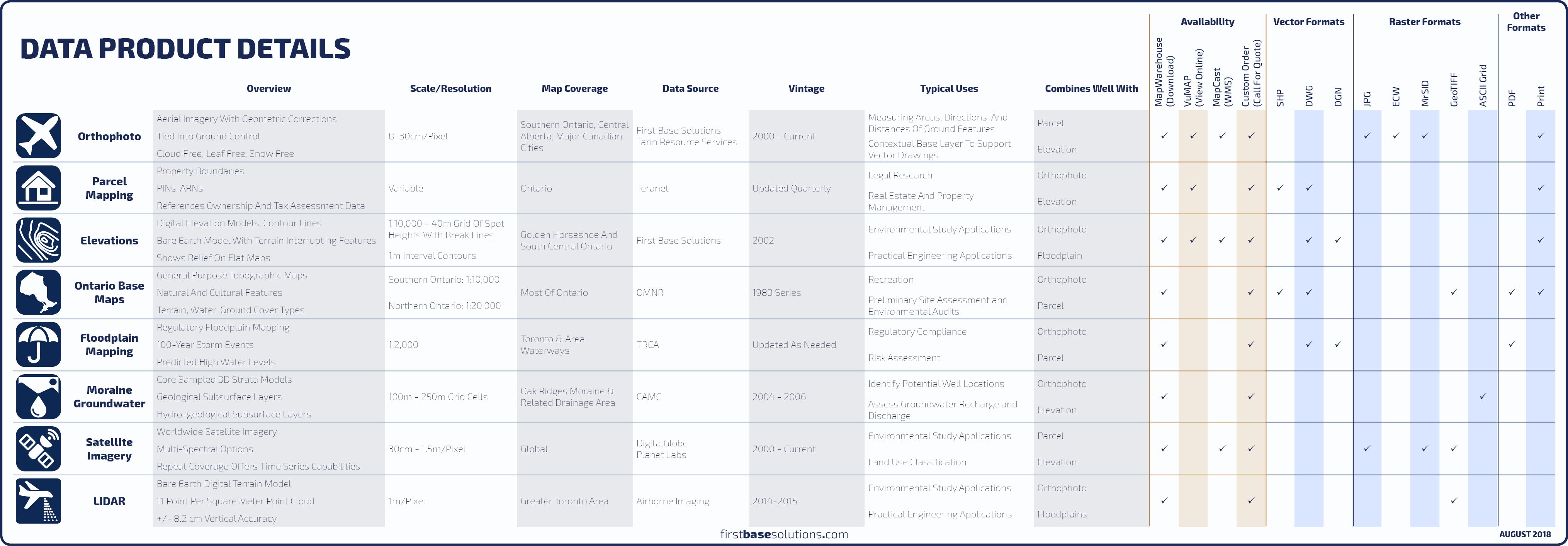 Compare All Data Products
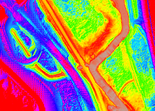
 Orthophoto
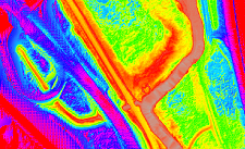
An orthophoto is an aerial photograph geometrically corrected such that the scale and overhead perspective is uniform, enabling users to measure true direction and distance.![]()
Compare With Satellite
|![]() FAQs
FAQs

 Satellite
Recent satellite imagery from Planet Labs Geomatics is now available in tiles across Ontario through MapWarehouse.![]()
Compare Sensors
|![]() FAQs
FAQs

 Teranet Parcel Mapping
Access a centralized library of the province’s 7.5 million parcels of land. The database contains digital mapping for property boundaries in Ontario along with attributes to uniquely identify each parcel.![]() Compare Boundary Mapping
Compare Boundary Mapping
|![]() FAQs
FAQs
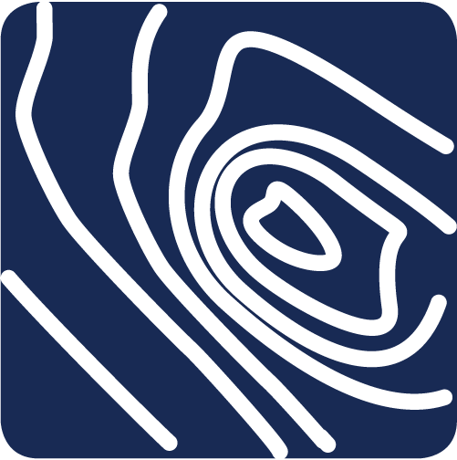
 LiDAR
LiDAR
Laser pulses from aircraft are used to collect point clouds from the reflected pulses. The point cloud is used to create digital elevation models depicting the bare earth.![]() Compare Elevation Mapping
Compare Elevation Mapping
|![]() FAQs
FAQs

 Elevations
First Base Solutions produces digital elevation models and 1m contours for areas covered by our orthophoto, or, we can source worldwide topographic coverage provided by DigitalGlobe.![]() Compare Elevation Mapping
Compare Elevation Mapping
|![]() FAQs
FAQs
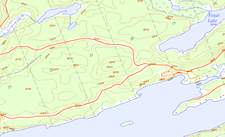
 Ontario Base Maps
OBM, or “topos” are a province-wide series of general-purpose topographic maps produced by the MNR, providing an excellent reference map for navigation in rural and backwoods regions.![]() FAQs
FAQs

 Flood Plain Mapping
Regulatory flood line mapping defines the known historical and predicted high water levels based on the 100-year storm event for lakes and rivers in the Toronto area.![]() FAQs
FAQs
 Oak Ridges Moraine Groundwater
Get 3D digital strata models of geological and hydrogeological subsurface layers across the Oak Ridges Moraine and it’s drainage areas in the GTA, from the Kawarthas to the Niagara Escarpment.![]() FAQs
FAQs
Download Free Samples 
Features
- Many Formats; JPG, MrSID, DWG, DGN, SHP, Etc
- Multiple Search Options
- View and Download Your Past Orders
- Preview Selected Items
- Access Vintage Data
- Download and Store Files Locally
- Large Coverage Area
Benefits
- Available 24/7
- Pay For Only Your Area of Interest
- Familiar Google Maps Interface
- Download Your Order in Minutes
- Helpful Customer Service and Support
- Data Continually Updated
- Convenient One Stop Data Shopping
 Blog: How To Interpret MapWarehouse File Names
Did you know the string of numbers actually means something useful? By interpreting the file names you can find:
The data type (orthophoto, parcel, contours),
The UTM coordinates of the file’s insertion point,
The year the data was produced,
The data provider (FBS, Teranet, TRCA)…


Blog: The Better Way To Order Spatial Data
Did you know you can download the coverage and tile boundaries for all the data you find on MapWarehouse? These indexes can be loaded in your own software to see the context of where the individual tile boundaries fall in relation to your existing data. You will be able to see at a glance how many tiles you will need to cover your area of interest…
Sell Your Data
FBS offers great partnership programs that make selling your geographic data easy and cost free.
We’ll sell your data on all our platforms to maximize your data’s distribution, allowing you to focus on what you do best: Creating More Data.
 Learn More
 Blog: How To Remove An Item From Your MapWarehouse Shopping Cart
You need to review your shopping cart before heading to the checkout. The tools to do this are hiding in plain sight. Before placing that angry phone call, please watch this one minute video…
Discover More
-

-
Data Catalogue
-

-
Satellite
-
-
LiDAR
-

-
Floodplain
-

-
Frequently Asked Questions
-

-
Orthophoto
-
-
VuMAP
-

-
FBS University