

 905-477-3600

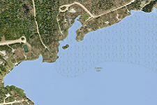
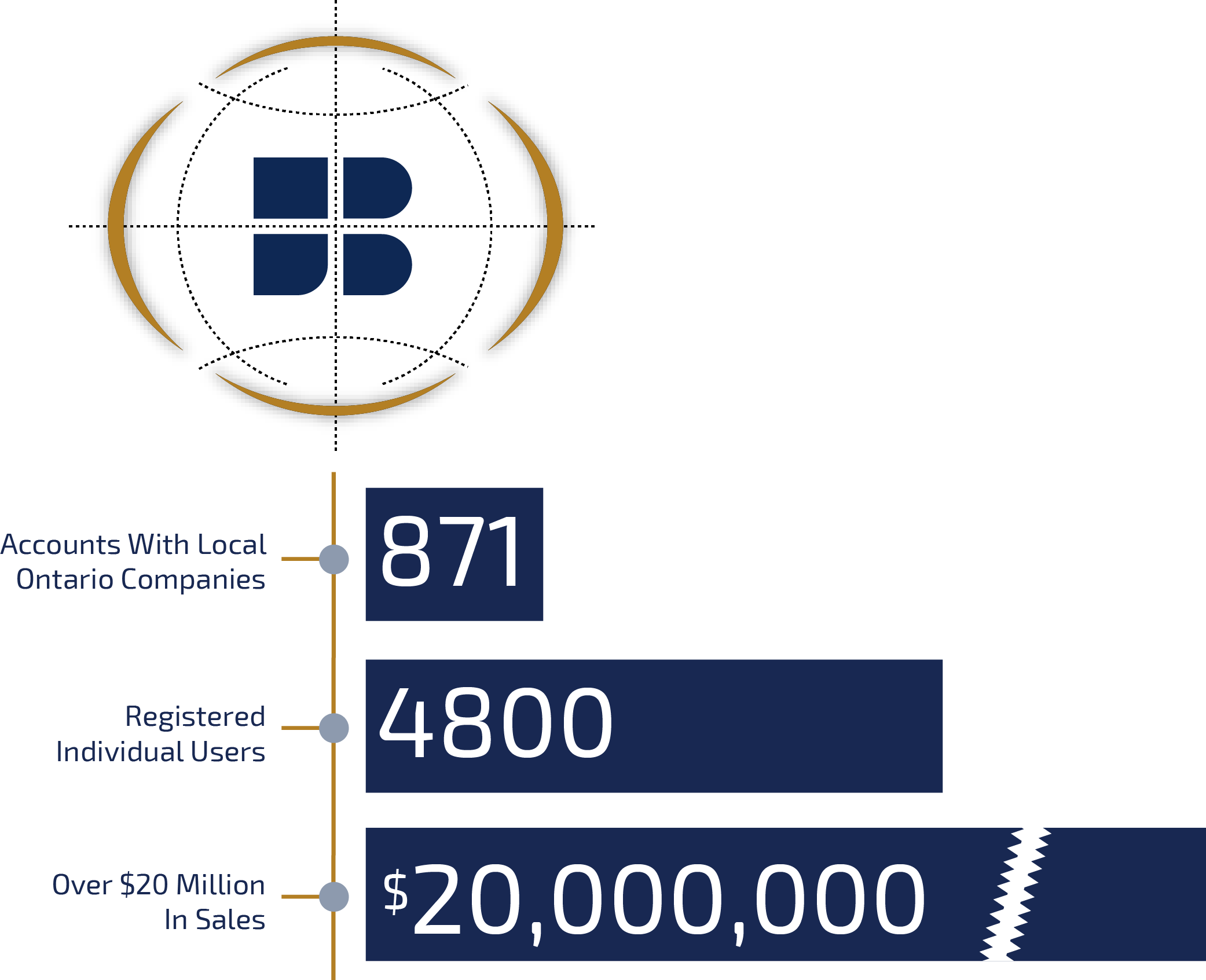
VuMAP is a feature-packed online mapping application with easy to use, built in tools to measure, draw, compare imagery year over year, and research property information.
Enhance your customer service capabilities, reduce accrued costs and streamline your sales process by quoting customers quickly without making costly site visits.
 Blog: How to export details of your saved research from VuMAP to a spreadsheet
Find the location on a map, Query to review the attributes of features in the area, Bookmark the chosen features, Save the attribute information to a spreadsheet.The video below will show you how, and lets you preview the property parcel features you won’t see with a free trial subscription.
Find the location on a map, Query to review the attributes of features in the area, Bookmark the chosen features, Save the attribute information to a spreadsheet.The video below will show you how, and lets you preview the property parcel features you won’t see with a free trial subscription.

VIEW
Unlimited access to browse the entire, full quality collection of aerial imagery and geospatial data.
![]()

QUERY
Research property information and query the complementary data layers for additional information.
![]()

MEASURE
Save measurements, drawings, annotations, and views to plan your project directly over the photo base layer.
![]()

REPORT
Use insights gained from VuMAP to respond to customers and enhance your day to day productivity.
![]()


Data Catalogue
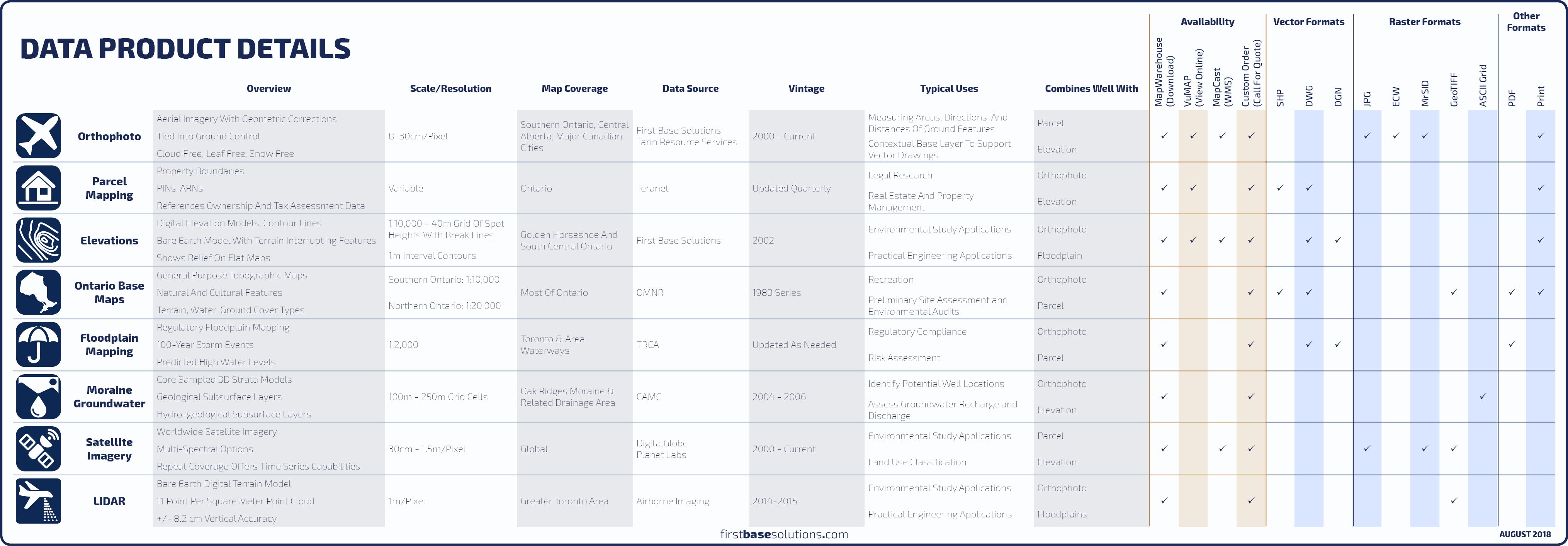 Compare All Data Products
 Orthophoto
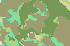
Imagery ranging from 2002-current covering Southern Ontario. Aerial imagery is geometrically corrected, enabling users to measure true direction, distance, and area.
![]() Compare With Satellite
|
Compare With Satellite
|
![]() FAQs
FAQs

 Teranet Parcel Mapping
Access mapping with PIN (Property Identification Number) and ARN (Assessment Roll Number) for every parcel in Ontario along with full legal descriptions.
![]() Compare Boundary Mapping
|
Compare Boundary Mapping
|
![]() FAQs
FAQs

 Elevations
Elevation contours in 1m intervals across the Golden Horseshoe produced by FBS, and coverage of all Ontario in 5m and 10m intervals.
![]() Compare Elevation Mapping
|
Compare Elevation Mapping
|
![]() FAQs
FAQs
Soil Descriptions
Soil descriptions for Southern Ontario describing slope classes, Canada Land Inventory (CLI) rankings, stoniness, drainage class, and texture for all soil components.
Water Features
Streams, permanent and seasonal water bodies; hydrography information derived from Ontario base mapping, plus aquatic ecosystems information.
Green Space
Parks and nature reserves in Ontario, plus terrestrial ecosystems descriptions.
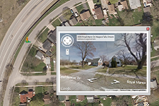
Google Maps and Google Street View
Familiar tools to help you navigate to your location. See the ground level view and overhead perspective at once.
Blog: VuMAP Tool Tips – See the VuMAP toolbox in action in these 30 second videos
Drawing Tool, Measure Tool, Annotation Tool, Query Tool, Save View Tool, Print Tool, Import Data Tool, Level 21 Zoom Tool…
Drawing Tool, Measure Tool, Annotation Tool, Query Tool, Save View Tool, Print Tool, Import Data Tool, Level 21 Zoom Tool…
Features
- Import, Export and Overlay Your Own Geospatial Data
- Measure Distance and Area Over the Photo
- Draw, Annotate, and Save Your Own Features
- Compare Vintage Photo and Detect Changes Over Time
- Query Data Layers for Additional Information About a Feature
- Transparencies Allow Two Layers to be Viewed Simultaneously
Benefits
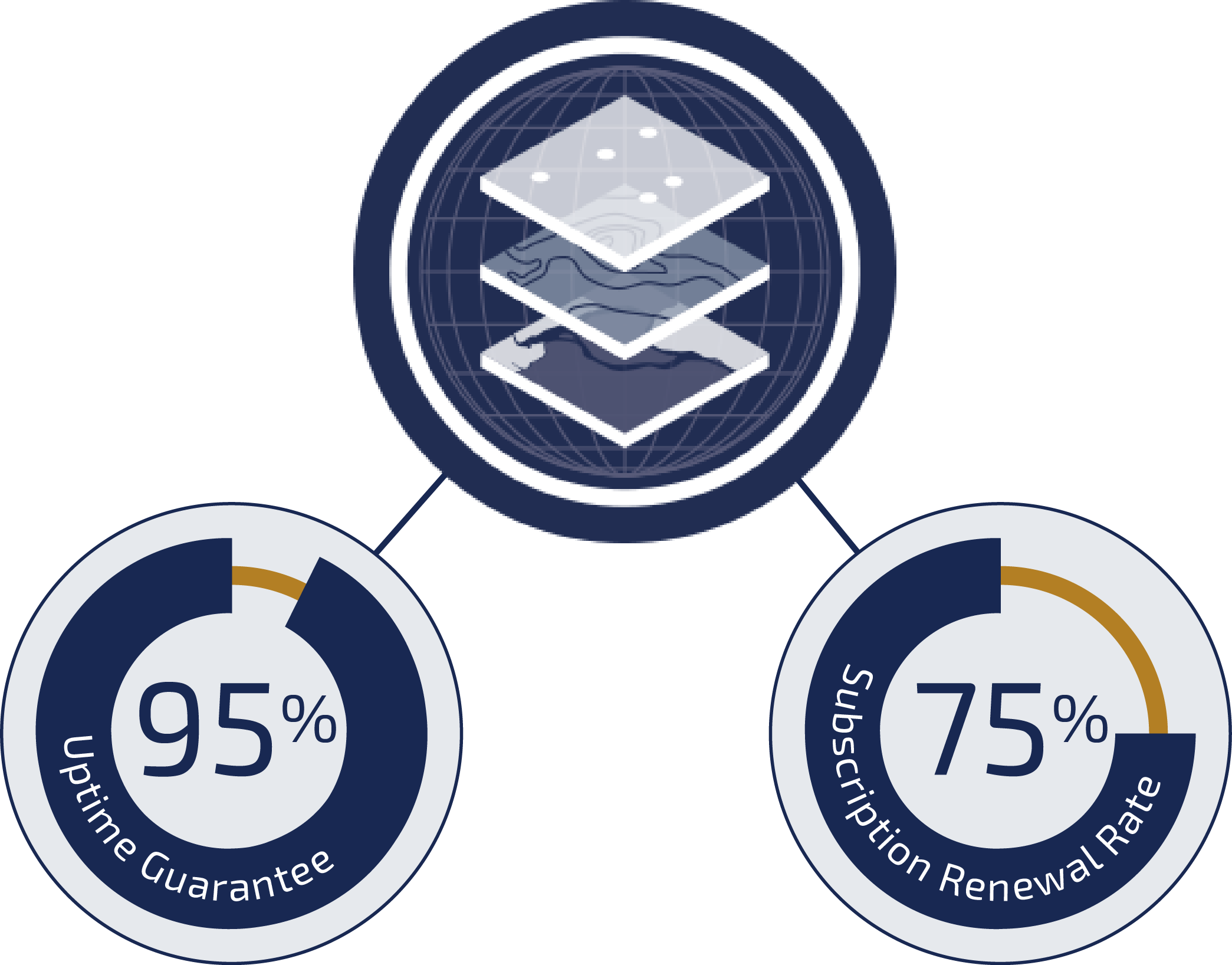
- Unlimited Access to the FBS Library
- Cut Down on Time Consuming Research and Site Visits
- Simple, Intuitive Tools, No New Software to Learn
- No Hidden Costs or Bandwidth Limits
- All Data Stored in the Cloud
- Free Trial Subscription
- Data Continually Updated
Blog: VuMAP Helps Property Research
Here’s how you can use VuMAP in day to day research to get PIN numbers quickly, plus gain contextual understanding from high resolution aerial imagery and mapping…
Here’s how you can use VuMAP in day to day research to get PIN numbers quickly, plus gain contextual understanding from high resolution aerial imagery and mapping…
Who’s It For?


Blog: Make accurate estimates with the click of a mouse
Measure and assess your site with high resolution aerial imagery to estimate material costs and quote customers from your desk. Gain insights that help you make smart decisions and direct your resources to where they’re most profitable…
Measure and assess your site with high resolution aerial imagery to estimate material costs and quote customers from your desk. Gain insights that help you make smart decisions and direct your resources to where they’re most profitable…
Sell Your Data
FBS offers great partnership programs that make selling your geographic data easy and cost free.
We’ll sell your data on all our platforms to maximize your data’s distribution, allowing you to focus on what you do best: Creating More Data.
 Learn More
Blog: Law of the Land: Adverse Possession
Goode v. Hudon, 2005. When one party has been continuously using abandoned land for a significant period of time, a claim for adverse possession can be made seeking to have the land deeded to them officially…
Goode v. Hudon, 2005. When one party has been continuously using abandoned land for a significant period of time, a claim for adverse possession can be made seeking to have the land deeded to them officially…
Discover More
-

-
Data Catalogue
-

-
Orthophoto
-

-
Frequently Asked Questions
-

-
Satellite
-

-
Parcel
-

-
Elevation
-

-
MapCast
-

-
FBS University