

 905-477-3600
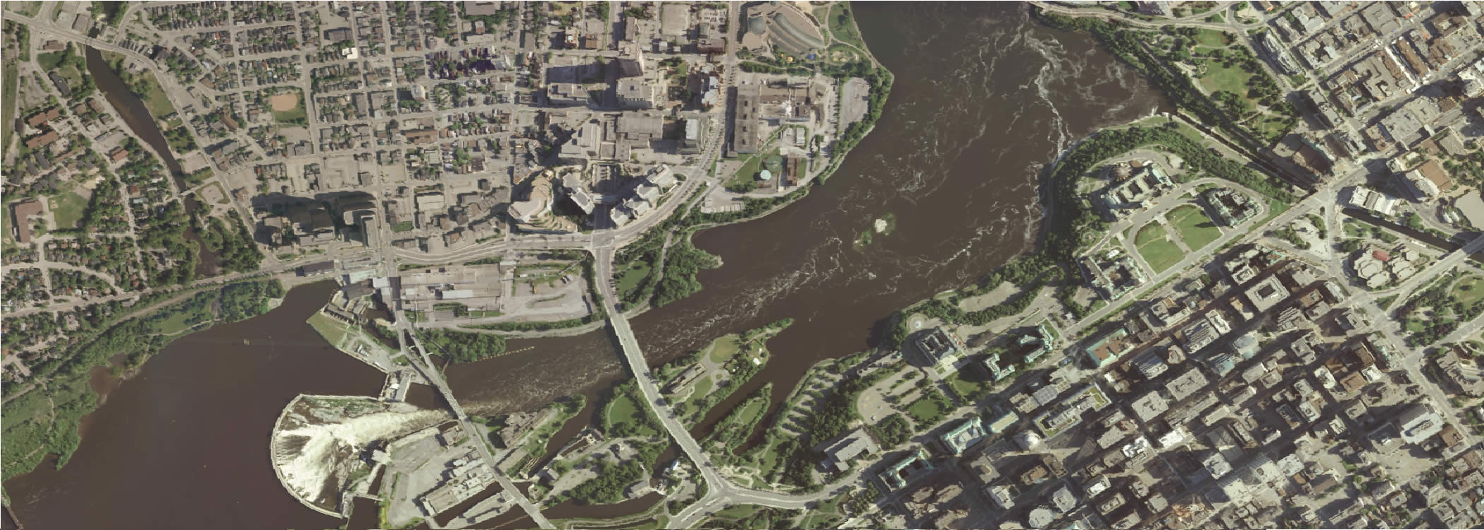

Aerial imagery is corrected so the scale and overhead perspective are uniform, just like a map.
Use our orthophoto to measure true direction and distances without distortions caused by the aircraft movement.


How To Purchase

MapWarehouse
Ontario’s Largest Geospatial Data Marketplace
Search for data, select files covering your location, download your order, and work with aerial imagery and geographic data. Use the interactive map to locate your area of interest and purchase multiple data sets easily and quickly with a credit card.![]() Go Now |
Go Now | ![]() Learn More
Learn More

VuMAP
Access Every Place From One Place
View geographic data, query the map for more information, measure ground features you see in the imagery, and report on your research using this feature-packed online mapping application. Compare imagery year by year and research land information from anywhere.![]() Go Now
Go Now
| ![]() Learn More
Learn More

MapCast
Unlimited Access To Ontario’s Largest Web Mapping Service
Connect to a high resolution aerial imagery mosaic base layer and elevation contours served directly to your CAD or GIS workstation, just as you would connect to data stored locally. Bandwidth based pricing allows your team to use MapCast as little or as much as you need.![]() Go Now |
Go Now | ![]() Learn More
Learn More

Zoom2it
Real Simple Real Estate Marketing
Get instant access to Ontario parcel boundaries drawn over high resolution aerial imagery. Generate three custom aerial images for your real estate listing focused on your property; a great way to market large, remote, or irregularly shaped properties.![]() Go Now |
Go Now | ![]() Learn More
Learn More

Custom Order
Hard Copy Prints
Order our Downtown Toronto laminated aerial photo wall map with street name index for your lobby or board room, or, have us create a custom layout for your site with aerial imagery, contour elevations, parcel boundaries, plus data you provide.![]() Go Now |
Go Now | ![]() Learn More
Learn More

Compare Orthophoto With Satellite Imagery
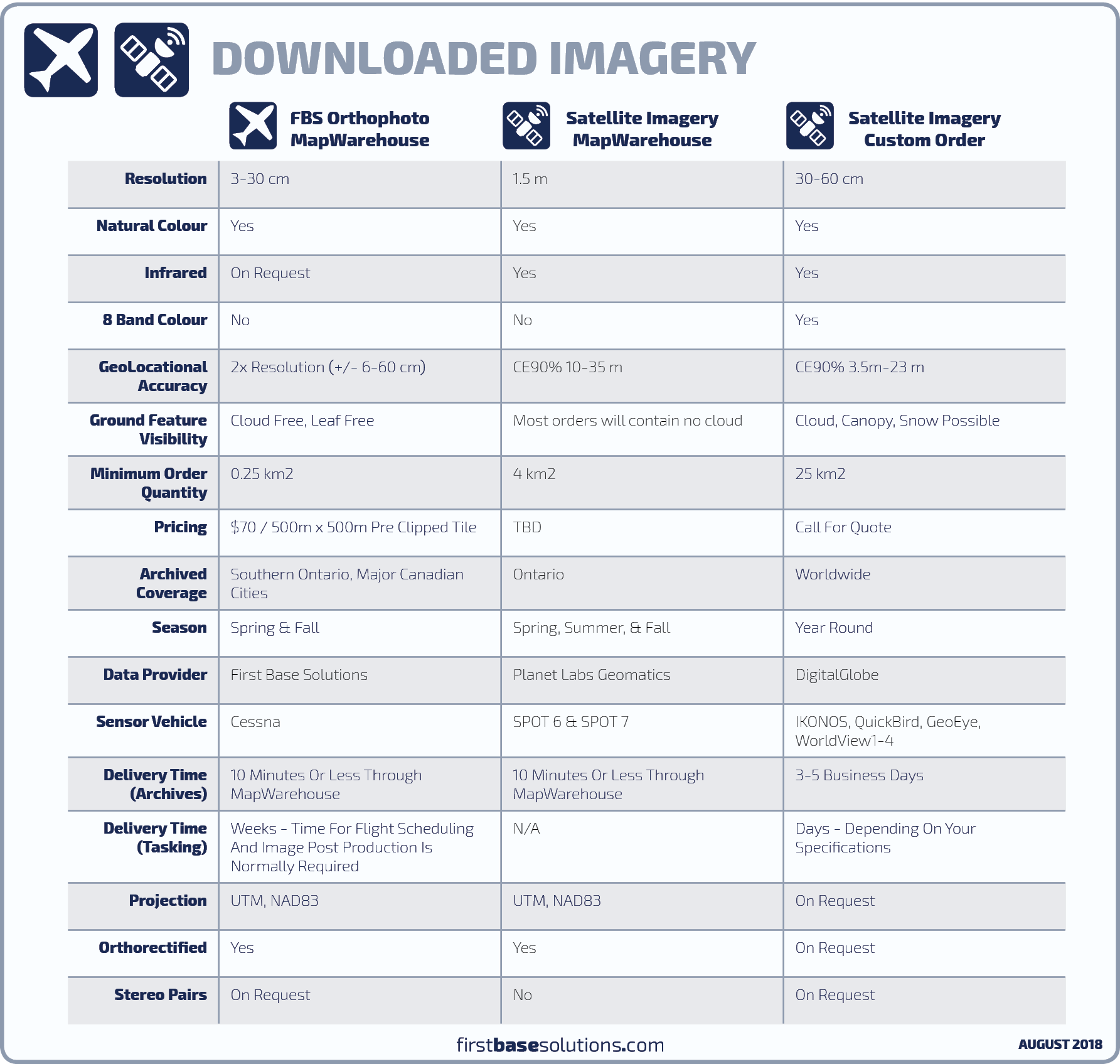
What’s Available?
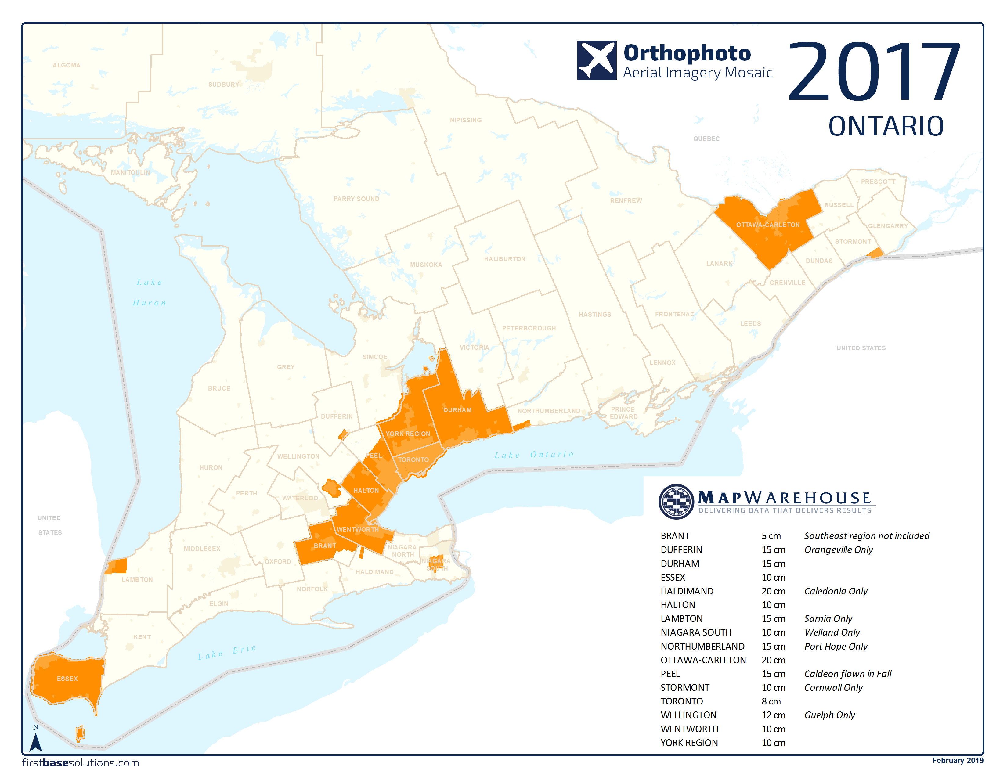
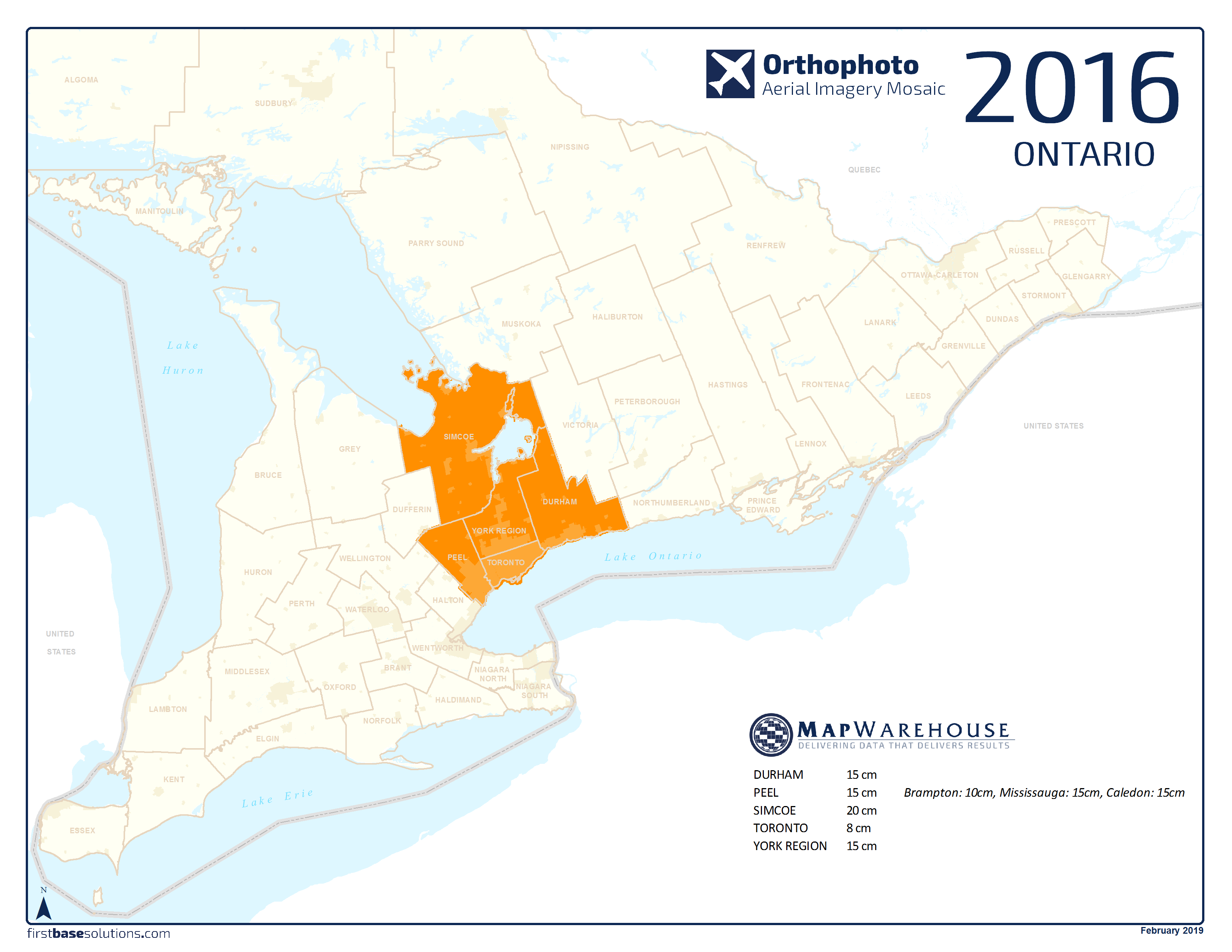
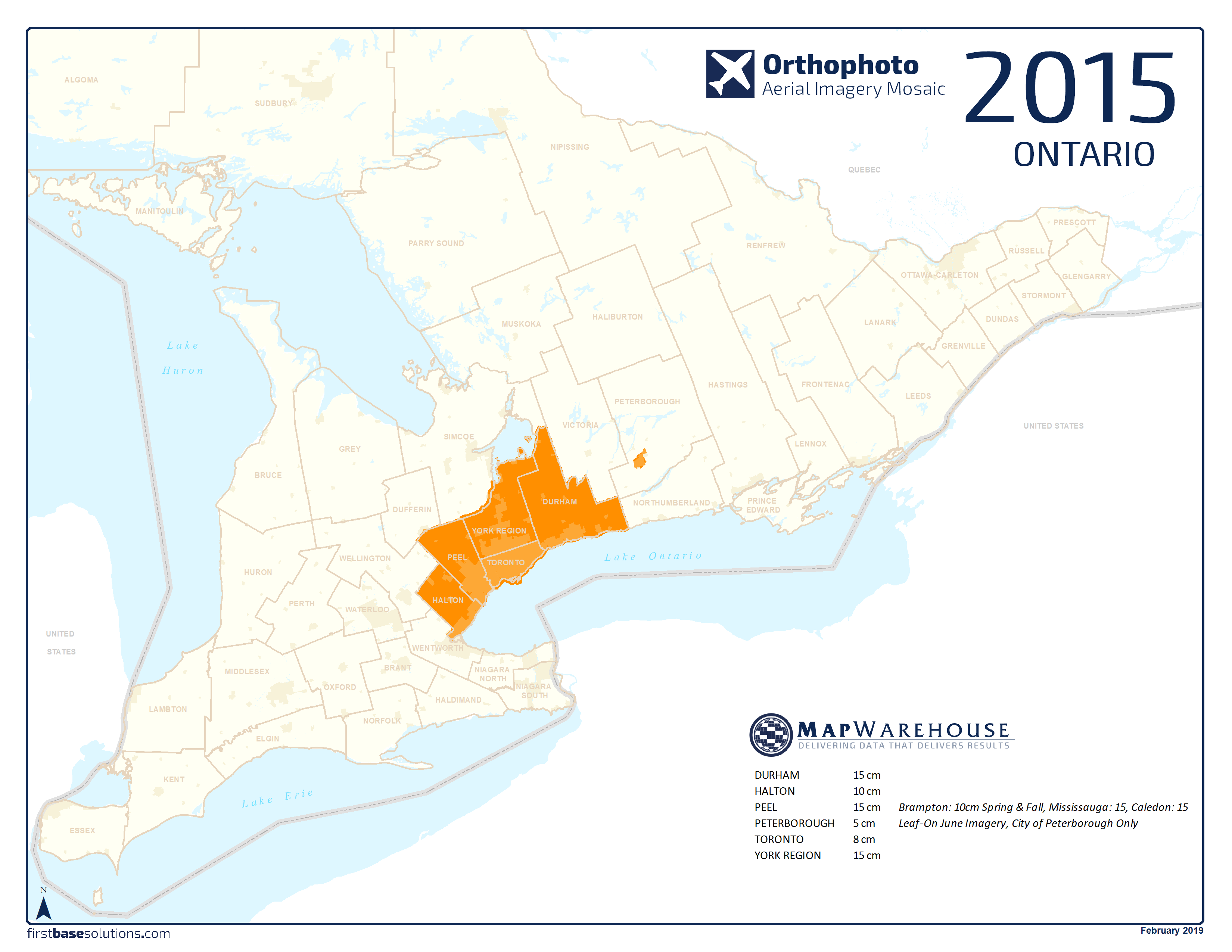
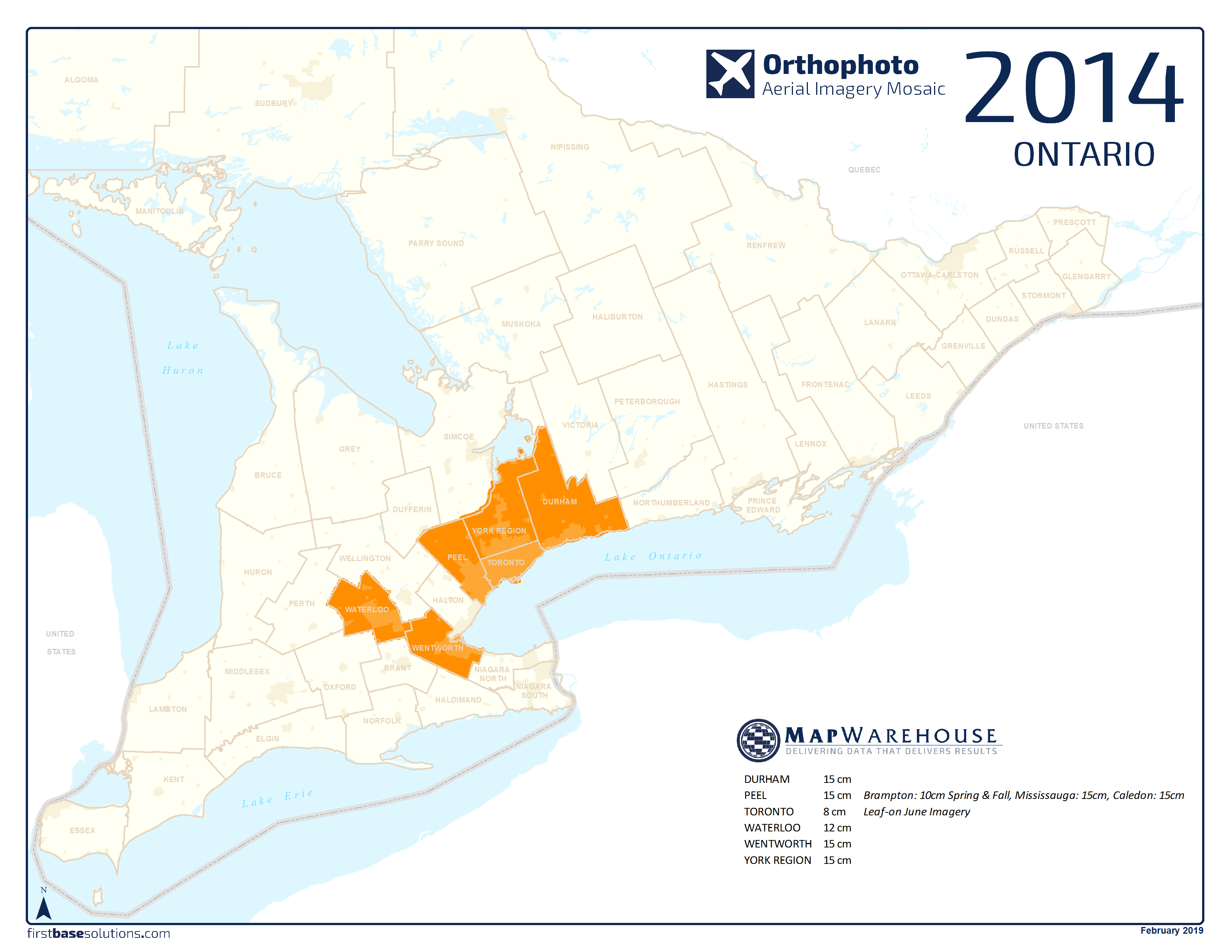
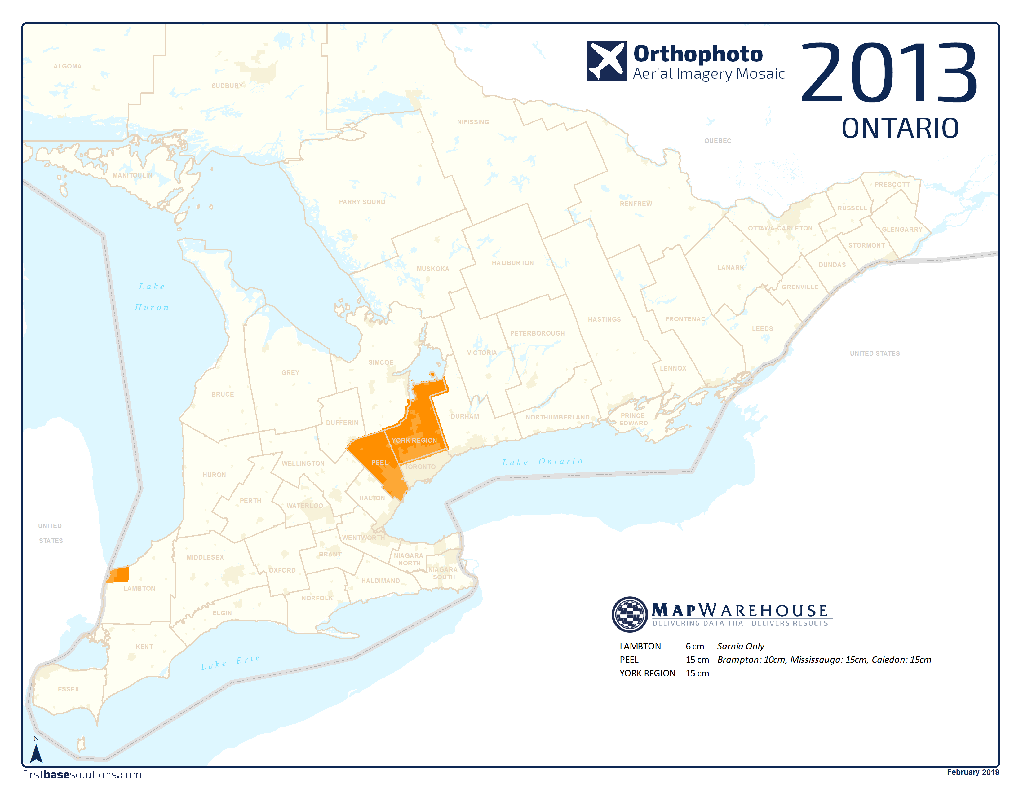
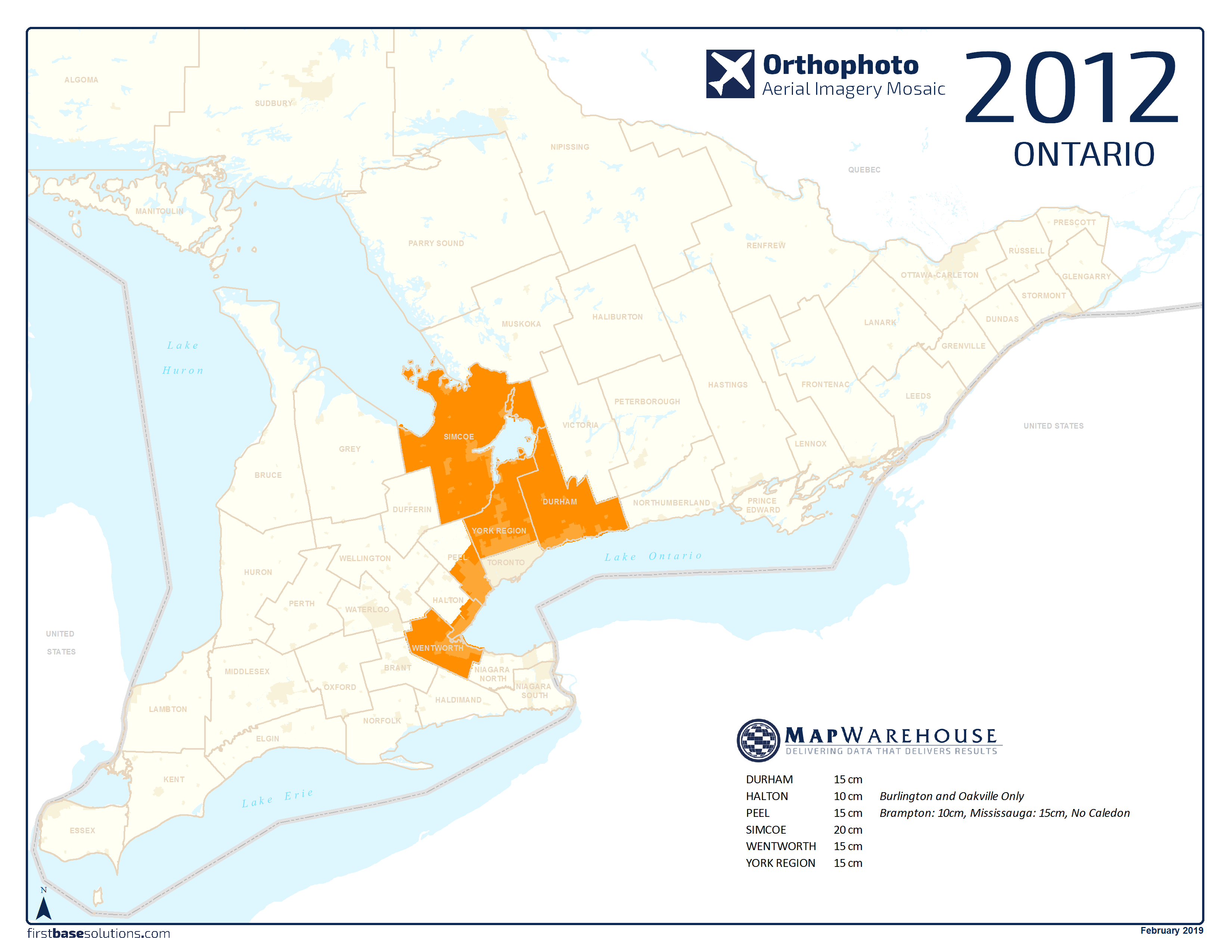
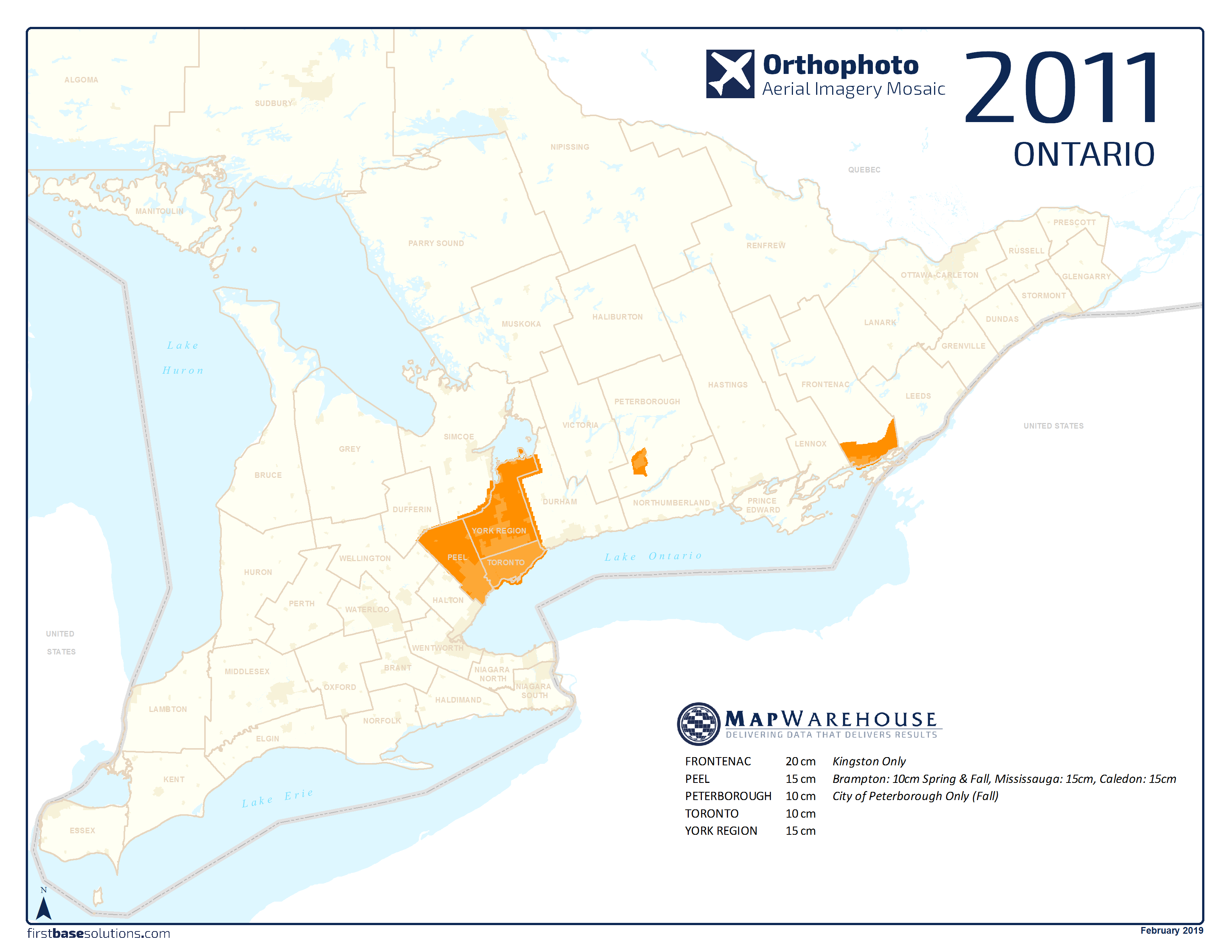
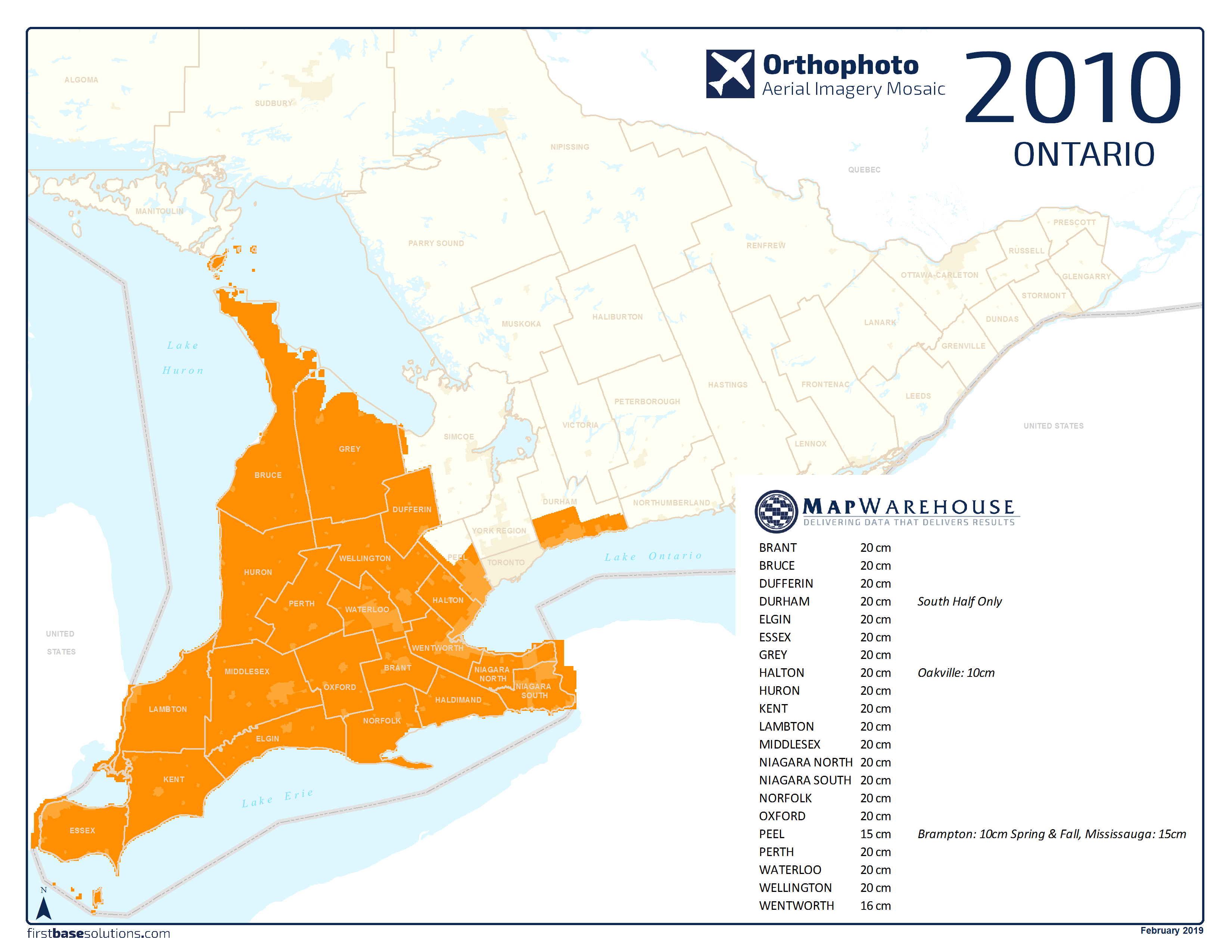
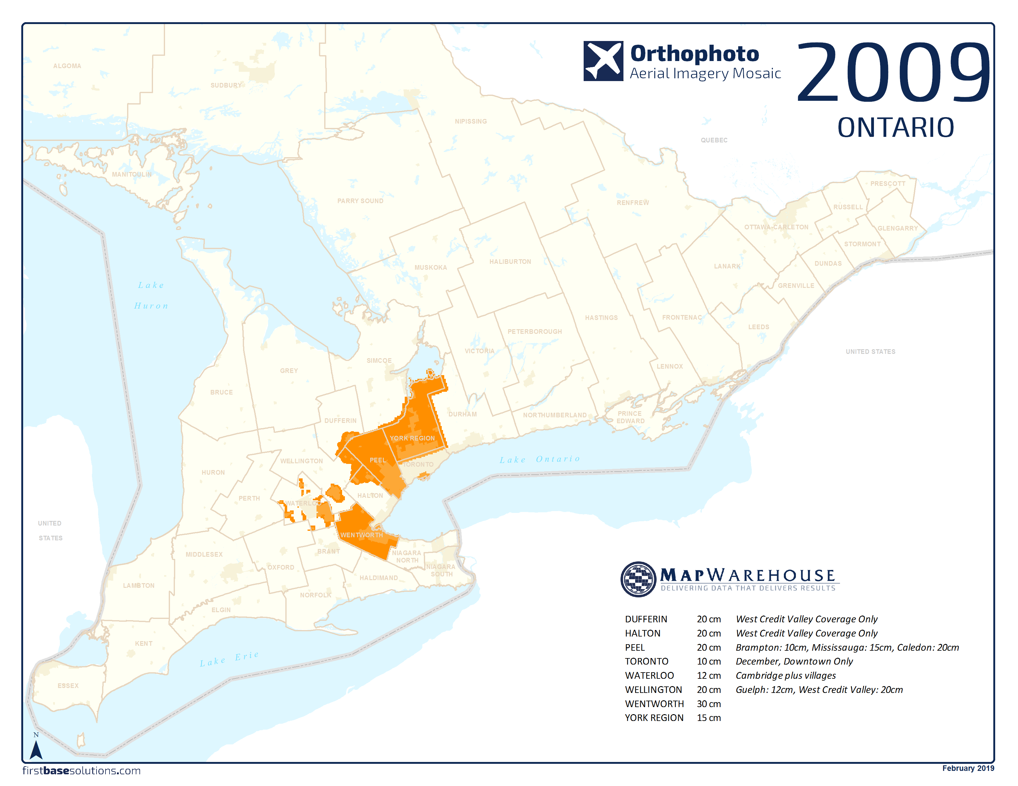
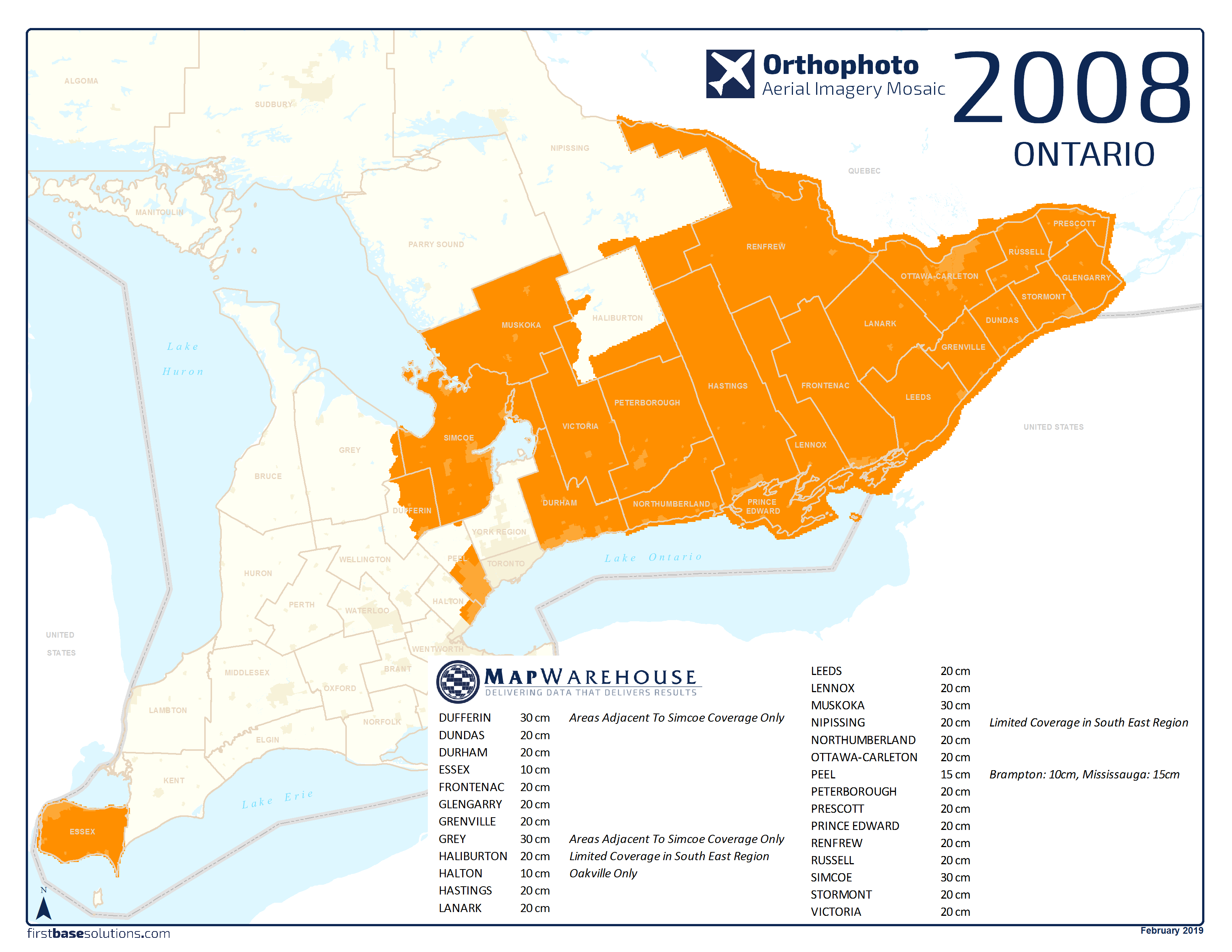
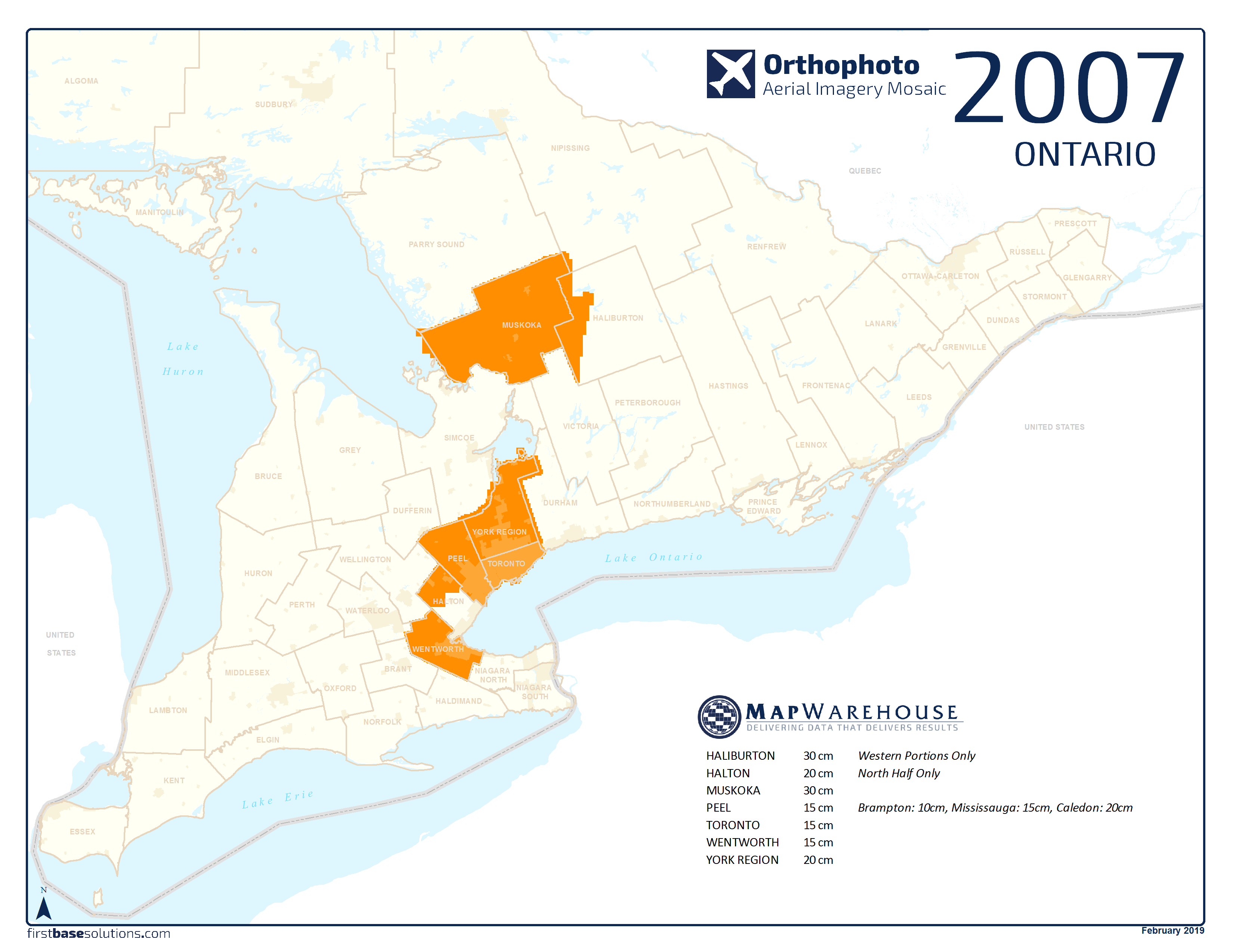
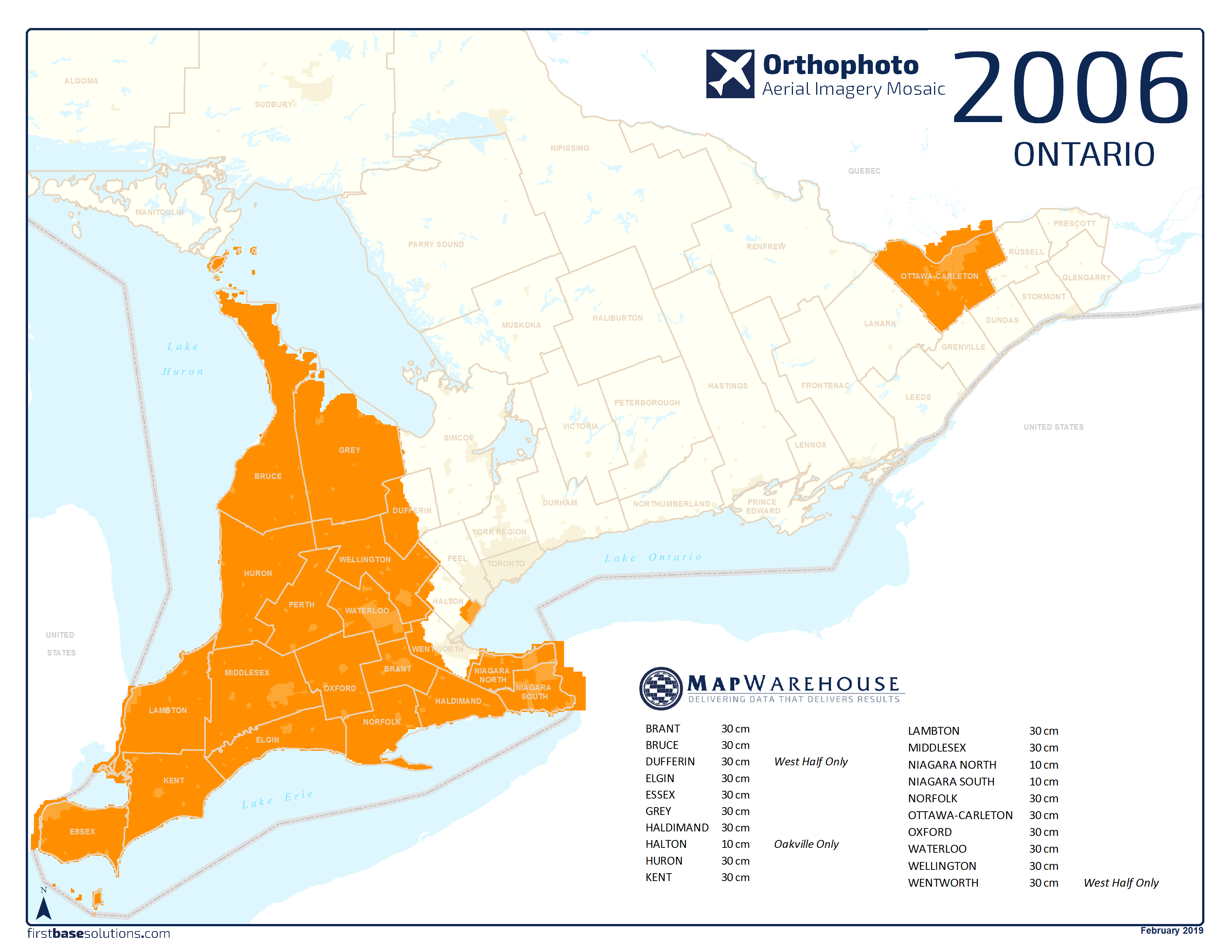
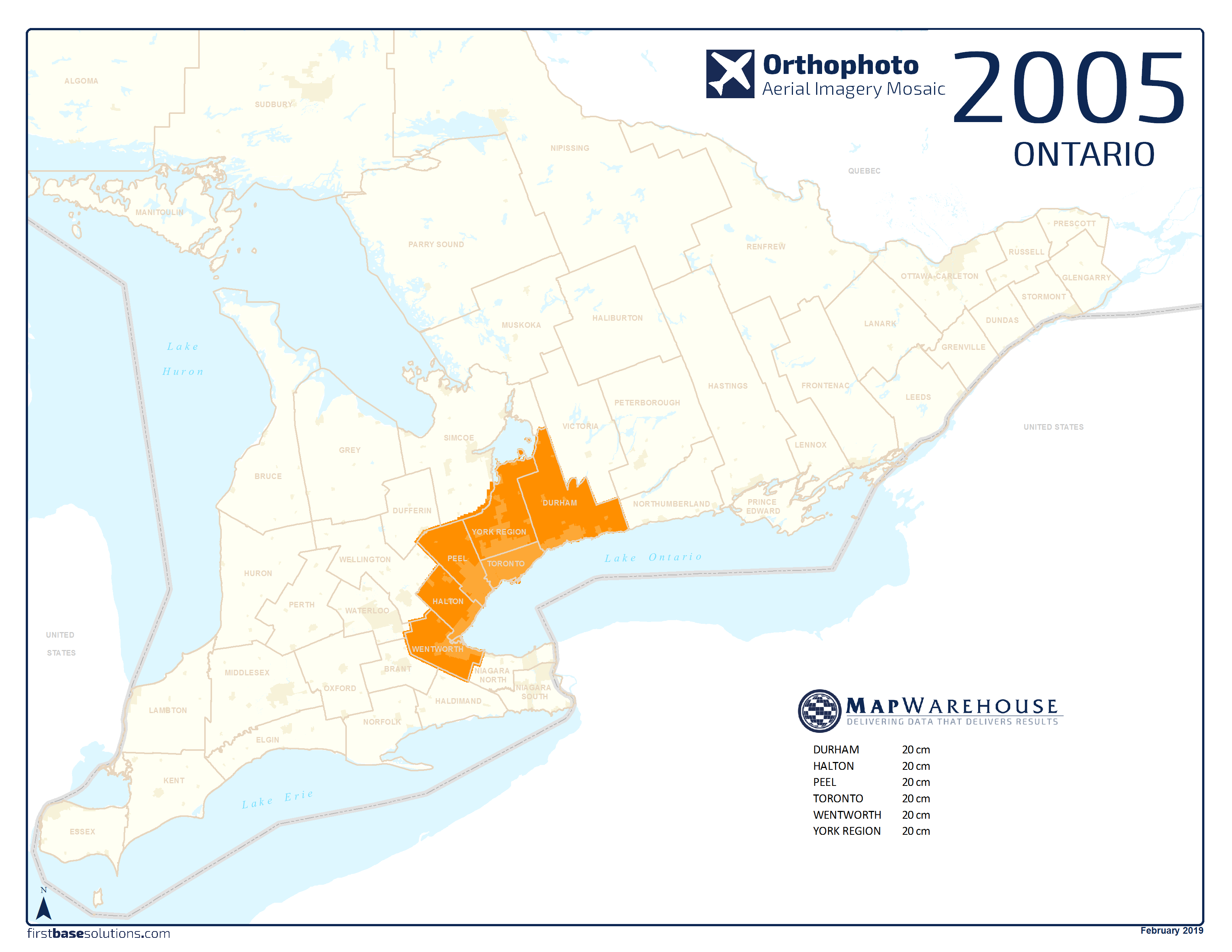
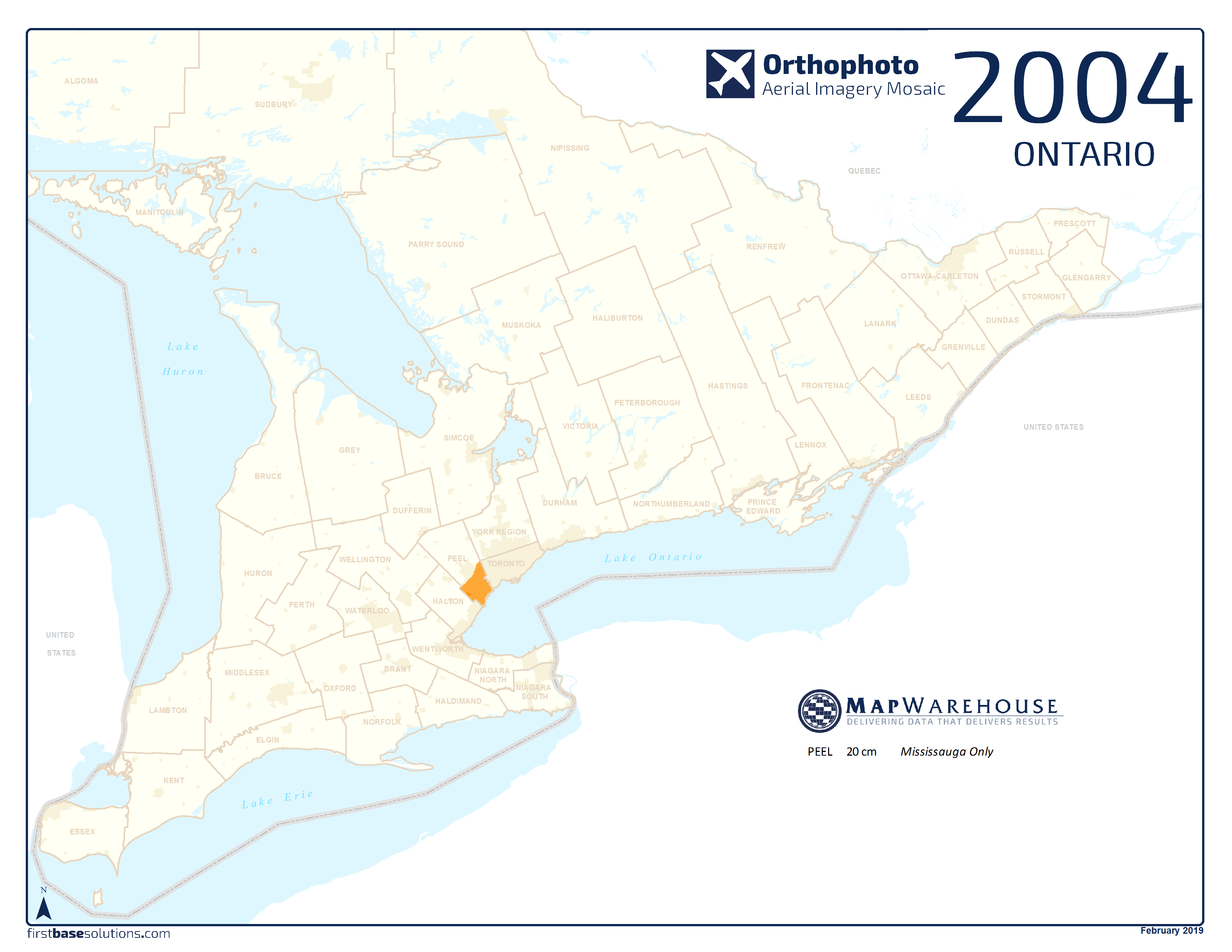
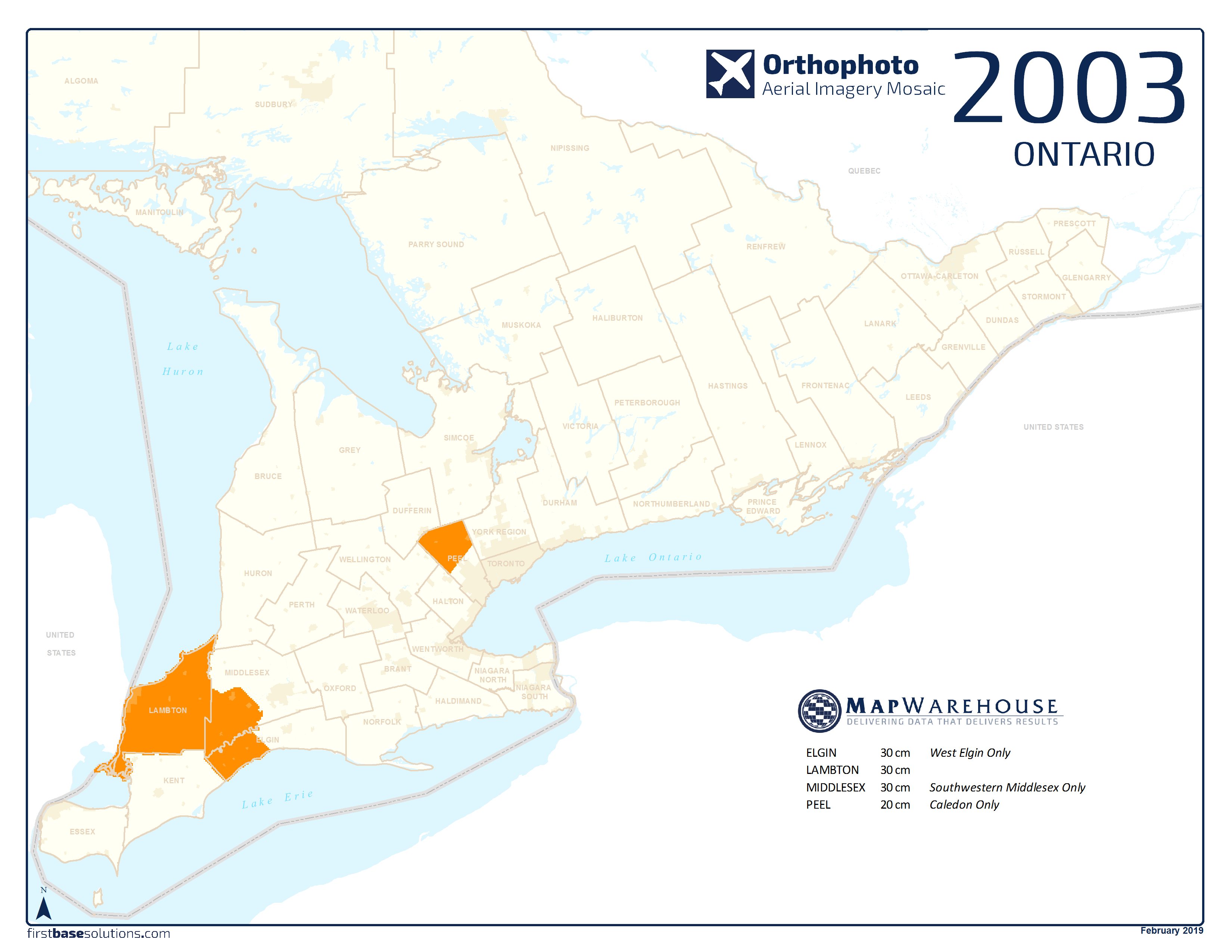
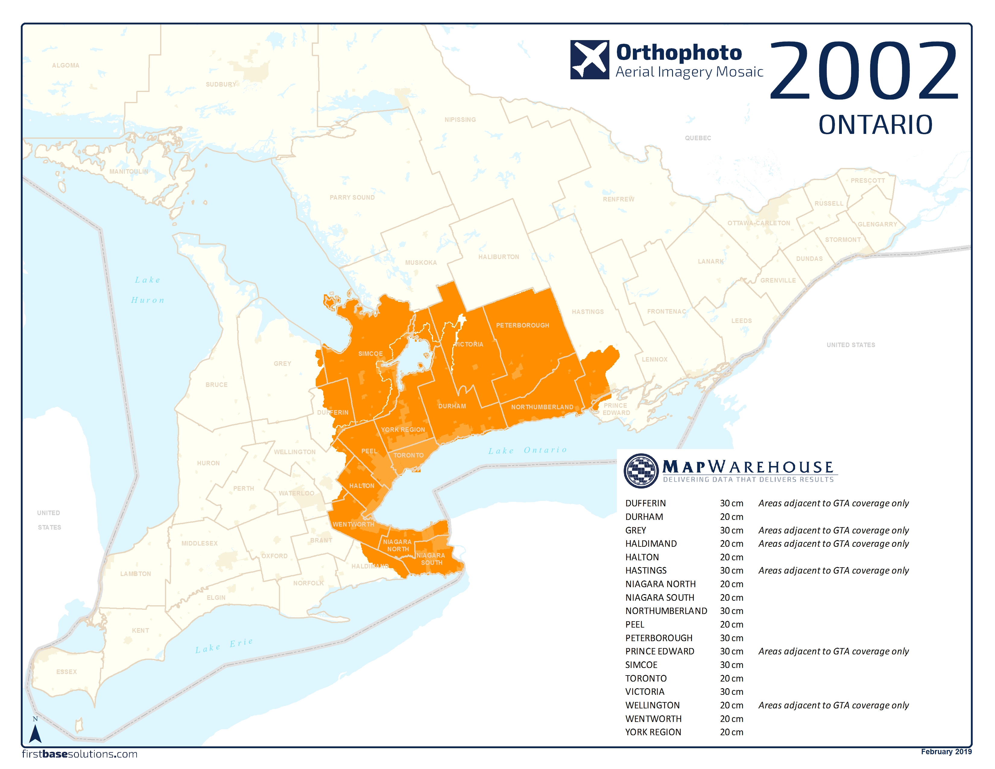
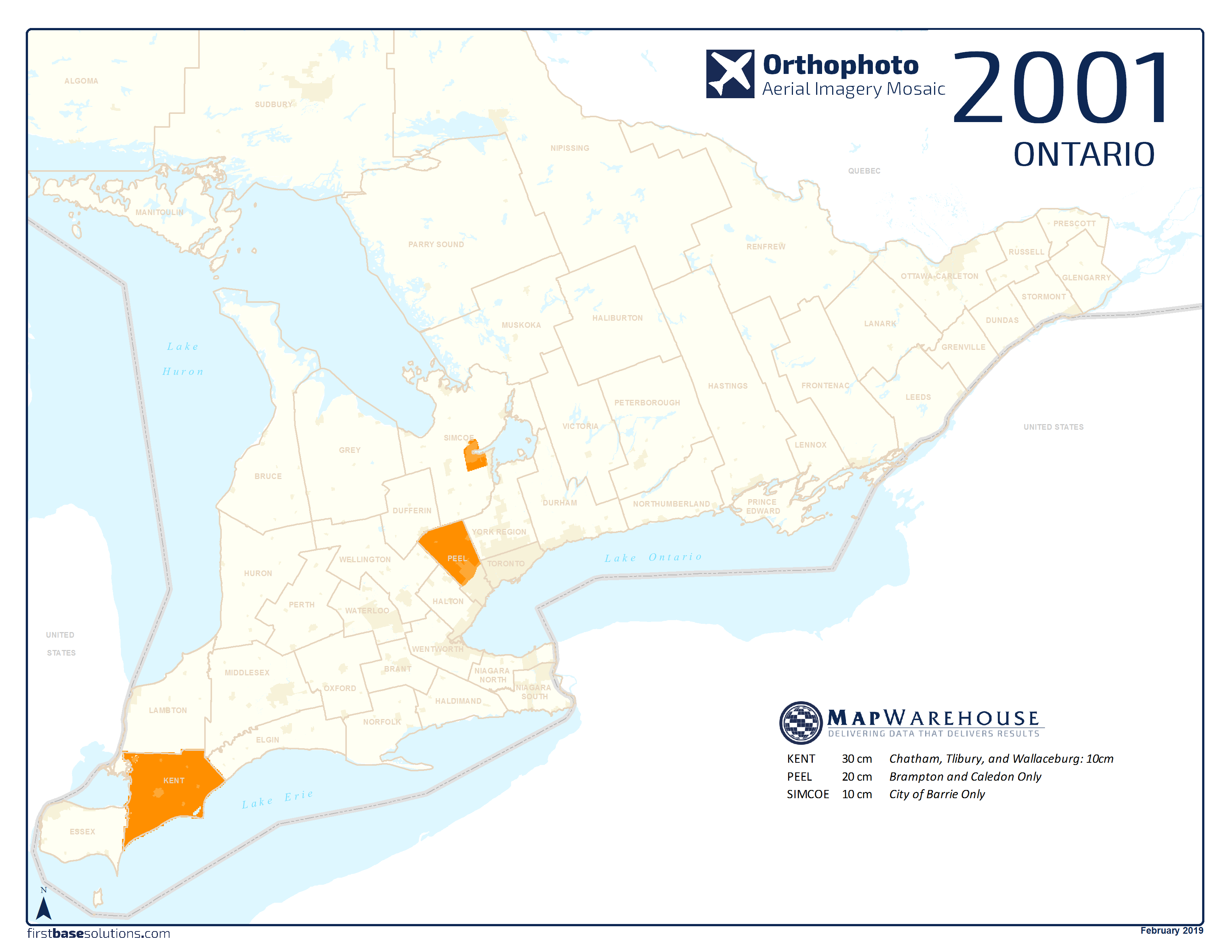
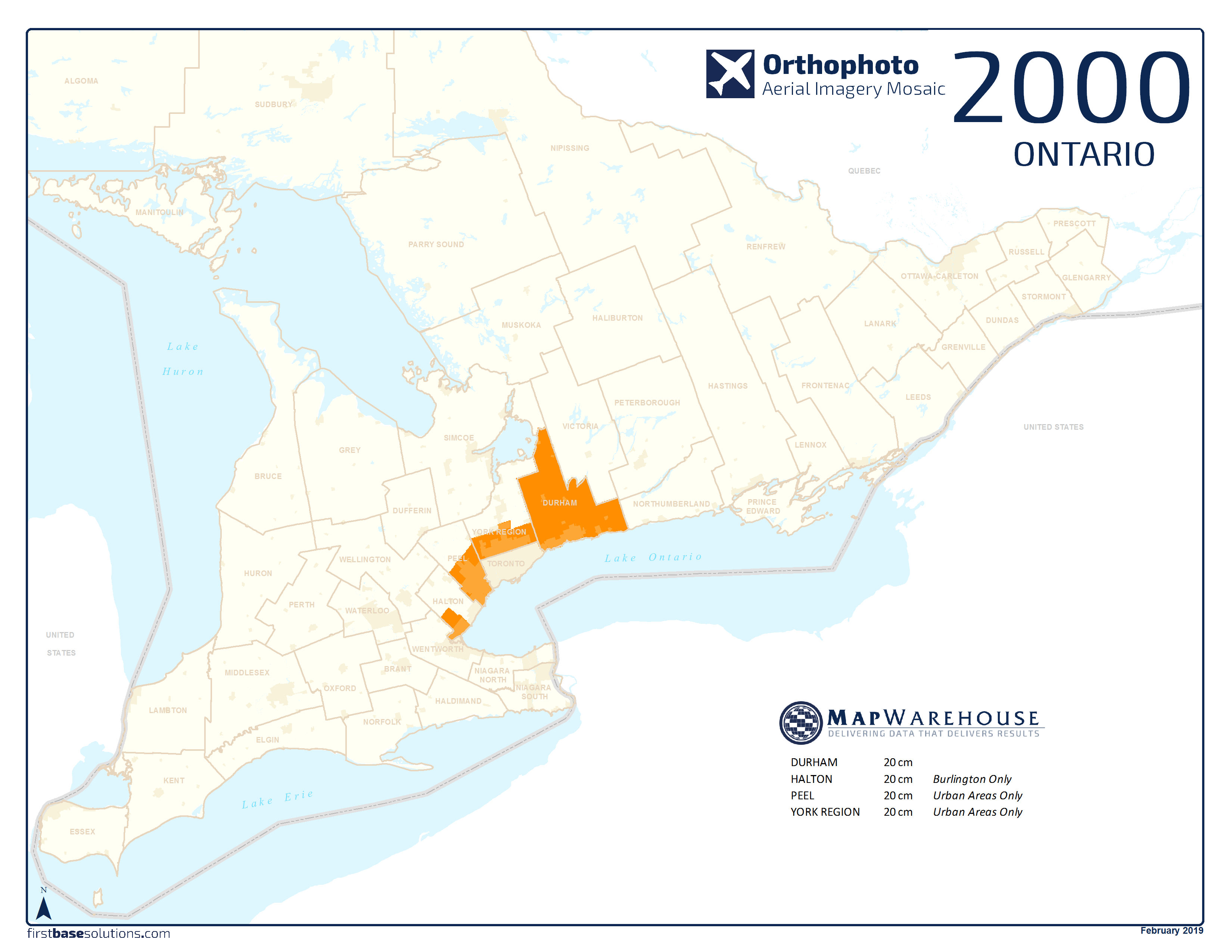
We collect imagery each year in early Spring and late Fall for select areas of Ontario at various resolutions.
Custom mapping and elevation models can be produced for any area where imagery exists. Just call for a quote.
*** All imagery is from early Spring collections unless stated otherwise in the notes section on each map. ***
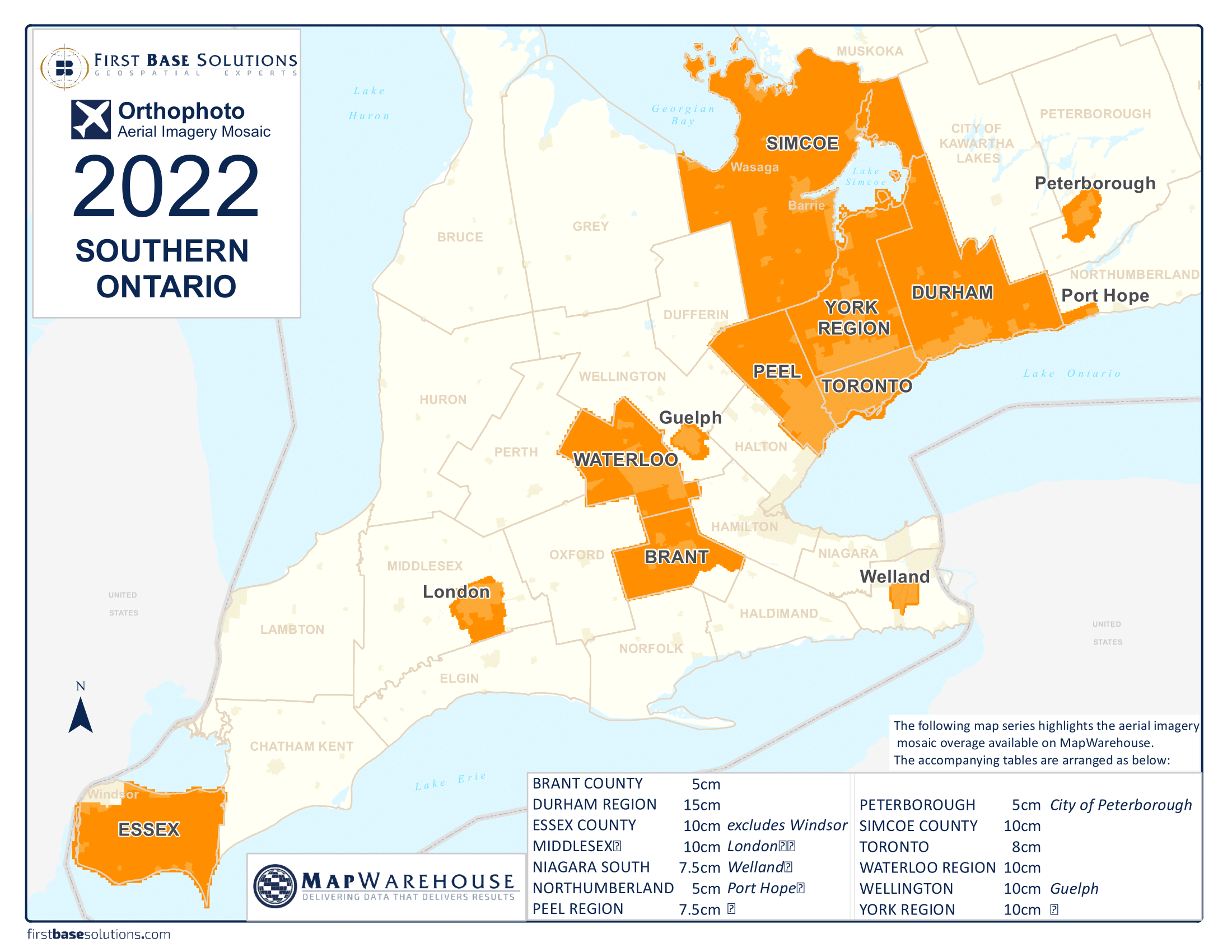
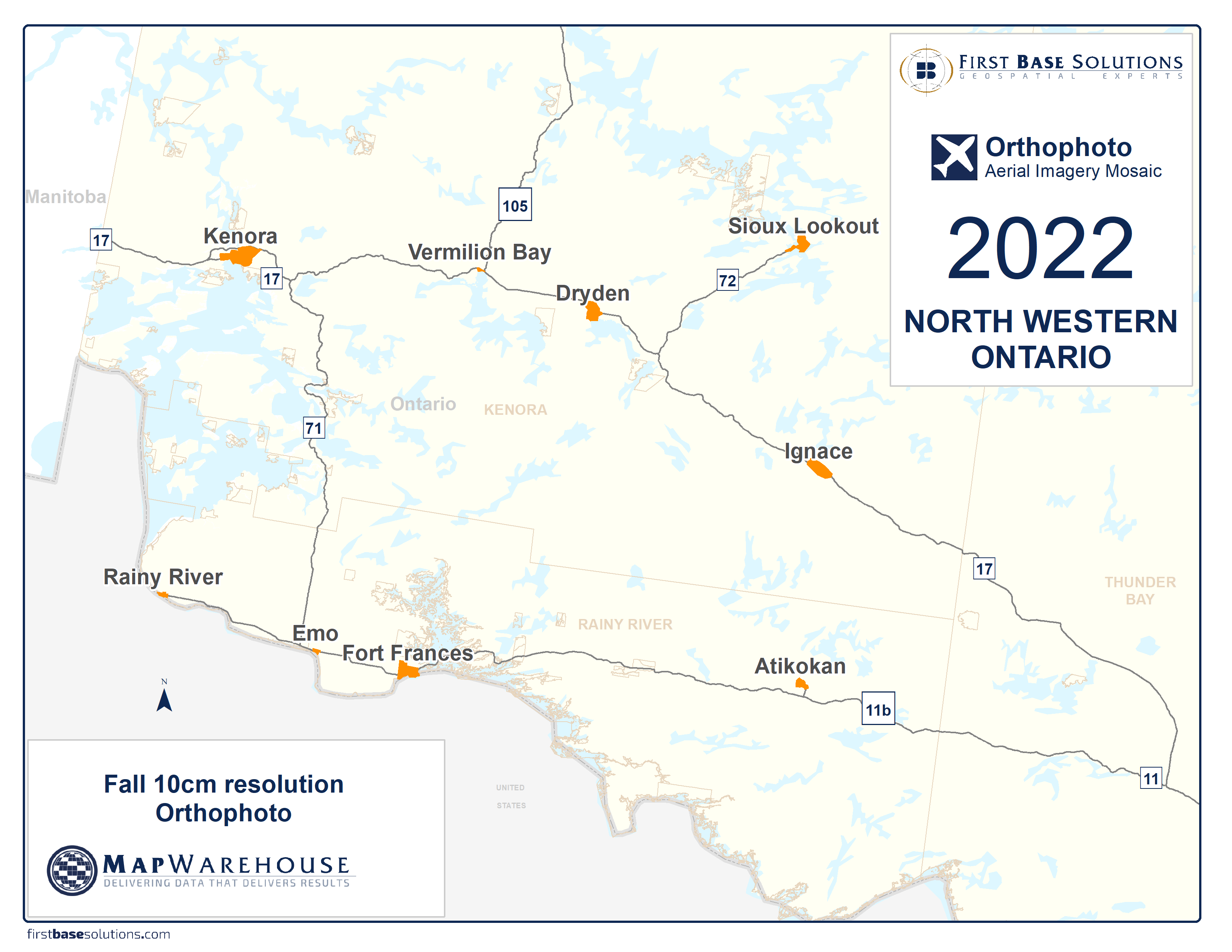
 Download All Ontario Ortho Coverages 2000 – 2022

 Video: Quick Tip – Choosing A Mapping Service [4:49]
Quickly compare three ways to get aerial imagery and geodata from First Base Solutions. This video will guide you through a quick overview of how to access aerial imagery and mapping using FBS‘s three services: MapWarehouse, MapCast, and VuMAP…
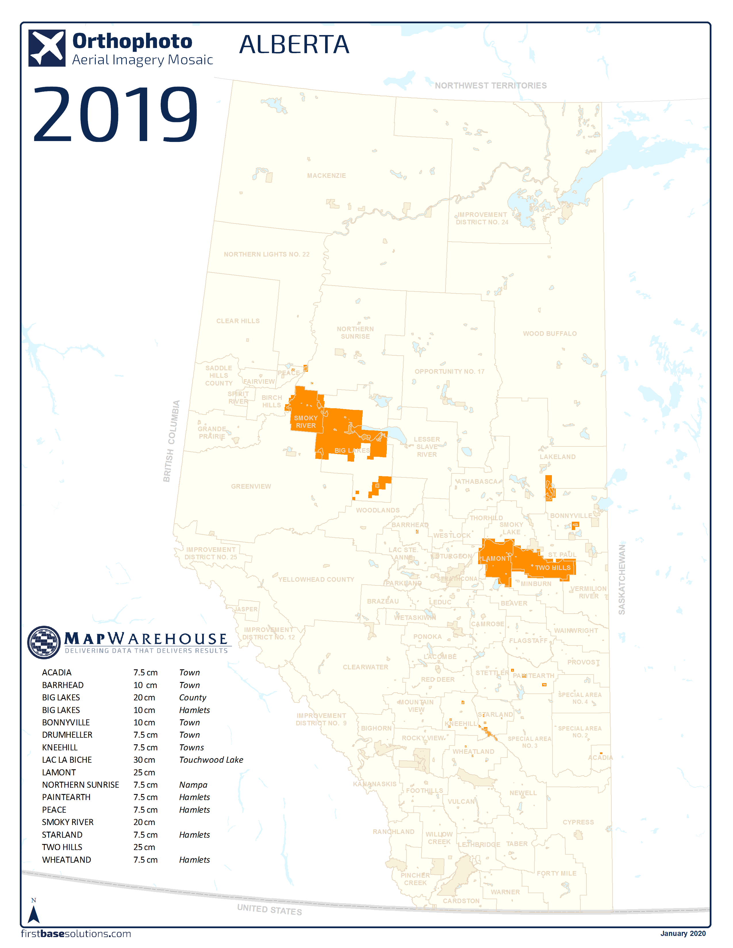
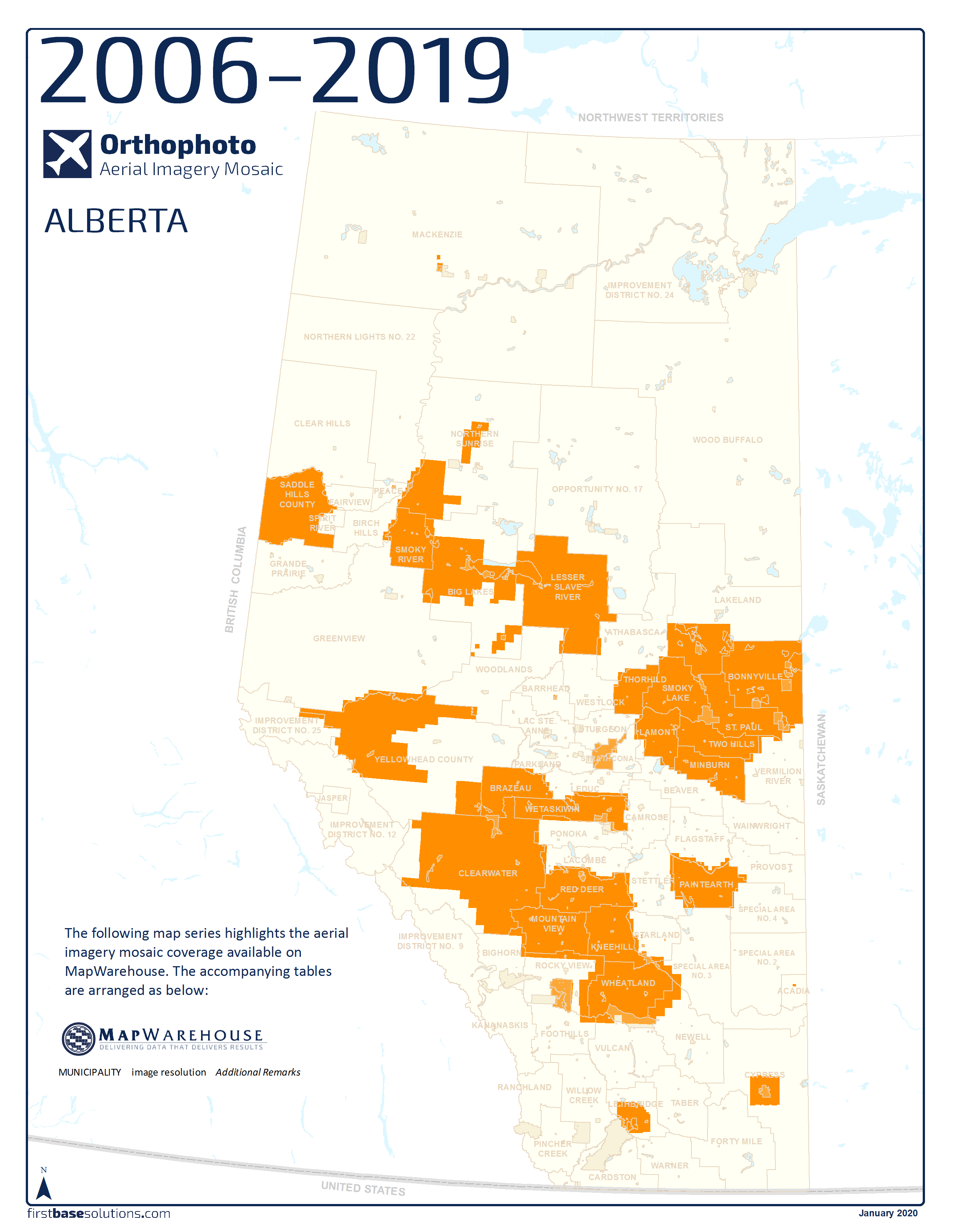
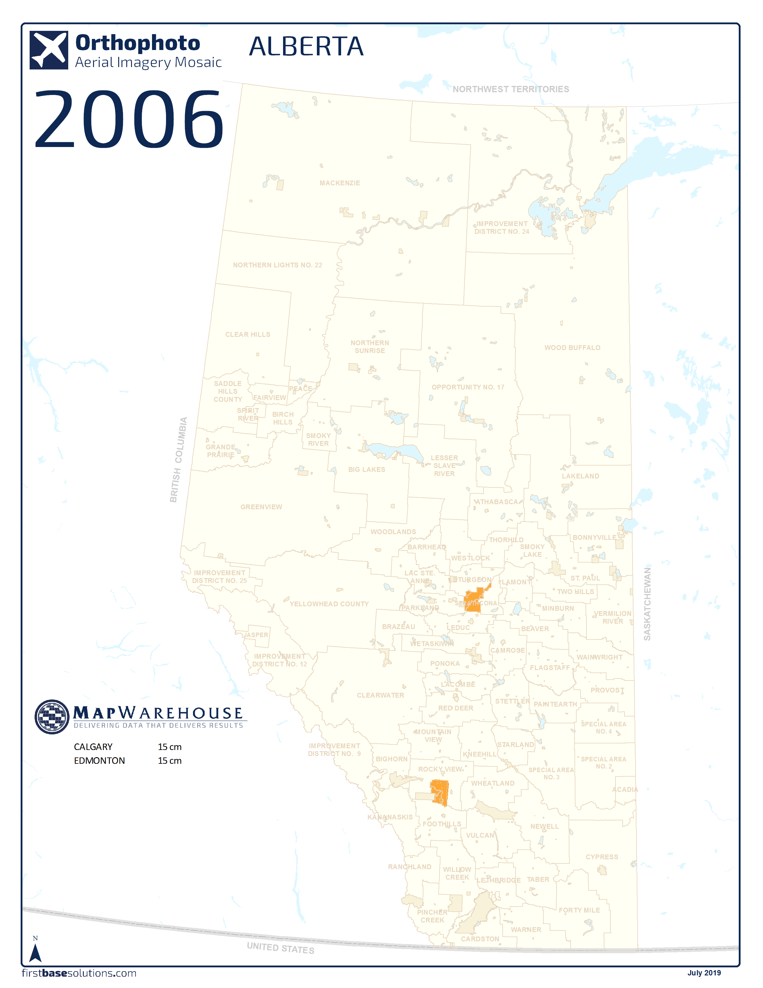
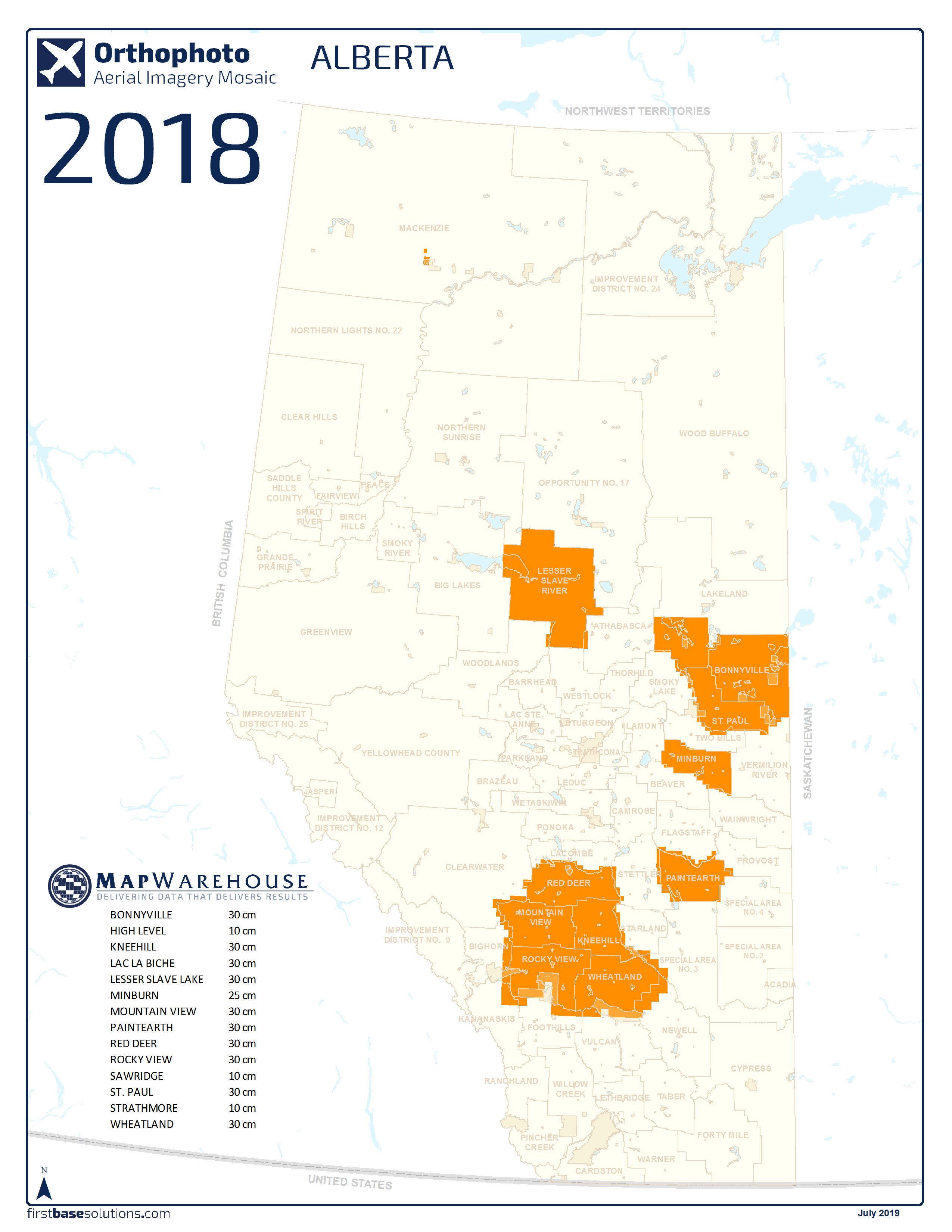
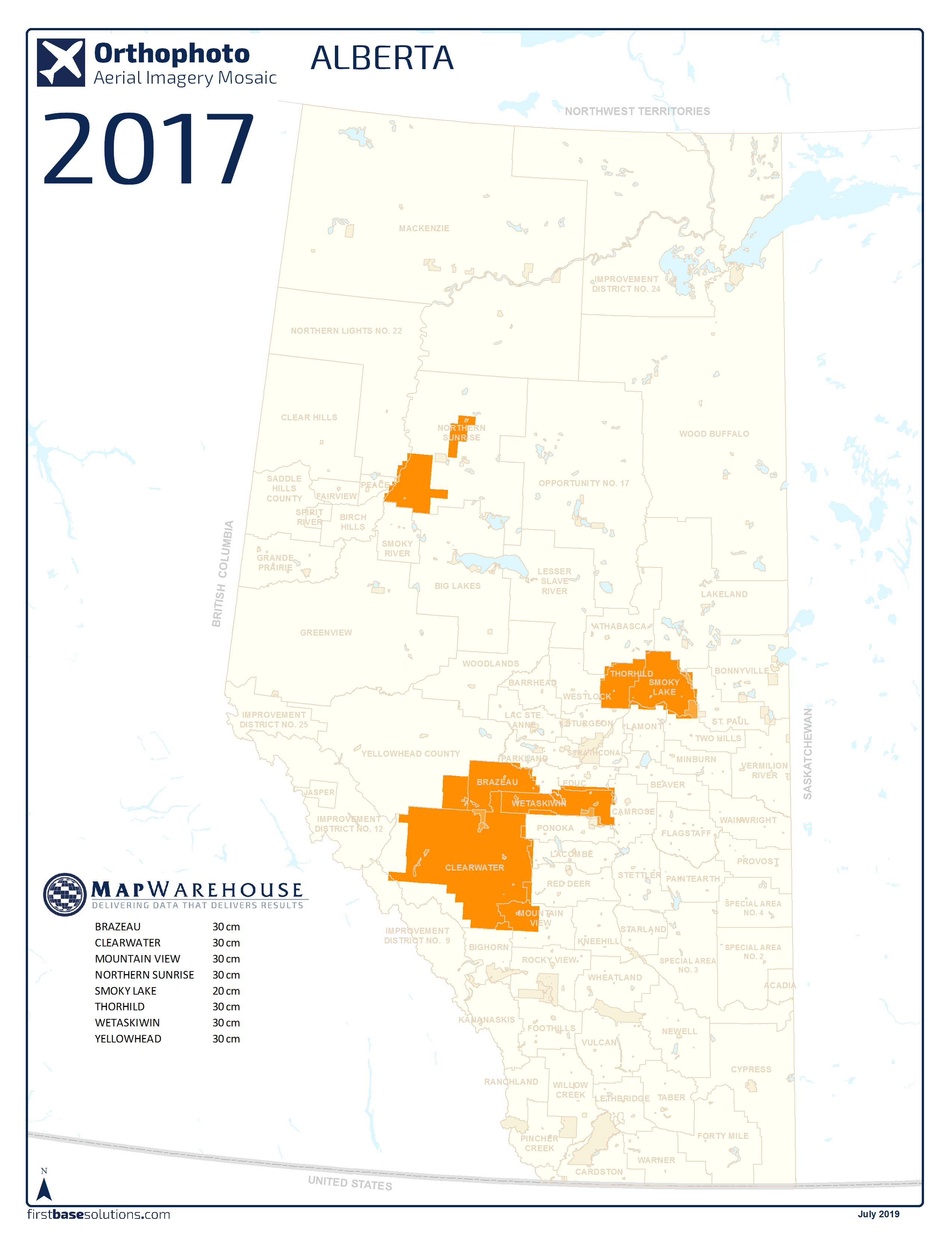
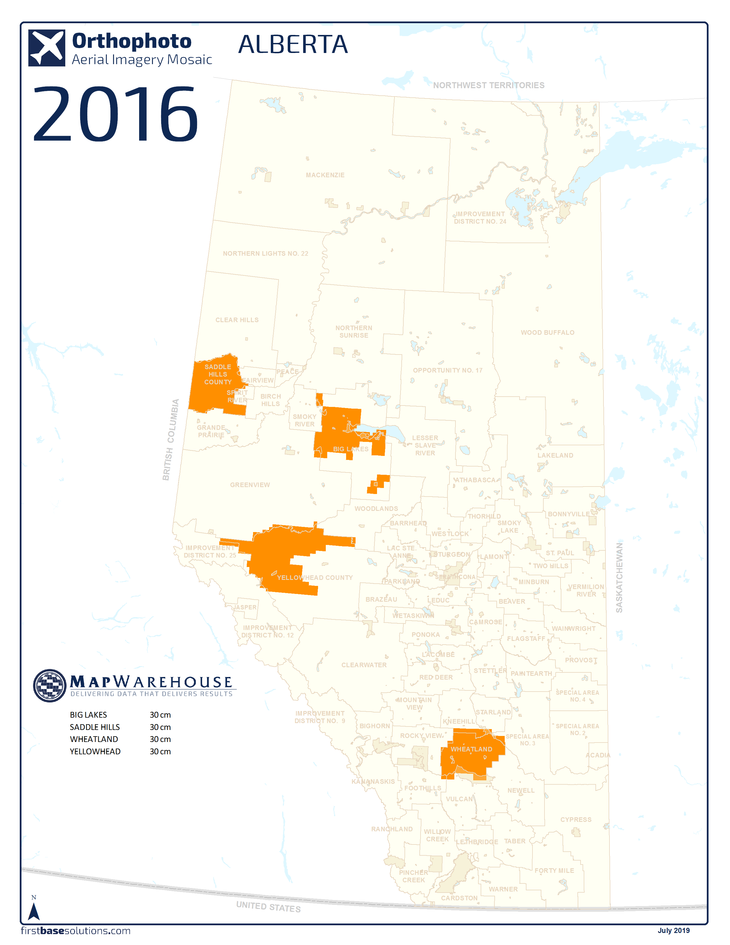
Download All Alberta Ortho Coverages 2006 – 2019

Who’s It For?
Our imagery is high resolution and free of snow, cloud, and foliage so you can see features on the ground clearly.
In combination with other mapping or on its own, orthophoto quickly adds value to any project.


 Blog: How Does Image Resolution Relate To Map Scale?
I’m Mapping At 1:2,000 Scale, What Resolution Should I Use for The Image Base Layer? First, 20cm imagery is not the same as 1:20 map scale…
Discover More
-

-
Data Catalogue
-

-
Custom Mapping
-

-
Satellite
-

-
Parcel
-

-
Elevation
-
-
LiDAR
-

-
Help & Support
-

-
FBS University