- Go to:
- MapWarehouse
- VuMAP
- MapCast
-

-

-

-
 905-477-3600


How To Purchase

MapWarehouse
Ontario’s Largest Geospatial Data Marketplace
Search for data, select files covering your location, download your order, and work with aerial imagery and geographic data. Use the interactive map to locate your area of interest and purchase multiple data sets easily and quickly with a credit card.
![]() Go Now |
Go Now | ![]() Learn More
Learn More
Custom Order
Contour Mapping With Sub-Meter Intervals
First Base Solutions will produce complex, precise custom mapping of your site such as ground feature delineation and 3D terrain modeling based on our aerial photo. A great option for sites needing highly detailed terrain, or where the land use has recently changed.
![]() Go Now |
Go Now | ![]() Learn More
Learn More
 Control and Accuracy Report
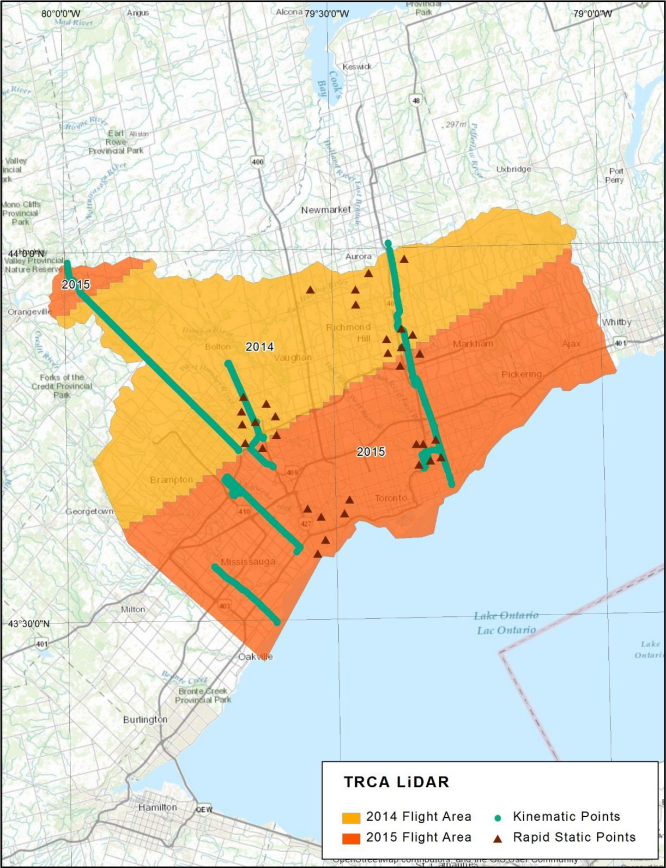
Available Data Coverage
 Blog: Getting Started With LiDAR
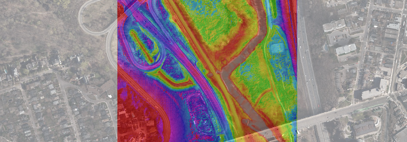
Bare earth elevation models are available on MapWarehouse in GeoTiff format. They are easy to use and highly accurate at +/- 10cm. Download the sample file and follow along with the video below to get started with LiDAR…
Bare earth elevation models are available on MapWarehouse in GeoTiff format. They are easy to use and highly accurate at +/- 10cm. Download the sample file and follow along with the video below to get started with LiDAR…
Who’s It For?
Many types of land information industries can use LiDAR, either alone or in combination with aerial imagery.
LiDAR is a great tool to capture large areas of data relatively quickly with excellent detail and accuracy.


Blog: Bumps In The Road? We’ve Got Mapping For That [Cheat Sheet]
As you can see in the chart, there are five products that you can extract elevation data from. Each has different types of deliverables, precision, and geographic coverage…
As you can see in the chart, there are five products that you can extract elevation data from. Each has different types of deliverables, precision, and geographic coverage…
Discover More
-

-
Data Catalogue
-

-
Orthophoto
-

-
Satellite
-

-
Parcel
-

-
Help & Support
-

-
Floodplain
-

-
Frequently Asked Questions
-

-
FBS University