- Go to:
- MapWarehouse
- VuMAP
- MapCast
-

-

-

-
 905-477-3600


How To Purchase

MapWarehouse
Ontario’s Largest Geospatial Data Marketplace
Search for data, select files covering your location, download your order, and work with aerial imagery and geographic data. Use the interactive map to locate your area of interest and purchase multiple data sets easily and quickly with a credit card.
![]() Go Now |
Go Now | ![]() Learn More
Learn More
 Compare All Data Products
 Compare All Data Products
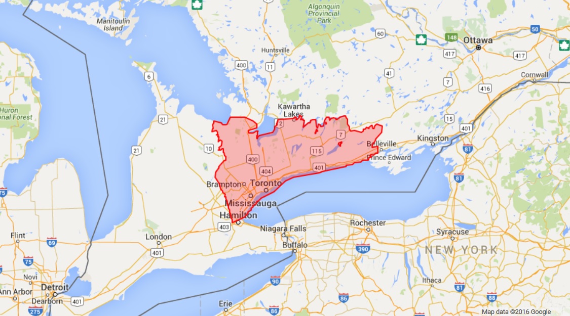
Available Data Coverage
 Blog: How Property Owners Can Prepare Against Floods
The downtown core sewer system was designed during a time before global warming was popular, and when the population was considerably smaller. And unfortunately fixing our aging sewer infrastructure is now quite the extensive project…
The downtown core sewer system was designed during a time before global warming was popular, and when the population was considerably smaller. And unfortunately fixing our aging sewer infrastructure is now quite the extensive project…
Who’s It For?
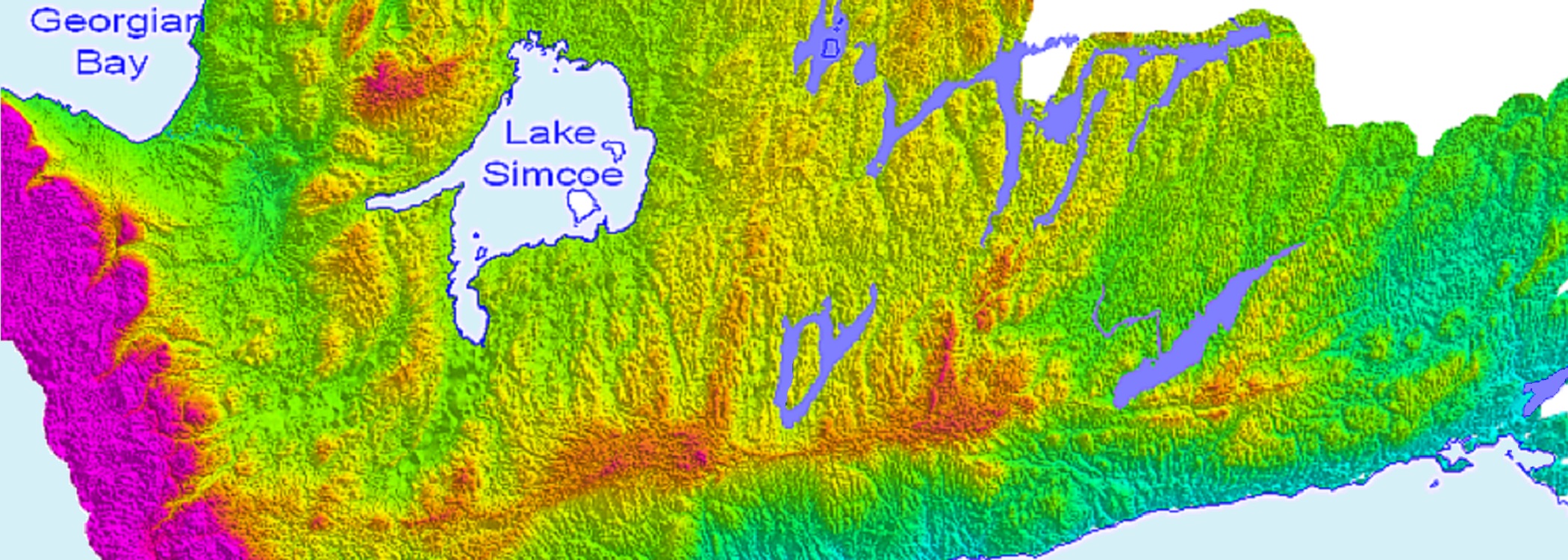
Layer depth, thickness, and composition at various points allows CAMC geoscientists to interpolate a 3D strata model which can be used to interpret geological variability at different sites.
Policymakers benefit from info about groundwater flow direction, recharge and discharge rates and hydraulic conductivity at different layers to pinpoint vulnerable areas and potential sites for higher capacity wells.


Blog: Bumps In The Road? We’ve Got Mapping For That [Cheat Sheet]
Elevation data from FBS is usually sold as either DEM with spot heights and break lines, or, as 1m interval contour lines derived from those DEM, but, we have a few other products you might not know about…
Elevation data from FBS is usually sold as either DEM with spot heights and break lines, or, as 1m interval contour lines derived from those DEM, but, we have a few other products you might not know about…
Discover More
-

-
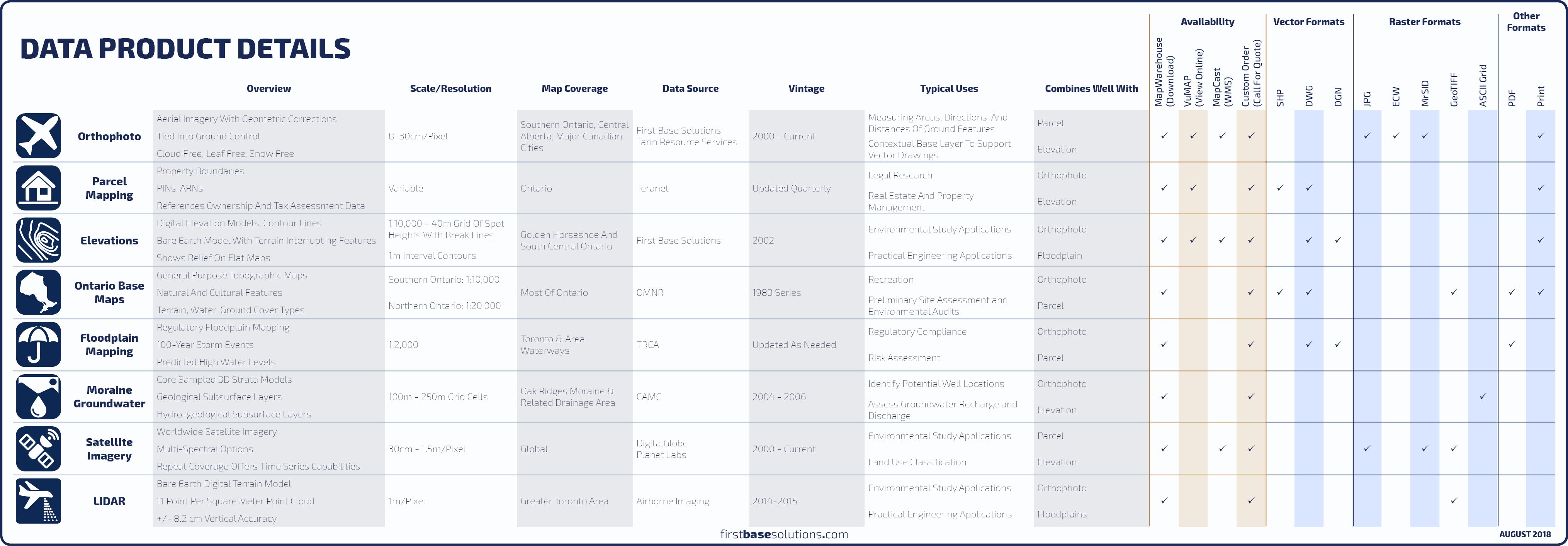
Data Catalogue
-

-
Orthophoto
-

-
Satellite
-

-
Parcel
-
-
MapCast
-

-
Floodplain
-

-
Frequently Asked Questions
-

-
FBS University