

 905-477-3600
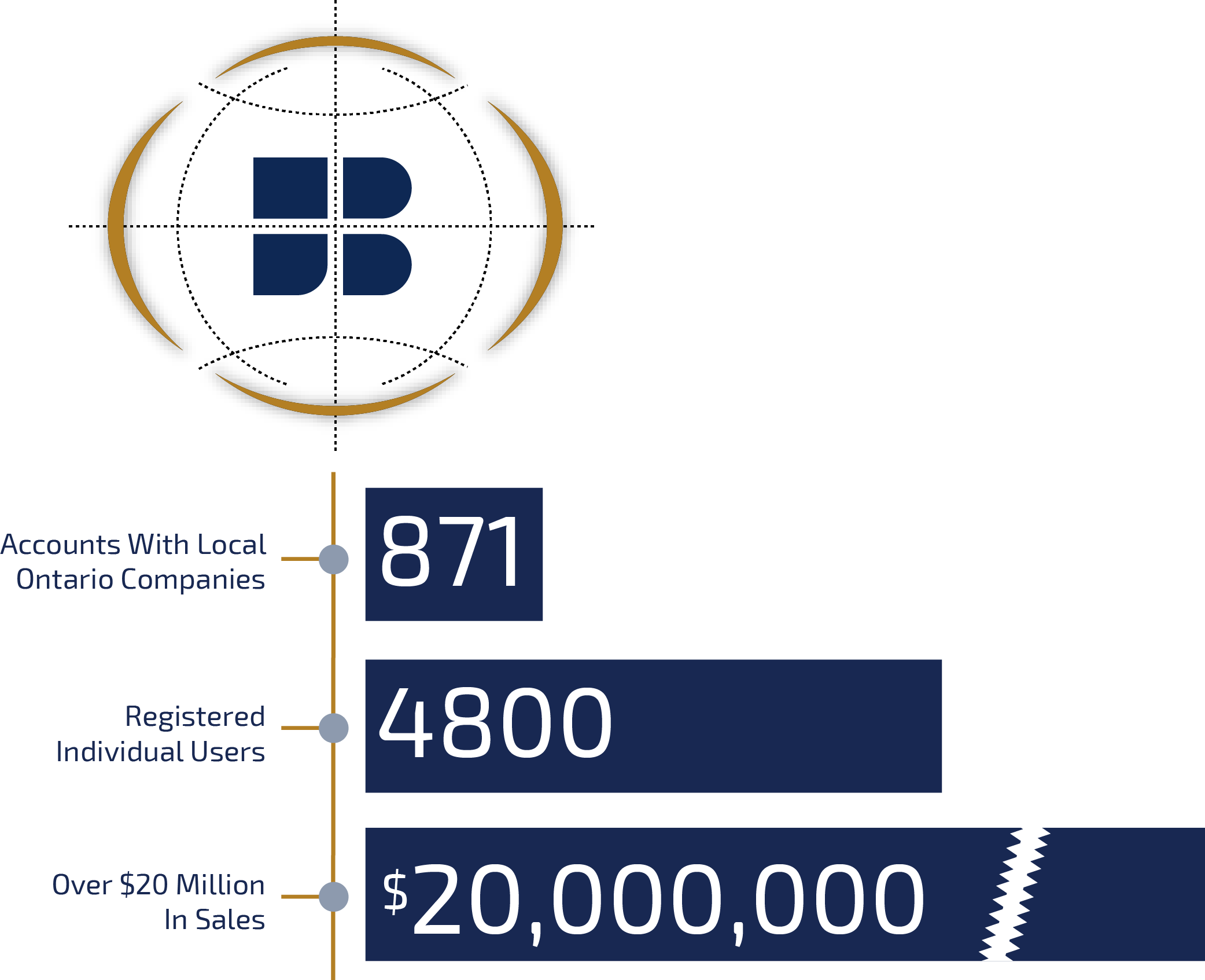
Sell your data through MapWarehouse, MapCast, and VuMAP. With over $20 million in sales, we welcome new partners and data sets that complement our current offerings.
First Base Solutions partners with Ontario’s most reliable geospatial data providers to offer our customers a one stop marketplace to view, buy, and download data.
 Blog: Let’s Make A Deal – How to sell your geospatial data through MapWarehouse
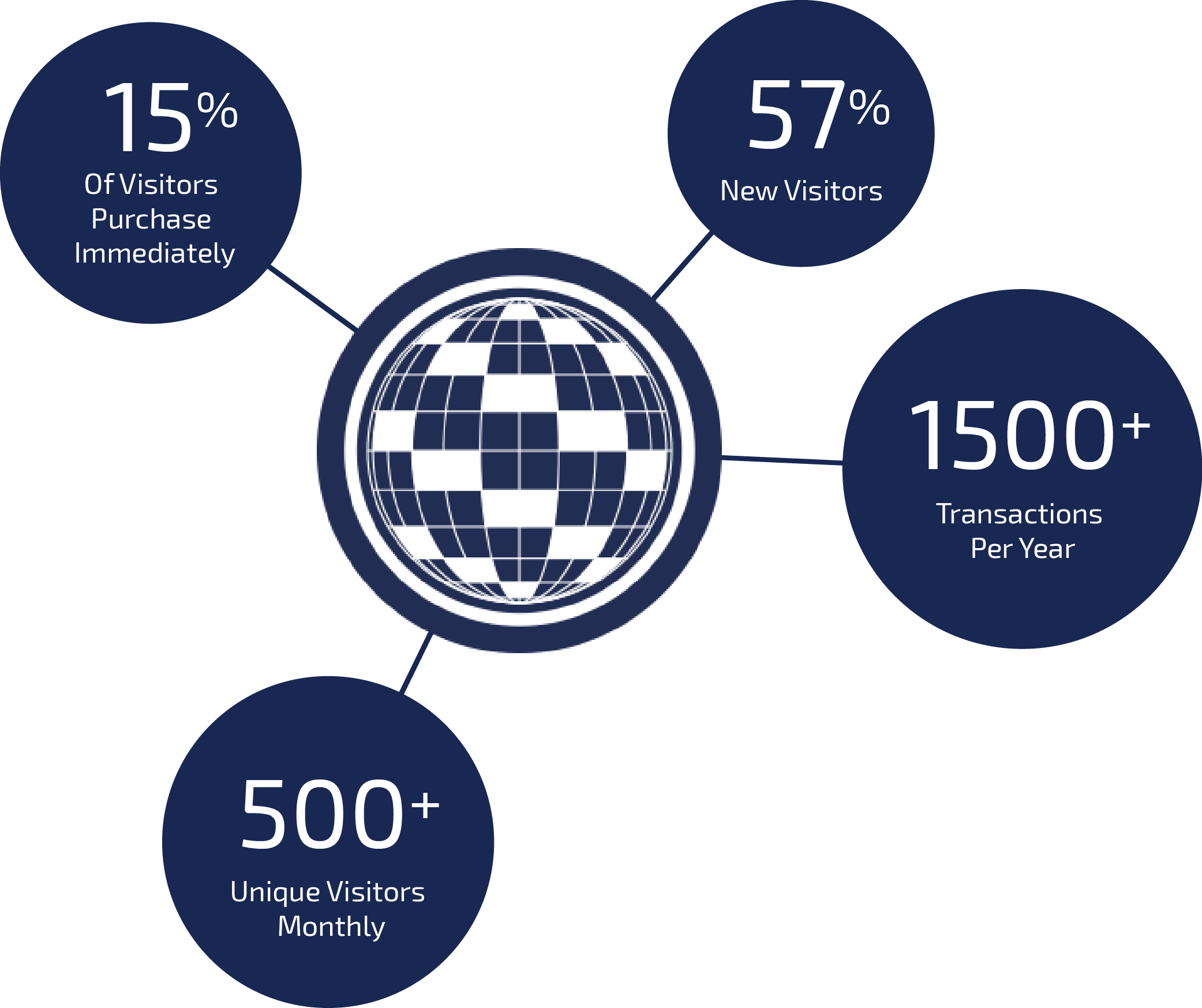
Our strategic partners that we’ve connected with over the last 15 years are the reason why MapWarehouse is Ontario’s largest geospatial data marketplace, and the inventory is constantly expanding. What’s in it for me? Money. The user friendly map-based search…
Our strategic partners that we’ve connected with over the last 15 years are the reason why MapWarehouse is Ontario’s largest geospatial data marketplace, and the inventory is constantly expanding. What’s in it for me? Money. The user friendly map-based search…
 First Base Solutions
Got data to sell? We’ve built a substantial customer base over the last 15 years. Let us handle the marketing and distribution of your spatial data while you collect royalties.
 Request A Demo
 MapWarehouse
Users can purchase and download a variety of geographic data through our online store’s map-based search. Add your data to our ever growing catalogue.
 Learn More
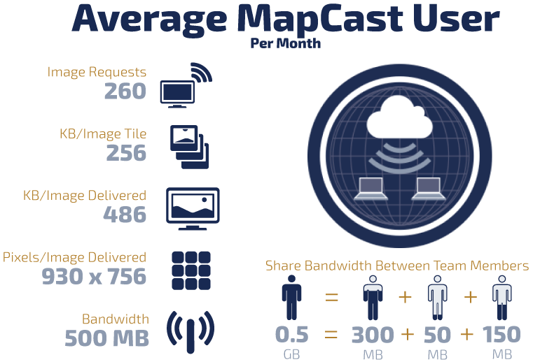
 MapCast
Distribute your data through our web mapping service. Subscribers access a view-only base layer served directly into their desktop CAD and GIS software.
Learn More
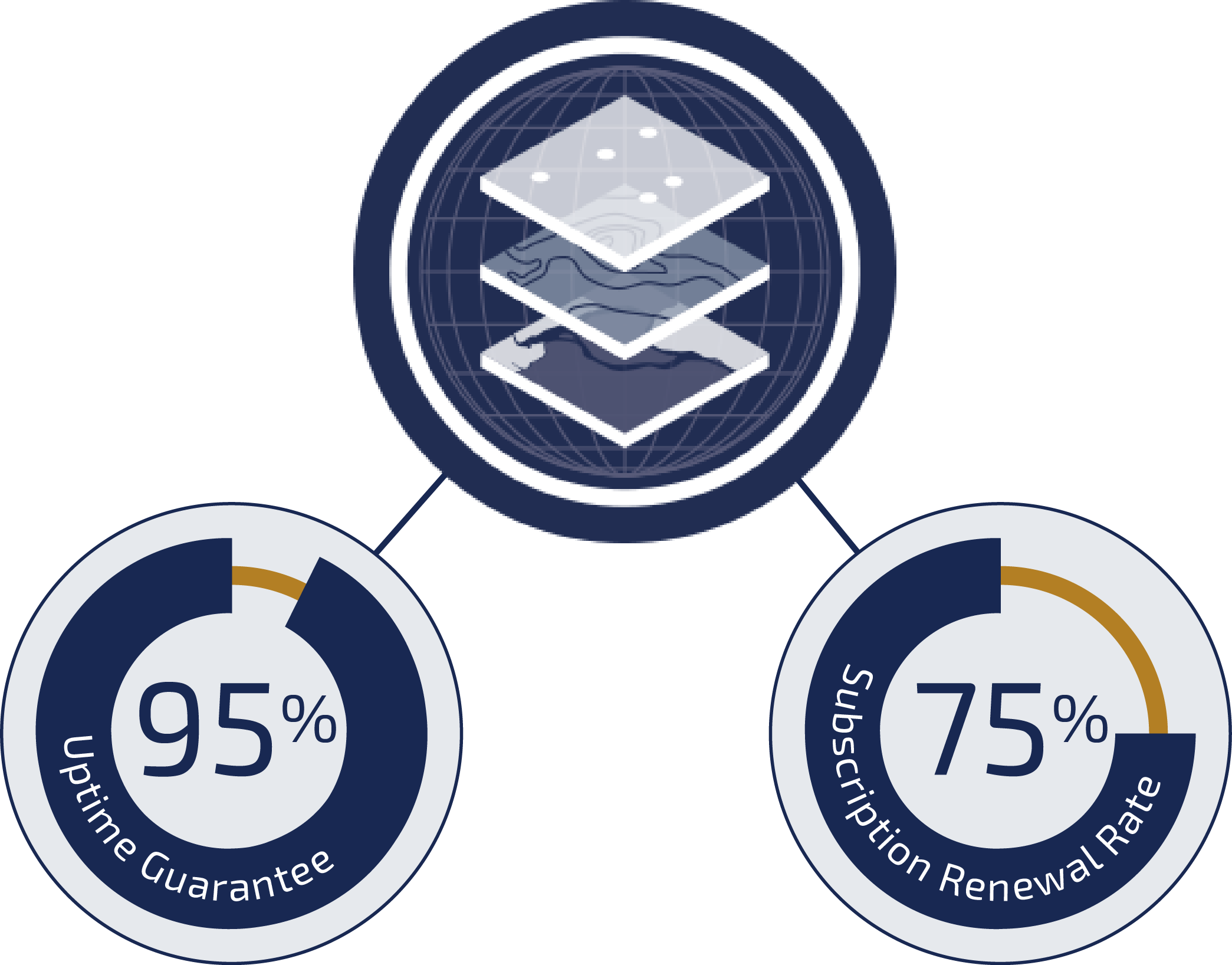
 VuMAP
VuMAP
Let subscribers view and query your data through our feature packed online mapping application, popular with researchers and many types of less technical industries.
Learn More
Blog: Saving, Surfing, or Streaming? How to choose the data delivery method that’s right for your project
Which data sets are available through which service? Which types of problems are best solved using which service?..
Which data sets are available through which service? Which types of problems are best solved using which service?..
Become A Partner
Do you have valuable spatial data but don’t know how to distribute it effectively? Do expensive infrastructure and start-up fees stop you from selling your data?
Let us sell your data on MapWarehouse, MapCast, and VuMAP easily and cost free, allowing you to focus on what you do best: Creating More Data.
We are currently accepting the following types of data:
- Aerial Photography
- Satellite Photography
- Conservation Authority Data
- Infrastructure & Utility Data
- Demographic Data
- Location-Based BI Data
- Road Data
- Zoning Information
- DEMs, DTMs, DSMs, etc
- Contours
- Points of Interest
- More Accurate Address data

Contact First Base Solutions now to learn more about how to become a partner: partnership@firstbasesolutions.com
Blog: Pull new insights from your GPS data to guide smart decision making with better base maps
The information inherent in a photograph, like the aerial imagery you’ll find on VuMAP, gives users the ultimate in accurate and easy data interpretation and decision making. There’s no learning curve. Anyone can look at their data points laid over an image map, and immediately..
The information inherent in a photograph, like the aerial imagery you’ll find on VuMAP, gives users the ultimate in accurate and easy data interpretation and decision making. There’s no learning curve. Anyone can look at their data points laid over an image map, and immediately..
Current Partners
We have established long term partnerships with geospatial data providers that connect our customers with the most up-to-date and reliable data for their projects.
Our partnerships continue to grow as we aggressively create and search for data to add to our library. Some of our current partners include:
Teranet
Teranet maintains parcel boundary mapping for every property in Ontario.
DigitalGlobe
DigitalGlobe collects high resolution, multispectral satellite imagery.
CAMC
The CAMC produces geological and hydrogeological strata models in the ORM.
TRCA
The TRCA maintains regulatory floodline mapping covering Toronto.
 More Partners
Discover More
-

-
Data Catalogue
-

-
Elevation
-
-
VuMAP
-

-
Image Acquisition
-

-
Frequently Asked Questions
-

-
Custom Mapping
-

-
Satellite
-

-
FBS University