

 905-477-3600
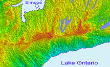
First Base Solutions (FBS) is a principal provider of aerial imagery, geospatial data and custom mapping solutions to organizations in North America.
Our collection of orthophoto and spatial data enables you to efficiently manage projects, offer superior service, and improve day-to-day decision making.

FBS‘s aerial image acquisition services meet your growing demand for geospatial data. Our fleet of Cessna aircraft with high-resolution mounted cameras are ready to capture custom aerial imagery on demand across North America.

Created In February of 2000 as a wholly owned subsidiary of J.D. Barnes Limited, our core purpose is delivering geospatial data and services. FBS caters to companies with diverse mapping needs, technical experience, and budgets.

Our vision and values are deeply rooted in First Base Solutions’ DNA. It’s the pledge our team makes to servicing and educating our customers with specific geospatial solutions that drives us to the forefront of technology.
 Blog: Wrapping Up 2018
In 2018, we accomplished important behind-the-scenes work in preparation for the upcoming launch of MapCast 2.0 in 2019. We also got to work developing relationships with data providers to bring new value-added mapping products to our MapWarehouse store as well as producing a library of mini tutorials to help you use them…
In 2018, we accomplished important behind-the-scenes work in preparation for the upcoming launch of MapCast 2.0 in 2019. We also got to work developing relationships with data providers to bring new value-added mapping products to our MapWarehouse store as well as producing a library of mini tutorials to help you use them…
What We Do For You
 Use Case: Entertech Xchange Facilitates Public Awareness
Enertech is a start-up company formed in 2011 in Wichita, Kansas that helps pipeline companies manage not just their infrastructure conditions, but also their massive stakeholder contact lists. The Xchange Public Awareness platform built by First Base Solutions (FBS) on top of…
Enertech is a start-up company formed in 2011 in Wichita, Kansas that helps pipeline companies manage not just their infrastructure conditions, but also their massive stakeholder contact lists. The Xchange Public Awareness platform built by First Base Solutions (FBS) on top of…

Increase Overall Productivity
Custom geospatial solutions by FBS allow your organization to increase productivity through real time tracking and monitoring of situations. By allowing your organization to view assets spatially, decisions can be made more accurately and timely, effectively increasing overall productivity.

Improve Day-to-Day Business Decisions
Accurate, available and up-to-date information enables your team to improve its decision making process. FBS provides your organization an improved platform to make informed and accurate decisions by combining spatial data with business data within the Google map interface.

Provide A Unique Competitive Advantage
MapWarehouse is an online data store that brings a repository of high quality spatial data to your fingertips. Browse, search and download data immediately from the comfort of your desk, 24/7. MapWarehouse allows your organization to provide a different aspect to your projects and company, making you stand out above the competition.

Reduce Costs
VuMAP’s online capabilities, along with Google’s user friendly interface, enable your organization to view spatial data without the use of special training or software at your convenience within your offices. VuMAP enables your organization to reduce costly site visits, and personnel requirements in particular phases of a project.

Enhance Project Accuracy
MapCast offers you direct access to First Base Solutions’ library of spatial data enabled for your own familiar GIS or CAD software packages. This allows your organization to accurately measure, understand and view projects by overlaying your data on a high resolution orthophoto base layer.

Boost Effective Communication
FBS‘ custom geospatial solutions provide effective up-to-date, real time communication to all stakeholders through web and mobile technologies. Effective communication is vital for any organization that has diverse projects that encompass different departments, offices, field employees and contractors.
Blog: Be Inspired By INSPIRE; Tips to manage a spatial data library
If you’re in the position to set up a modern spatial data department for your company, large or small, here’s a few underlying basic principles to keep in mind…
If you’re in the position to set up a modern spatial data department for your company, large or small, here’s a few underlying basic principles to keep in mind…
The FBS Difference
Values
Changing views to get a better perspective. Giving our customers an improved vantage point to make informed decisions.- To treat our business, people and customer with integrity
- To embrace continuous improvement and innovation
- To display reliability and consistency by delivering what we promised, when we promised
- To pursue growth, learning and development
- To give back to our communities and our people
- To have fun and celebrate our success
Vision
Relentlessly pursuing innovative geospatial technology that helps build the leading organizations of the future.Position:
Enabler(s): to make able; give power, means, knowledge, competence, or ability to; First Base Solutions enables all organizations through education to change traditional ways of viewing day-to-day business to gain an improved perspective to make accurate and effective decisions. Through customer specific geospatial solutions; organizations can benefit by dramatically reducing overall cost, increasing productivity, enhancing communication and an overall rise in profits. Blog: Decision Guide: Ground or Aerial Survey?
Why buy DEM or contour mapping if you need a survey anyway? One’s not better than the other, they both have their place in the project life cycle. Take a detailed look…
Why buy DEM or contour mapping if you need a survey anyway? One’s not better than the other, they both have their place in the project life cycle. Take a detailed look…
Discover More
-

-
Data Catalogue
-
-
Moraine Groundwater
-

-
Floodplain
-

-
Orthophoto
-

-
Satellite
-

-
Elevation
-

-
Frequently Asked Questions
-

-
FBS University