

 905-477-3600
Vivid, large format colour prints for golf course design, legal exhibits, commercial property marketing, and more.
Have us compile a custom map combining your data with ours. Add logos, label special features, add any data you choose.
Contact Us For A Quote

Data Options
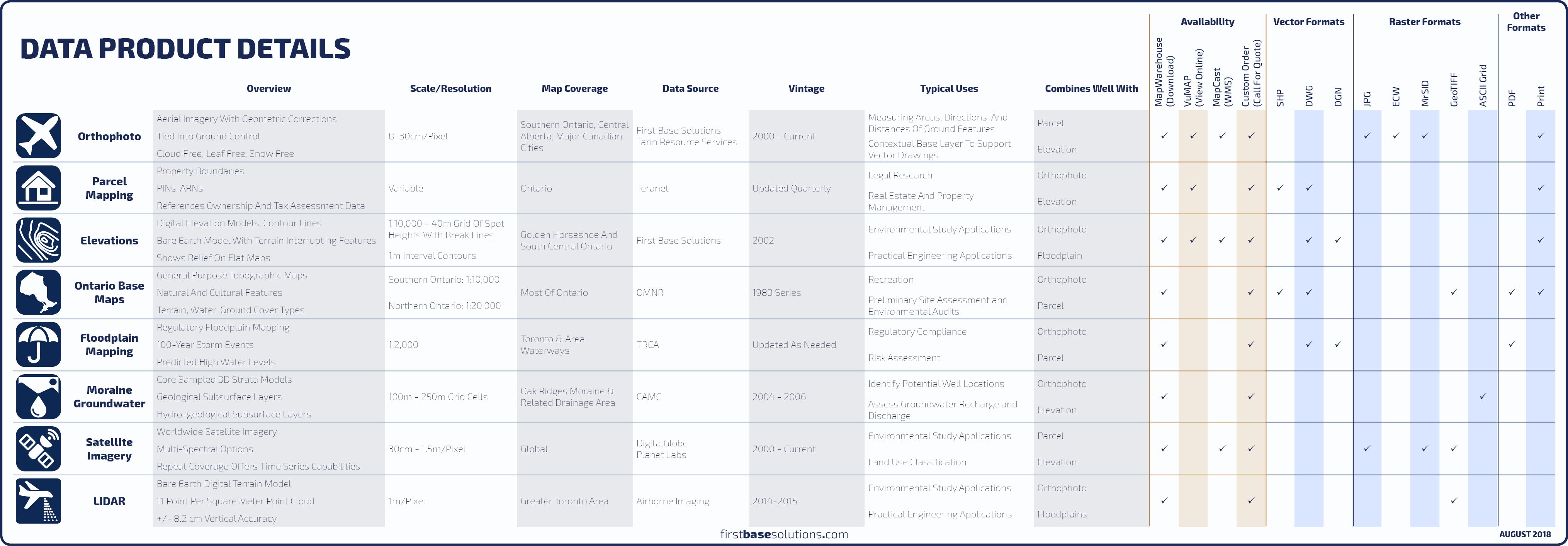 Compare All Data Products
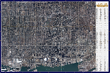
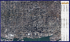
 Downtown Toronto Laminated Wall Map
Our newest print on demand product offering! Downtown Toronto featuring 1:5,000 scale current aerial imagery with indexed street labels. Laminated finish lets you take notes with Post-its or dry erase markers.
![]() Get A Quote
|
Get A Quote
|
![]() FAQs
FAQs
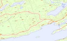
 Ontario Base Maps
OBM, or “topos” are a province-wide series of general-purpose topographic maps providing an excellent reference map for navigation in rural and backwoods regions. Have one printed on demand.
![]() FAQs
FAQs

 Orthophoto
Imagery ranging from 2002-current covering Southern Ontario. Aerial imagery is a great contextual base layer to build your custom mapping over.
![]() FAQs
FAQs

 Teranet Parcel Mapping
Add a layer of property boundary mapping over our imagery. Label parcels with PIN (Property Identification Number), ARN (Assessment Roll Number) or descriptions you provide. ![]() Compare Boundary Mapping
|
Compare Boundary Mapping
|
![]() FAQs
FAQs

 Elevations
Elevation contours in 1m intervals across the Golden Horseshoe produced by FBS, and coverage of all Ontario in 5m and 10m intervals.![]() Compare Elevation Mapping
|
Compare Elevation Mapping
|
![]() FAQs
FAQs
Download Free Samples 
In Depth
Features
- Impressive Full Colour, Large Format Prints
- Photo Paper, Regular Bond, Clear Film, Gator Board, or Any Media you Request
- Printed Maps Include Titles, Scale, North Arrow, Road Labels, Photo Details, Print Date, Our Logo and Other Data or Labels You Provide
- FBS Can Arrange for Printing at Any Size on a Variety of Specialty Media and Laminating Options
Benefits
- Fast Turnaround for Pre-Set Layouts (OBM‘s, Downtown Toronto Aerial Photo Wall Map)
- We Compile Custom Layouts of Our Photo at Any Size and Map Scale You Choose
- Add Property Boundaries, Contour Lines, Logos, Points of Interest, or Any CAD or GIS Vector Data You Provide on Top of Our Photo
- Delivered Promptly to Your Home or Business
 Blog: Key concepts in digital mapping for professionals in any industry
They’re easy to understand and interpret. They make boring data look like extraordinary data. They help you interpret other types of documents. They are time stamped objective records of the past. They’re also inexpensive…
They’re easy to understand and interpret. They make boring data look like extraordinary data. They help you interpret other types of documents. They are time stamped objective records of the past. They’re also inexpensive…
Who’s It For?


Blog: What Happened? [Photoblog]
Take a look at the before and after aerial images from First Base Solutions, spot the differences, then find out the full story below…
Take a look at the before and after aerial images from First Base Solutions, spot the differences, then find out the full story below…
Discover More
-

-
Data Catalogue
-

-
Orthophoto
-
-
Wall Map
-

-
Parcel
-

-
Elevation
-

-
Floodplain
-

-
Frequently Asked Questions
-

-
FBS University