Make the sale or manage your property portfolio with mapping tools for real estate pros like you.
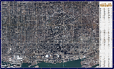
We’ve combined our own high resolution aerial imagery with easy to use tools for property research and information management.
Use Cases
Increase Sales and Marketing
- Effective Target Marketing
- Customer Analytics
- Optimize Sales Force Allocation
- Increase Customer Retention
Property Management
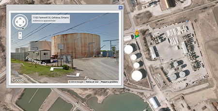
- Asset Tracking and Management
- Internal and Public Communication
- Manage Routine Maintenance Cycles
- Capital Project Planning
Reduce Assessment Costs
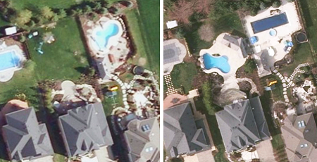
- Detect Physical Changes to Properties
- Assess Properties Remotely
- Accurate Valuations
- Analytics and Reporting
Custom Solutions
Get a fully comprehensive solution that:

- Improves Sales and Profitability Through Effective Target Marketing
- Improve Communities and Public Perception
- Optimizes Development Locations with Improved Understanding of Geographic Data
- Improves Operational Efficiencies Through Optimizing Sales Force Allocation
- Improves Margins
- Improves Customer and Tenant Satisfaction
- Improves Situational Awareness Through Geographic and Location-Enabled Data
- Improves Modeling, Analysis and Research
Discover More
-

-
Data Catalogue
-

-
Zoom2It
-

-
Frequently Asked Questions
-

-
Parcel
-

-
Orthophoto
-
-
Wall Map
-

-
VuMAP
-

-
FBS University


 905-477-3600

 Blog: Three Ways Aerial Imagery Helps Real Estate Pros
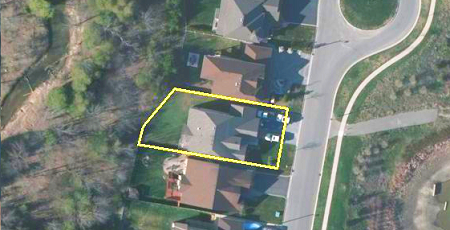
 Use Cases In Depth