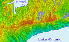
Research remote areas, monitor environmental changes over time, accurately assess site conditions.
Collaborate on large scale projects and planning using a common mapping tool, then share engaging, visual reports with stakeholders.
Use Cases
Seamless Jurisdictional Communication
- Enable Data Sharing, Distribution, and Publication
- Coordinate on Policies and Action Plans
- Improve Accuracy, Integrity and Completeness of Data
- Reduce Administrative and Maintenance Costs
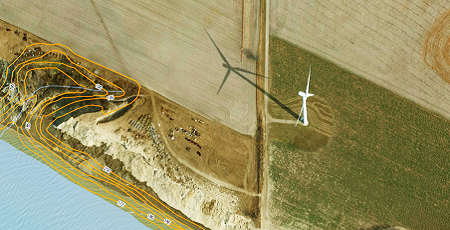
Renewable Energies
- Assess Site Suitability for Wind and Solar
- Research Land Information
- Manage Infrastructure and Maintenance Cycles
- Forecast Demand and Resource Potential
Regulatory Compliance
- Accurate Calculations
- Composite and Historical Reports
- Flexibility to Adapt to Regulatory Changes
- Streamlined Compliance Processes
Custom Solutions
Get a fully comprehensive solution that:

- Seamlessly Communicates Between Regions, Municipalities and Government Agencies
- Increases Productivity
- Improves Project Timeline Accuracy
- Reduces Cost and Deficiency
- Improves Resource Tracking and Monitoring
- Provides Value Added Service for the Public and Key Stakeholders
- Improves Analysis and Reporting Accuracy
Discover More
-

-
Data Catalogue
-
-
Moraine Groundwater
-

-
Floodplain
-

-
Orthophoto
-

-
Satellite
-

-
Elevation
-

-
Frequently Asked Questions
-

-
FBS University


 905-477-3600

 Blog: Spatial Data Expedites Environmental Protection
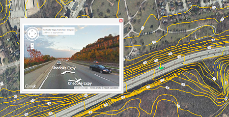
 Use Cases In Depth