Custom mapping applications help you plan, track, and communicate the project progress.
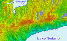
Get engineering quality imagery, terrain models, boundaries, floodplains and more for your developable land.
Use Cases
Site Details – Increase Project Accuracy
- Precise Geo-Location Data
- High Resolution Photographic Detail
- Big Picture Perspective
- Make Educated Assumptions Before the Project Begins
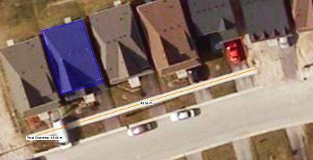
Site Analysis – Reducing Project Costs
- One Stop Shopping for Engineering Grade Data
- Direct Measurement of Distances, Areas, and Earthwork Computations
- Limit the Number of Costly Surveys and Site Visits
- Non-Intrusive Site Investigation Techniques
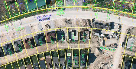
Improved Decision Making
- Evaluate Site Conditions Quickly
- Visualize and Share Complex Information
- Plan and Track Project Progress
- Make Well-Informed Strategic Decisions
Custom Solutions
Get a fully comprehensive solution that:

- Provides a Competitive Advantage During the Project Bid Stage
- Increases Project Accuracy
- Reduces Production Time
- Allows Accurate Site Analysis
- Improves Overall Decision Making
- Reduces Costly Errors and Deficiencies
Discover More
-

-
Data Catalogue
-

-
Orthophoto
-

-
Elevation
-

-
Custom Mapping
-
-
Moraine Groundwater
-

-
Parcel
-

-
Frequently Asked Questions
-

-
FBS University


 905-477-3600

 Blog: Unearthing The York University Tunnel Mystery
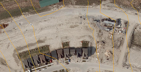
 Use Cases In Depth