905-477-3600
 Ontario Base Maps

Ontario Base Maps are a province wide series of general purpose maps produced by the MNR.
Also called “topos” OBM provide an excellent reference map for navigation in rural and backwoods regions across the province.


 Blog: Dear FBS, What Does Aerial Imagery Have To Do With Baseball?
You see, ‘Base’ as in ‘First Base’ comes from ‘Base Mapping’, as in, our data is the ‘First Base’ layer for your project. Our ‘Solution’ is to enhance decision making for projects in any industry through the use of reliable, high quality information…
You see, ‘Base’ as in ‘First Base’ comes from ‘Base Mapping’, as in, our data is the ‘First Base’ layer for your project. Our ‘Solution’ is to enhance decision making for projects in any industry through the use of reliable, high quality information…
How To Purchase

MapWarehouse
Ontario’s Largest Geospatial Data Marketplace
Search for data, select files covering your location, download your order, and work with aerial imagery and geographic data. Use the interactive map to locate your area of interest and purchase multiple data sets easily and quickly with a credit card.
![]() Go Now |
Go Now | ![]() Learn More
Learn More

Custom Order
Hard Copy Prints
Provide a map sheet number, found on MapWarehouse, to help us locate your area of interest. We will print a 30″ x 24″ hard copy of the selected sheet on demand and ship it to you with a turnaround time of just a day or two.
![]() Go Now |
Go Now | ![]() Learn More
Learn More
 Compare All Data Products
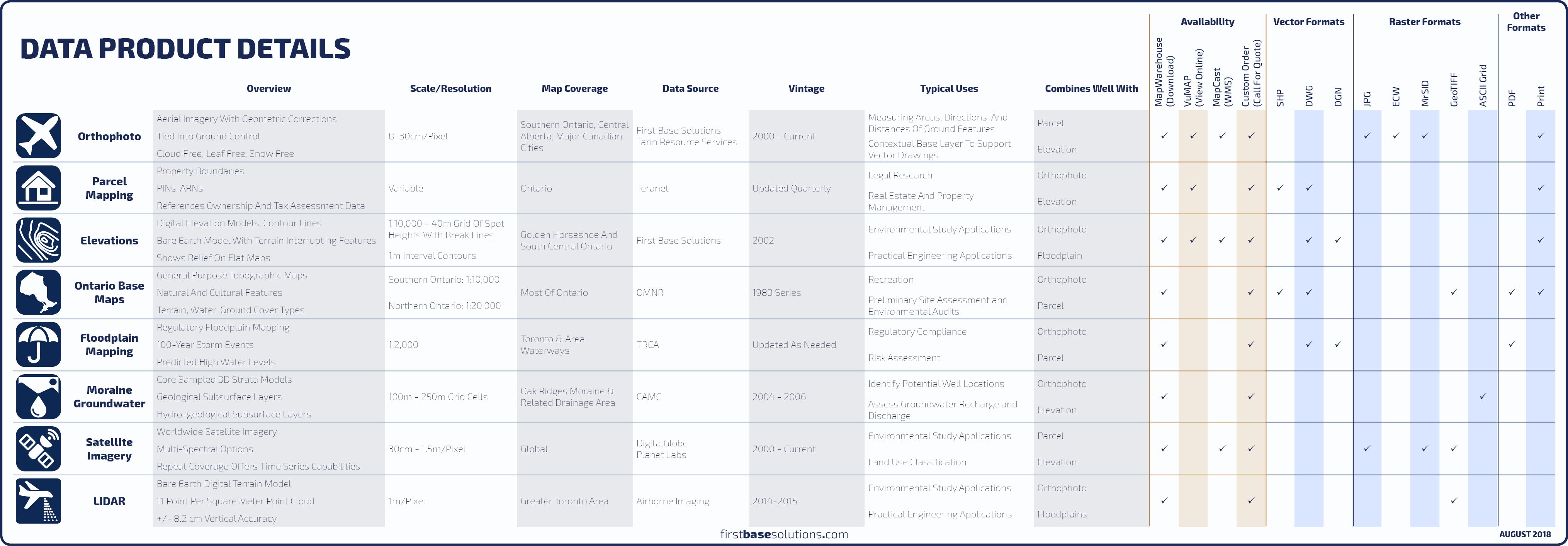 Compare All Data Products
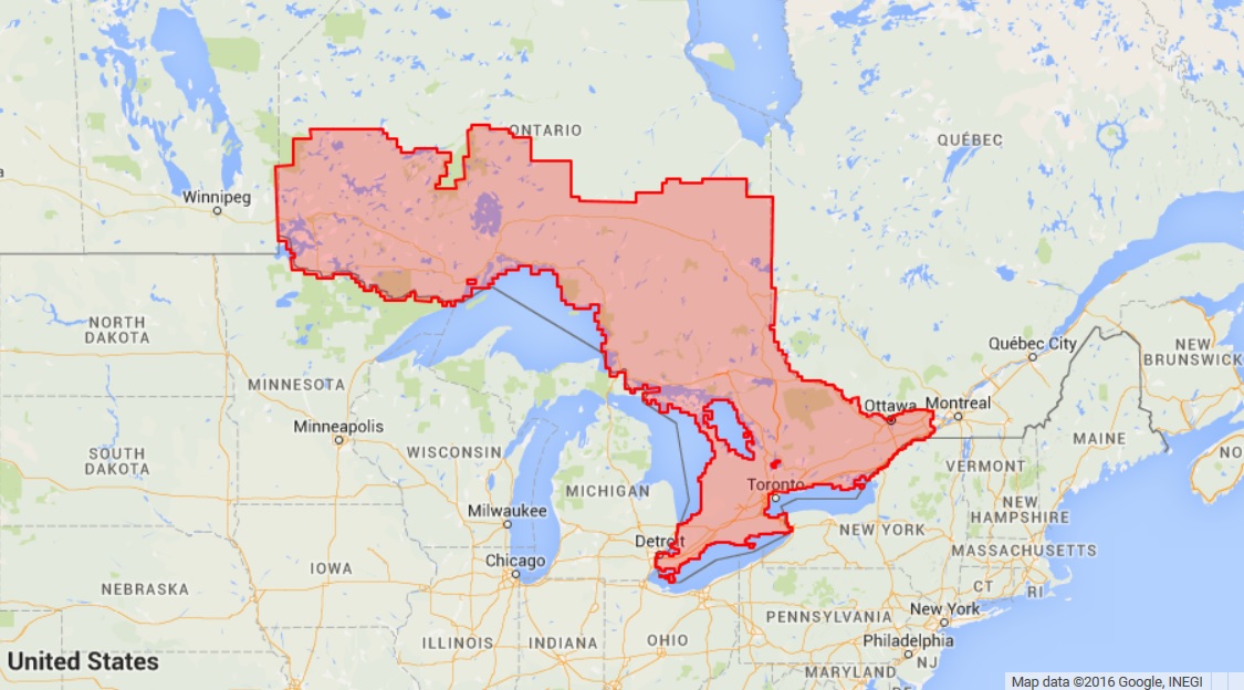
Available Data Coverage
Blog: Rarely Asked Questions – Isn’t There Anything Newer?
Fifteen years isn’t long in geological time. So is it really worth your time to look for updated mapping if you’re only interested in geological features or other map data that won’t change at all in your relatively short human lifetime? Probably not…
Fifteen years isn’t long in geological time. So is it really worth your time to look for updated mapping if you’re only interested in geological features or other map data that won’t change at all in your relatively short human lifetime? Probably not…
Who’s It For?
OBM are simple to read and understand for non-technical users. Areas of different land use types and water are identified by shaded blocks of colour.
Standard symbols are used throughout the series for roads, lot and concession lines, topography, and various points of interest for built and natural features.


Blog: Open Season; Are you GAME day ready?
If your plans involve heading into the woods, especially an area you’re not familiar with, First Base Solutions has maps and solutions to help you plan your expedition, stay safe, and keep it legal…
If your plans involve heading into the woods, especially an area you’re not familiar with, First Base Solutions has maps and solutions to help you plan your expedition, stay safe, and keep it legal…
Discover More
-

-
Data Catalogue
-

-
Orthophoto
-

-
Satellite
-

-
Parcel
-
-
Wall Map
-

-
Floodplain
-

-
Frequently Asked Questions
-

-
FBS University