

 905-477-3600
 Custom Mapping
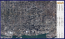
First Base Solutions will produce complex, precise custom mapping of your site such as ground feature delineation and 3D terrain modeling based on our aerial photo.
FBS also provides geometry retrofitting, data massage, format conversion, datum translation and reprojection services for your legacy spatial data.


In Depth
Features
- Detailed Topographic Mapping at Contour Intervals Up To 1/2m
- Photo Control Points for Superior Locational Accuracy
- Vertical accuracy 2x the photo resolution
- Deliverable in Any CAD or GIS Vector Format
- Includes the Features of Interest to You – Roads, Drainage, Buildings, Anything You Choose
- Fast Delivery Where Photo Resources Already Exist
- Upgrade Your Existing Datasets, or Have FBS Establish a Land Information System to Organize Mapping Resources
Benefits
- Timely Access to Information Critical to Making Decisions
- Risk Mitigation – No Need to Expose Field Crews to Unknown Hazards
- Considerable Cost and Time Savings Over Traditional Map Production Methods
- Reliable and Up-to-Date – We Handle Your Aerial Image Acquisition
- Digitize Your Legacy Map Collections for Use with Modern Mapping Software
- Integrates With Existing and Future Mapping Data Sets

Blog: All About Custom Mapping & Terrain Models
Custom photogrammetric mapping is a specialized service offered by First Base Solutions where the ground features you’re most interested in can be delineated from aerial photos and delivered in your choice of GIS or CAD formats…
Custom photogrammetric mapping is a specialized service offered by First Base Solutions where the ground features you’re most interested in can be delineated from aerial photos and delivered in your choice of GIS or CAD formats…
Who’s It For?


Blog: Is Fast Better Than Free?
Where does spatial data come from? How does it get created? How does a commercial organization acquire it? Where critical decisions need to be made, it’s critically important to…
Where does spatial data come from? How does it get created? How does a commercial organization acquire it? Where critical decisions need to be made, it’s critically important to…
Discover More
-

-
Data Catalogue
-
-
Wall Map
-

-
Elevation
-

-
Floodplain
-

-
Image Acquisition
-

-
Frequently Asked Questions
-

-
Parcel
-

-
FBS University