905-477-3600
 Satellite

Earth imaging satellites capture high and mid-resolution imagery covering Ontario, Canada, and the world!
FBS helps you order archived or brand new imagery from our data partners at Planet Labs and DigitalGlobe including multispectral and false colour infrared.


How To Purchase

MapWarehouse
Ontario’s Largest Geospatial Data Marketplace
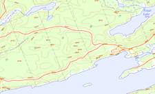
Search for data covering your location and download your order to use locally. Use the interactive map to locate your area of interest and purchase multiple data sets easily and quickly with a credit card. Full Ontario coverage from the SPOT 6 and 7 satellites.
![]() Go Now |
Go Now | ![]() Learn More
Learn More

Custom Order
Contact Us For Special Orders
First Base Solutions can help you determine the best satellite products for your project and navigate the complex ordering process from the Digital Globe constellation. Purchase archived imagery or tasking for new acquisition. Contact customer service.
![]() Go Now
Go Now

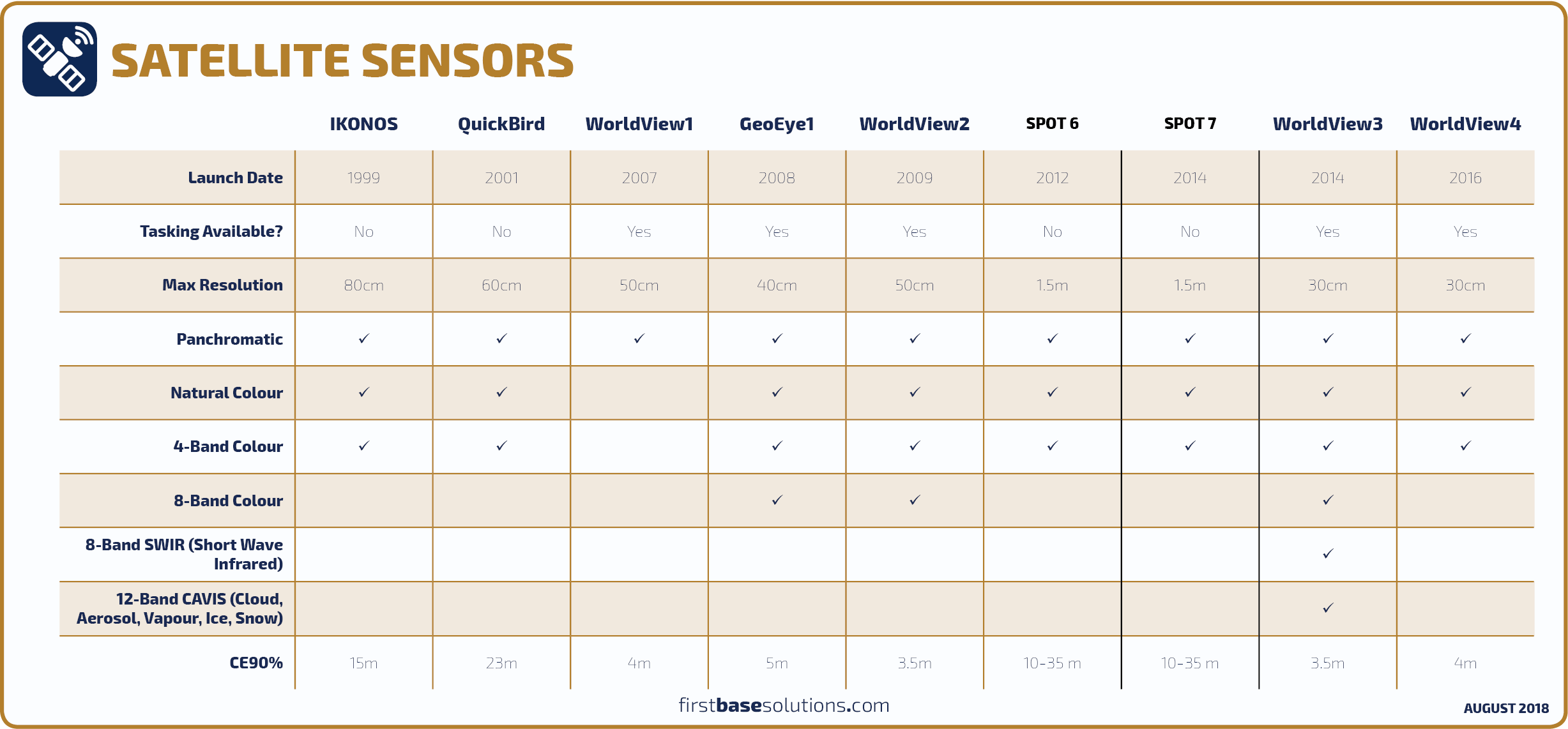
Compare Satellite Sensors

Blog: What Can I Do With 8 Band Imagery?
With 8 band imagery, there are 512 3-band combinations to choose from! Land use classifications can be tailored to highlight more specific surface types based on narrow band ranges…
With 8 band imagery, there are 512 3-band combinations to choose from! Land use classifications can be tailored to highlight more specific surface types based on narrow band ranges…
Who’s It For?
Satellite imagery can be used to classify surface materials and vegetation types, or monitor land use patterns over time with spectral bands outside the visible range.
Projects covering large or remote areas can use satellite imagery in lieu of costly, time consuming, and potentially dangerous ground surveys.


Blog: A Planet Sized Data Delivery – Now Available!
The satellite imagery on MapWarehouse will have similar characteristics to the orthophoto we’ve sold for years. The imagery is mosaicked and colour balanced to provide consistency across the entire coverage area, pan sharpened, and orthorectified. Everything is application ready…
The satellite imagery on MapWarehouse will have similar characteristics to the orthophoto we’ve sold for years. The imagery is mosaicked and colour balanced to provide consistency across the entire coverage area, pan sharpened, and orthorectified. Everything is application ready…
Discover More
-

-
Data Catalogue
-

-
Orthophoto
-

-
Printing
-

-
Parcel
-
-
Planet Labs
-

-
Floodplain
-

-
Frequently Asked Questions
-

-
FBS University