905-477-3600
 What Can I Do With 8 Band Imagery?
 512 RGB Visualizations to choose from

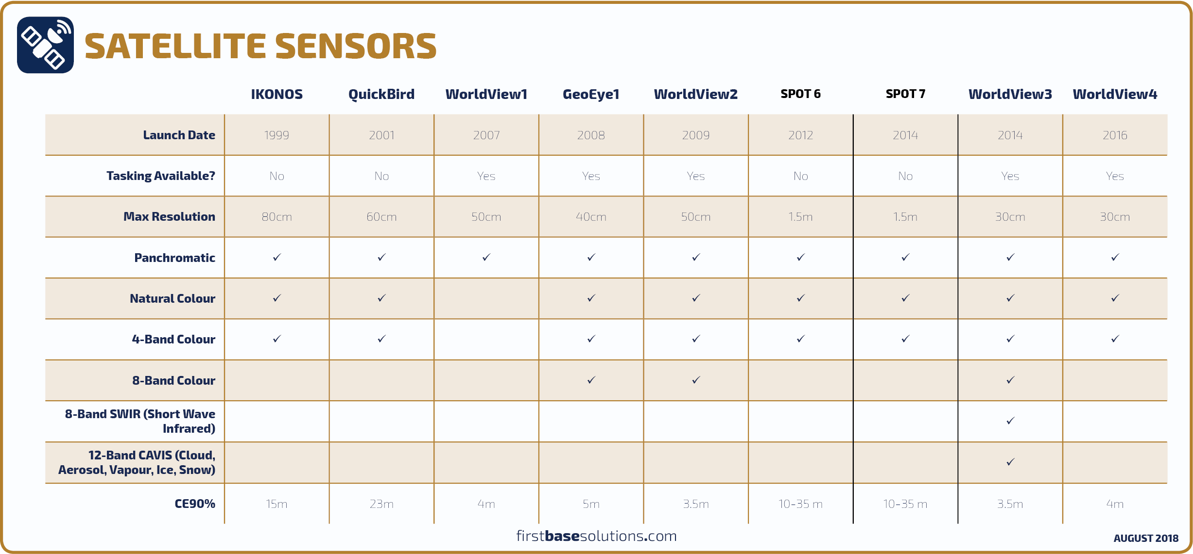
The satellite imagery we provide is often ordered as "natural colour" with red, green, and blue spectral bands to simply provide a base layer for mapping in areas where aircraft sourced orthophoto is not available or not current enough. For more sophisticated applications, multi-spectral imagery with 4 bands or 8 bands can be ordered to view imagery in "false colour".