Keep your data collection up-to-date with custom aerial imagery and mapping from First Base Solutions.
Let us build custom mapping tools to help you and your community get more insights out of the data you already have.
Use Cases
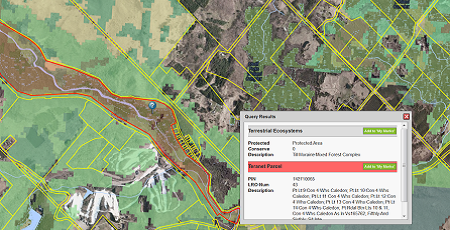
Improve Zoning and Land Use Decision Making
- Easy Evaluation of Land Information
- Set Priorities for Policy Makers
- Centralized Database to Manage Data
- Reporting and Analysis
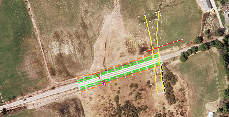
Improve Public Services Communication
- Manage Capital Projects
- Improve Services for Individuals
- Two-way Communication With Citizens
- Administrative Efficiency
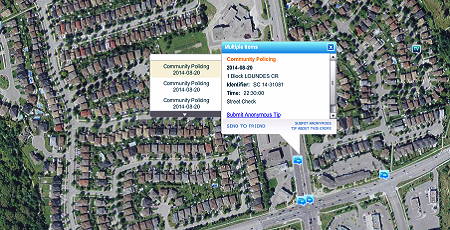
Information Sharing
- Public and Internal Mapping Assets
- Centralized Database
- Scalable Solutions
- Inter-Departmental Communication
Custom Solutions
Get a fully comprehensive solution that:

- Increases Effective Internal and External Communication
- Provides Value Added Services to the Public and Community
- Reduces Production Cost and Errors
- Enables Monitoring and Tracking of Contractors, Billing, and Invoicing
- Effectively Monitors Municipal Infrastructures
- Improves Disaster Relief Plans and Protocols
- Enhances Emergency Response
Discover More
-

-
Data Catalogue
-

-
Custom Mapping
-

-
MapCast
-

-
Image Acquisition
-
-
Wall Map
-

-
Satellite
-

-
Frequently Asked Questions
-

-
FBS University


 905-477-3600

 Blog: Mapping technology for urban planning & municipal governments